
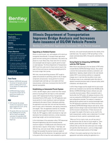
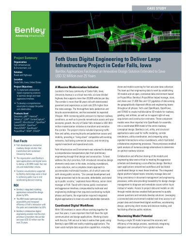
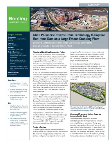
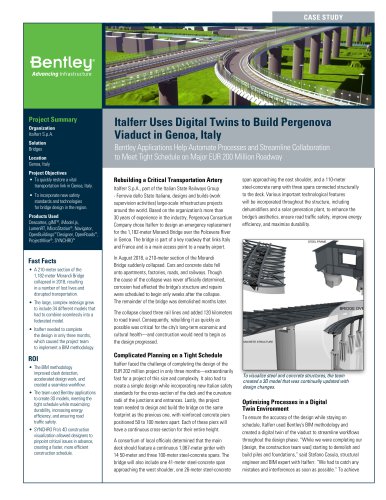
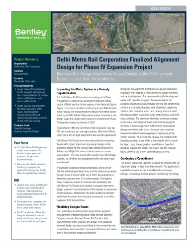
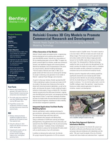
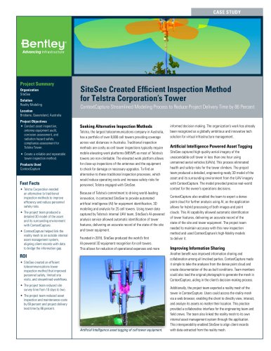
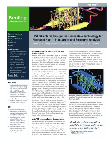
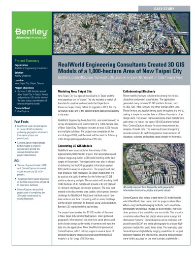
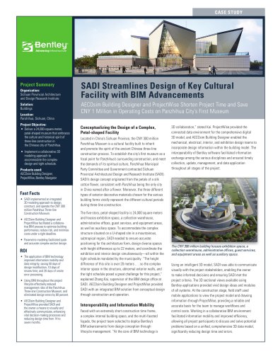
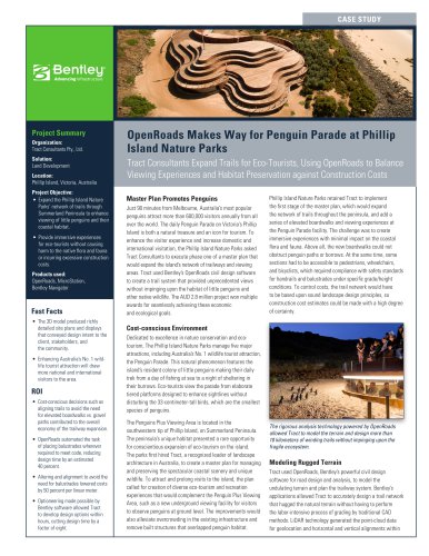
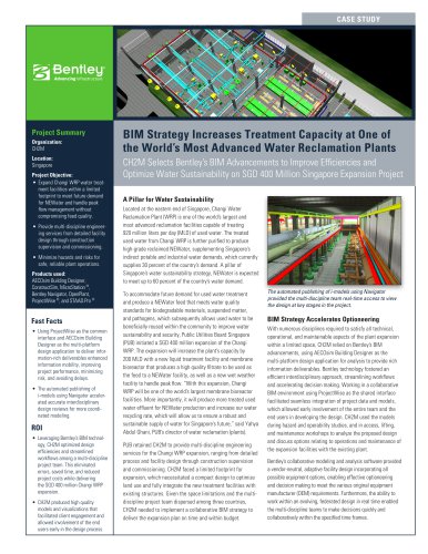
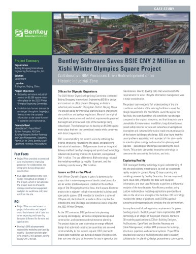
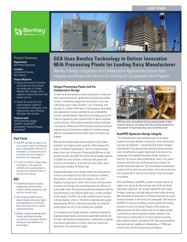
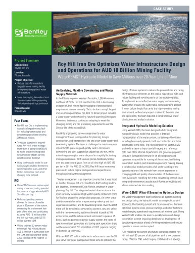
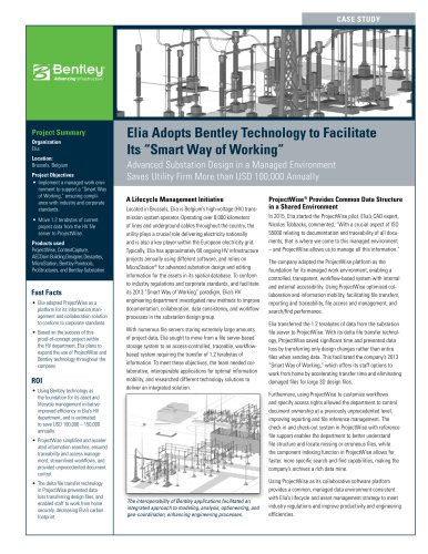
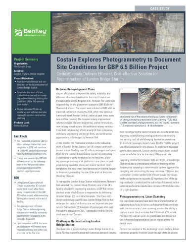
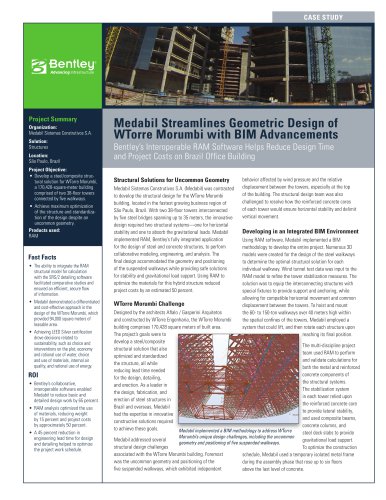
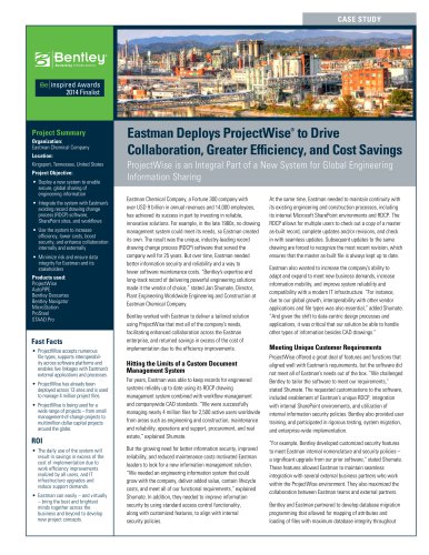
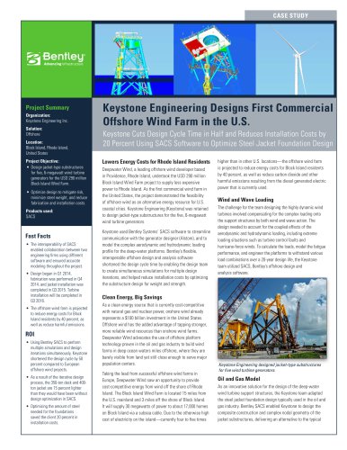
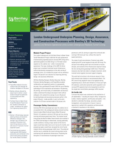
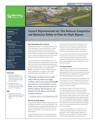
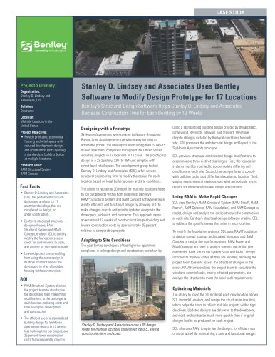
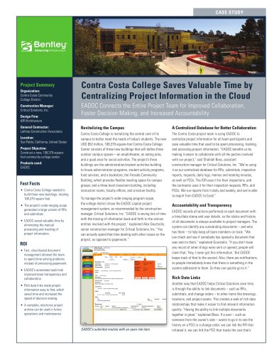
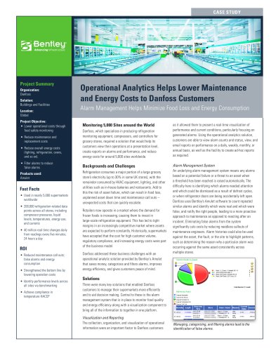
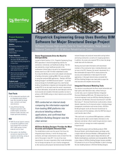
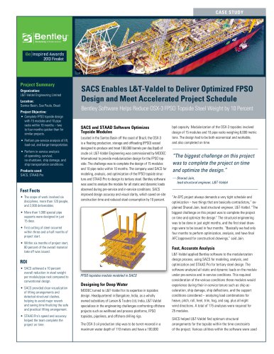
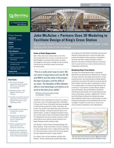
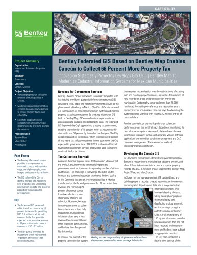
Excertos do catálogo

ٮ Geospatial Server Bentley Cadastre includes Bentley Map and takes advantage of the many capabilities it offers. From Bentley Map, Bentley Cadastre receives XML Feature Modeling (XFM), the topology model, the ability to define and enforce business and topological rules in efficient creation and editing workflows, and an extensive range of map presentation and output capabilities. Bentley Map brings CAD accuracy, ease-of-use, and efficiency to GIS, along with all the power of MicroStation > in a three-tier architecture. > With Bentley Cadastre, you can split and merge parcels, modify the cadastral fabric, and develop easements and right-of-ways while topology is dynamically maintained. > Move COGO data directly into topology with the integrated COGO Editor. The COGO Editor provides a fast and accurate means of creat- ing parcel data from the boundary descriptions recorded in official documents. > ٮ . > Parcel data layered with topography and imagery Bentley Cadastre includes extensive sample XML schemas for North America and Europe. These schemas are easily customizable using the Geospatial Administrator, which relies on Bentleys XML Feature Modeling (XFM) technology. > With the Bentley Cadastre intuitive tools, one stroke of the cursor can perform several op- erations including modifying the parcel edges, joining the parcel faces, updating parcel attributes and re-calculating the area and re- annotating the new parcel. > Bentley Cadastre is completely customizable. The user can readily develop custom dialogs in association with custom XFM features. Data integrity is preserved with logical business rules, such as customizable preset domain constraints, to enforce accuracy and depend- ability. > Dynamically place points through radial or rectangular measurements from a user defined baseline or produce a list of radial or rectangu- lar ғstaking measurements from a collection of graphically placed points as they relate to a user defined baseline. With Linear Adjust- ment, integrate inaccurate point data into the placement of a linearly adjusted boundary with weighted ԓconfidence variables applied to the point data. > Bentley Cadastre allows you to define logical business rules that ensure the spatial and legal accuracy of land information. The rules are ap- plied during placement and editing operations in order to maintain data integrity. > Splitting a large parcel into 7 equal areas With only a couple clicks of the mouse you can split a large parcel into several equal areas and produce the legal descriptions of the resultant parcels. With Bentley Cadastre you can accomplish this in just minutes, eliminating the time-consuming methods of the past. Oracle Spatial is fast becoming the standard method for organizations to store and manage large volumes of spatial data. Bentley Cadastre can edit data directly in any standard two-tier Oracle Spatial environment or extract, edit, and post to Oracle Spatial via the Bentley Visit us on the Web for more information about Bentley solutions and services. www.bentley.com >
Abrir o catálogo na página 1
ՕՕՕ Օ Օ ՕՕ Օ Օ Օ ՕՕ Օ Օ Example XML schemas and data in both North American and European formats Over 1000 customizable features including: Cadastre/ topography / base map / guide map / hypsography / buildings Օ ՕՕՕ ՕՕՕՕ Օ ՕՕ Split and merge parcelsModify cadastral fabric Develop easements and right-of-ways Topology is dynamically maintained during editing operations > Move COGO data directly into topology with the integrated COGO editor Create parcel data from legal descriptions Dynamically create topology from boundaries defined by legal descriptions On-screen digitizing Maintain, modify,...
Abrir o catálogo na página 2Todos os catálogos e folhetos técnicos Bentley Systems Europe B.V.
-
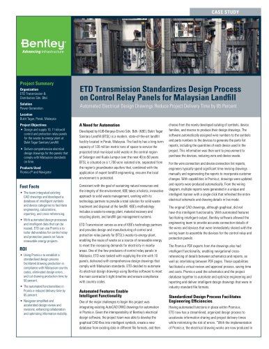
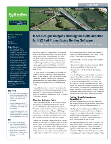
 Sweco’s ‘Live BIM’ Railway Project
2 Páginas
-
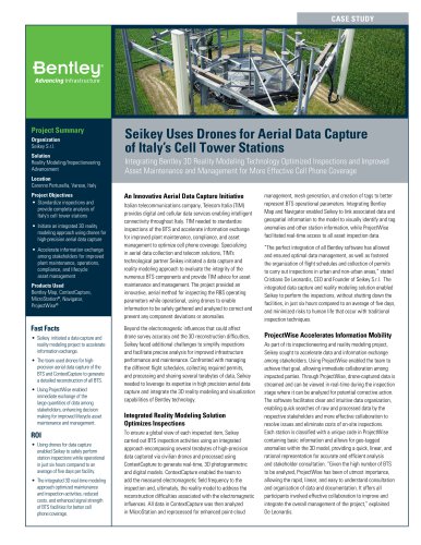
 Digital Airport Project Showcase
18 Páginas
-
 Water_Hazelwood_Coal_Mine
2 Páginas
-
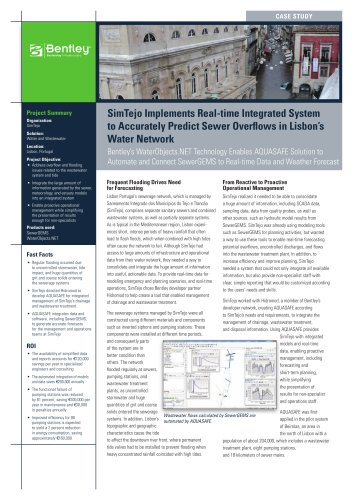
 Water_Simtejo_case_study
2 Páginas
-
 WaterTreatment_GippslandWaterFactory
2 Páginas
-
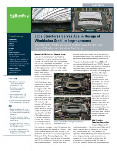
 Wimbledon Stadium_Case Study
2 Páginas
-
 WSP-Shard_Case_Study
3 Páginas
-
 Bentley’s Water Project Showcase
92 Páginas
-
 Mine Water Software Solution
4 Páginas
-
 AutoPLANT Equipment V8i
2 Páginas
-
 AutoPLANT Piping V8i
2 Páginas
-
 ConstructSim
2 Páginas
-
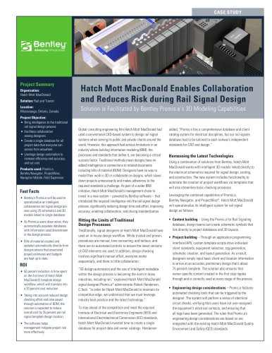
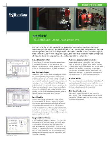 promis•e
2 Páginas
-
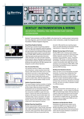 Bentley Instrumentation and Wiring
2 Páginas
-
 Bentley Datasheets
2 Páginas
-
 Making PDS Interoperable
17 Páginas
-
 Bentley OpenPlant PowerPID
2 Páginas
-
 Bentley OpenPlant Isometrics Manager
2 Páginas
-
 Bentley OpenPlant ModelServer V8i
2 Páginas
-
 Bentley OpenPlant Modeler V8i
2 Páginas
-
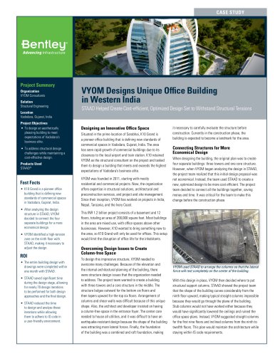
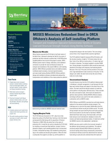
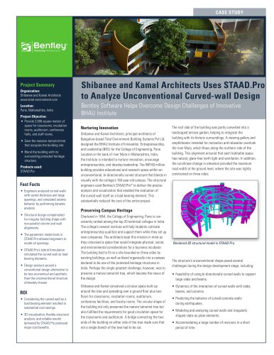
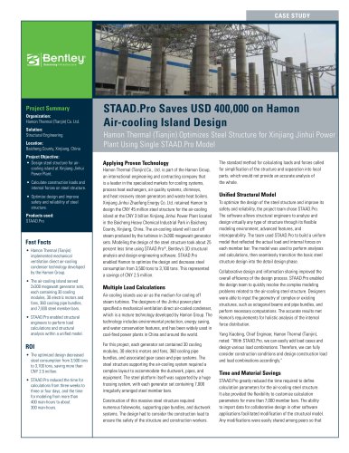
 STAAD.Pro
2 Páginas


Catálogos arquivados
-
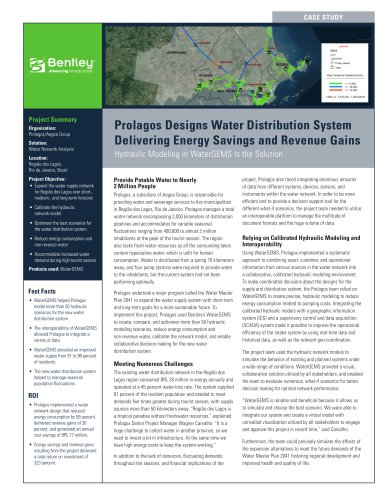
 Water modelling
24 Páginas
-
 Bentley Water V8 XM
2 Páginas
-
 PowerMap V8 XM Edition Spec Sheet
2 Páginas
-
 STAAD Foundation
2 Páginas
-
 RAM CADStudio
2 Páginas
-
 RAM Connection Product brochure
4 Páginas
-
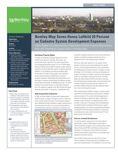
 Bentley MAP
2 Páginas
-
 Bentley Structural Brochure
2 Páginas
-
 Bentley Project Yearbook 2006
82 Páginas
-
 Bentley SewerCAD
2 Páginas
-
 Bentley WaterCAD
2 Páginas
-
 Bentley WaterGEMS
2 Páginas
-
 Bentley HAMMER
2 Páginas
-
 Bentley StormCAD
2 Páginas
-
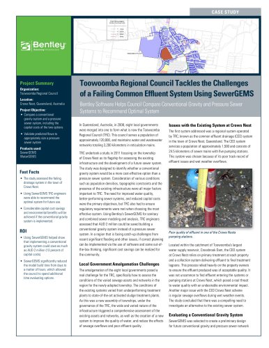
 Bentley SewerGEMS
2 Páginas
-
 Bentley AutoPlant P&ID
2 Páginas
-
 Bentley Microstation
2 Páginas
-
 Bentley Architecture
2 Páginas
-
 Bentley ProjectWise brochure
2 Páginas
-
 Bentley CivilStorm
2 Páginas
-
 Bentley ProjectWise
4 Páginas
-
 Bentley Digital Plant Solutions
3 Páginas
-
 Bentley PowerDraft
2 Páginas
-
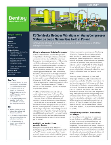
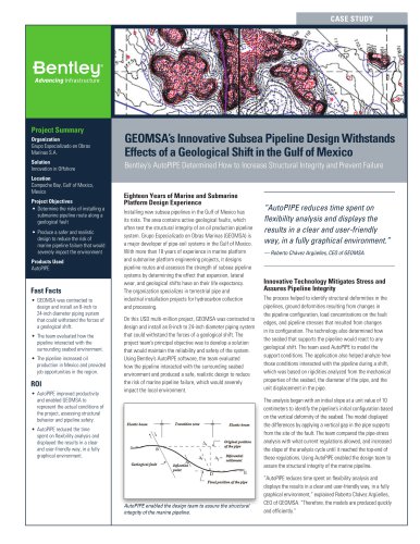
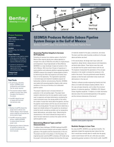
 Bentley AutoPipe Specsheet
2 Páginas


