- Catalogs
- Wuxi Bewis Sensing Tecnology LLC
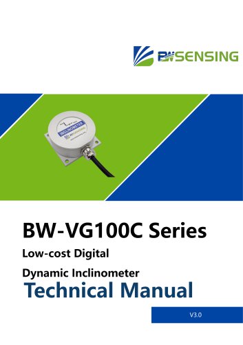
- GI3100G High-precision Fiber Optic Integrated Navigation System Technical Manual
- Company
- Products
- Catalogs
- News & Trends
- Exhibitions
GI3100G High-precision Fiber Optic Integrated Navigation System Technical Manual
1 /10Pages

GI3100G High-precision Fiber Optic Integrated Navigation System Technical Manual
1 /10Pages
Catalog excerpts

GI3100G Series High-precision Fiber Optic Integrated Navigation System
Open the catalog to page 1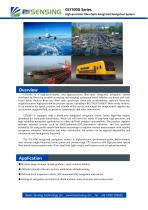
GI3100G Series High-precision Fiber Optic Integrated Navigation System GI3100G is a high-performance and high-precision fiber-optic integrated navigation system developed by Bewis for aviation surveying and mapping, unmanned aerial vehicles, sea-based and roadbased fields. Built-in three-axis fiber optic gyroscope, three-axis accelerometer, optional three-axis magnetic sensor, high-precision air pressure sensor, including a BD/GPS/GLONASS three-mode receiver. It can measure the speed, position, and attitude of the carrier, and output the compensated angular rate, acceleration, magnetic field,...
Open the catalog to page 2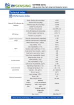
GI3100G Series High-precision Fiber Optic Integrated Navigation System Technical index Performance index North Seeking Accuracy(deg) Attitude angle Accuracy(deg) Speed Accuracy(m/s) Azimuth Keeping Accuracy(deg) Azimuth Accuracy(deg) Position Accuracy(m) Attitude angle maintaining Position accuracy(km) Azimuth measurement range(deg) Attitude measurement range(deg) Measurement range( deg/s) bias stability(º/h) Bias repeatability(º/h) Random walk coefficient(º/√h) Scale factor Non-linearity (ppm) Scale factor asymmetry(ppm) Scale factor repeatability(ppm) Measurement range(g) Offset stability(mg)...
Open the catalog to page 3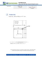
GI3100G Series High-precision Fiber Optic Integrated Navigation System Weight(kg) Product Size Product Size:L208 mm×W208 mm ×H117(mm) Note: NO dimension tolerance is specified according to grade C of GB/T1804-2000. GI2200 Customised fibre optic gyro combination inertial guide form facto Bewis Sensing Technology LLC
Open the catalog to page 4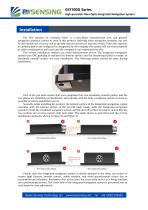
GI3100G Series High-precision Fiber Optic Integrated Navigation System The GPS antenna we routinely select is a zero-phase measurement one, and general navigation antennas cannot be used in this product. Although some navigation antennas can also be directional, the accuracy will be greatly reduced and errors may also result. If the user replaces an antenna that is not configured or designated by the company, the system will not work properly or other consequences will occur, and the company is not responsible for this. The correct installation method can avoid measurement errors. The integrated...
Open the catalog to page 5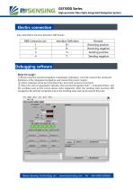
GI3100G Series High-precision Fiber Optic Integrated Navigation System Electirc connection Data cable RS422 interface definition, DB9 female: Remark Receiving positive Receiving negative Sending positive Sending negative Debugging software ①Ensure that the inertial navigation is absolutely stationary, correctly connect the serial port hardware of the integrated navigation, and connect the power supply. ② Select computer serial port and baud rate, next click connects serial port. ③ Enter the correct geographic latitude, click Inertial Navigation Start → Command Enter, and the working state on...
Open the catalog to page 6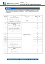
GI3100G Series High-precision Fiber Optic Integrated Navigation System After the system works, it broadcast navigation data to the outside during normal operation on 100Hz Frequency and RS422 communication 115200bps, n, 8, 1, 48 bytes of data per frame is shown in the following table: Navigation Data Working data: 0- monitor status、 Inertial navigation pitch ([-90 ,90]°) , Unit 0.01° short int (Low byte first, High byte last) Speed after GPS satellite positioning, unit 0.1 m/s east is negative, north to west is positive, Unit0.1° Bewis Sensing Technology LLC 180]°) , North to east is negative,...
Open the catalog to page 7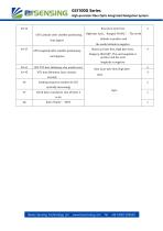
GPS Latitude after satellite positioning, Unit degree GPS Longitude after satellite positioning, unit degrees GPS UTC date (ddmmyy, day month year) UTC time (hhmmss, hour, minute, second) Sending sequence number (0-255 cyclically increasing) Check byte, cumulative sum of bytes 3 to 46 Bewis Sensing Technology LLC float (Low byte first, High byte last) ,Ranges[-90,90] °, The north latitude is positive and the south latitude is negative. float (Low byte first, High byte last) , Ranges[-180,180]°, The east longitude is positive and the west longitude is negative. float (Low byte first, High byte...
Open the catalog to page 8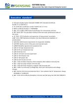
GI3100G Series High-precision Fiber Optic Integrated Navigation System Executive standard ● Enterprise Quality System Standard: ISO9001:2015 Standard (Certificate No.064-21-Q-3290-RO-S) ● CE certification (certificate number: M.2019.103. U Y1151) ● ROHS (certificate Number: G 190930099) ● GB/T 191 SJ 20873-2003 General specification for inclinometer and level ● GBT 18459-2001 The calculation method of the main static performance index of the sensor ● JJF 1059.1-2012 Evaluation and expression of measurement uncertainty ● GBT 14412-2005 Mechanical vibration and shock Mechanical installation of...
Open the catalog to page 9
GI3100G Series High-precision Fiber Optic Integrated Navigation System Wuxi Bewis Sensing Technology LLC Add:Building 30, NO. 58, Xiuxi Road, Binhu District, Wuxi Jiangsu China Tel:0510-85737158 Mail:[email protected] Web:www.bwsensin
Open the catalog to page 10All Wuxi Bewis Sensing Tecnology LLC catalogs and technical brochures
 BW-D63-B
5 Pages
 BW-C50-B
4 Pages
 BW-B80-B
5 Pages
 GI320
GI32025 Pages
 BWSENSING BWK217S
8 Pages
 AH100C
9 Pages
 LoRaWAN G500 Gateway
1 Page
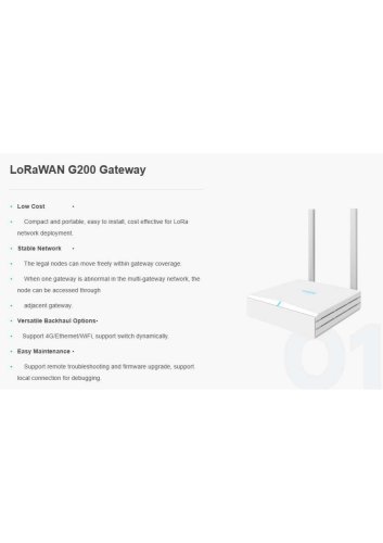 LoRaWAN G200 Gateway
1 Page
 BWSENSING BWS5000E
14 Pages
 BWSENSING Catalog 2020
60 Pages
 BWSENSING BWK228
13 Pages
 BWSENSING BWK218
12 Pages
 BWSENSING BWK220
13 Pages
 BWSENSING BWK210
13 Pages
 BWSENSING BWK227S
13 Pages
 BWSENSING BWK226S
13 Pages
 BWSENSING BWK225S
12 Pages
 BWSENSING BWK216S
12 Pages
 BWSENSING BWK215S
12 Pages
 BWSENSING BWL320
13 Pages
 BWSENSING BWL328
13 Pages
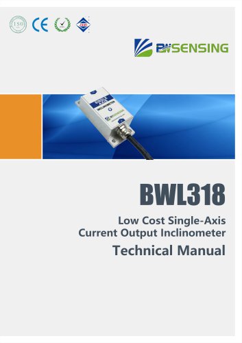 BWSENSING BWL318
12 Pages
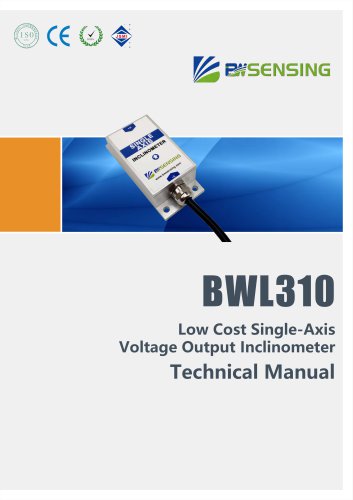 BWSENSING BWL310
13 Pages
 BWSENSING BWL327S
13 Pages
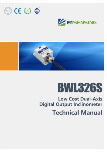 BWSENSING BWL326S
13 Pages
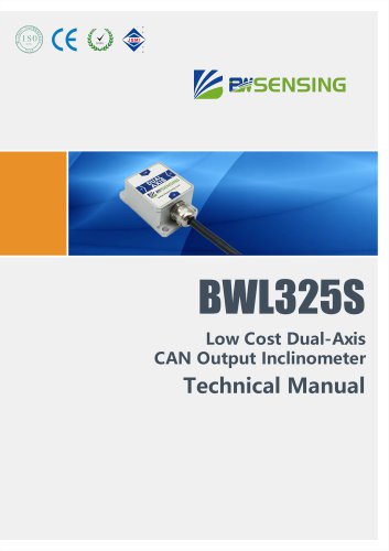 BWSENSING BWL325S
12 Pages
 BWSENSING BWL317S
12 Pages
 BWSENSING BWL316S
12 Pages
 BWSENSING BWL315S
12 Pages
 BWSENSING BWN460
12 Pages
 BWSENSING BWN428
13 Pages
 BWSENSING BWN427
13 Pages
 BWSENSING BWN425
12 Pages
 BWSENSING BWN420
13 Pages
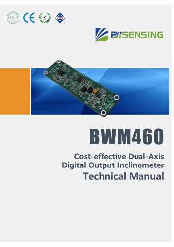 BWSENSING BWM460
12 Pages
 BWSENSING BWM427
13 Pages
 BWSENSING BWM426
13 Pages
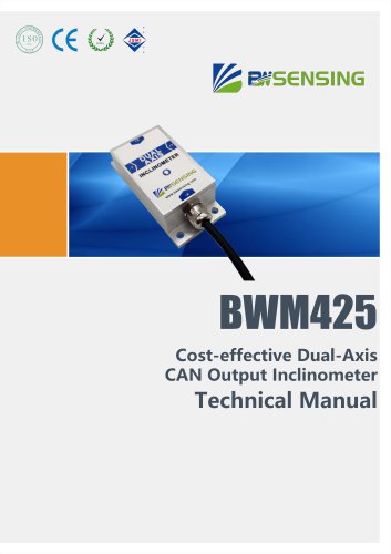 BWSENSING BWM425
12 Pages
 BWSENSING BWM420
13 Pages
 BWSENSING BWM418
12 Pages
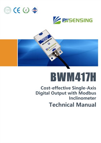 BWSENSING BWM417H
12 Pages
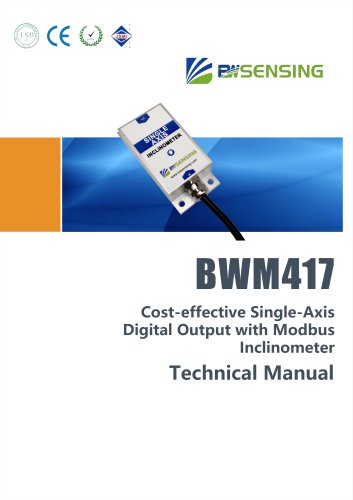 BWSENSING BWM417
12 Pages
 BWSENSING BWM416
12 Pages
 BWSENSING BWM415
12 Pages
 BWSENSING BWM410
12 Pages
 BWSENSING BWH528
14 Pages
 BWSENSING BWH527
13 Pages
 BWSENSING BWH526
14 Pages
 BWSENSING BWH525
12 Pages
 BWSENSING BWH520
14 Pages
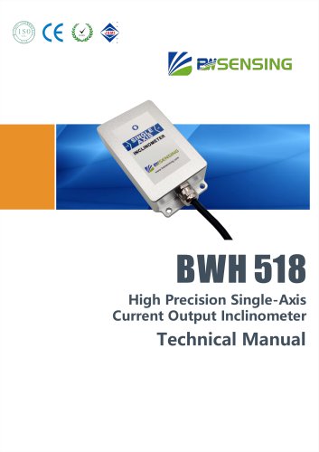 BWSENSING BWH518
13 Pages
 BWSENSING BWH517
12 Pages
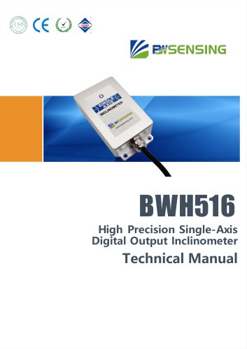 BWSENSING BWH516
13 Pages
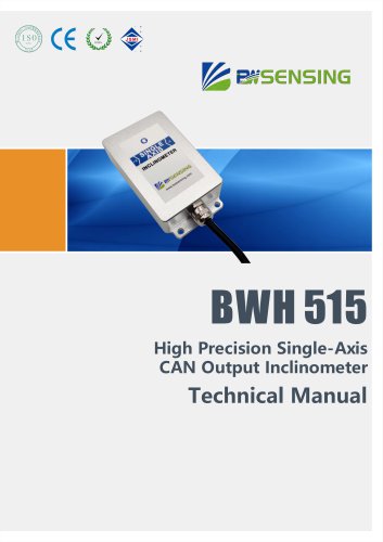 BWSENSING BWH515
12 Pages
 BWSENSING BWH510
13 Pages
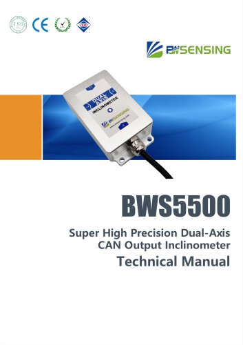 BWSENSING BWS5500
12 Pages
 BWSENSING BWS4800
14 Pages
 BWSENSING BWS5700
13 Pages
 BWSENSING BWS2500
12 Pages

Archived catalogs
 BWSENSING BWN426
13 Pages
- Digital imager
- Visible imager
- Measuring device
- Industrial camera module
- Infrared imager
- Monitoring camera system
- Detection camera system
- Communication gateway
- Waterproof camera module
- Compact imager
- Industrial gateway
- Thermographic camera
- Inspection imager
- Digital gauge
- Temperature-controlled camera
- High-speed camera module
- Wireless gateway