


GTL-1000

GTL-1000
The GTL-1000 is a Laser Scanner Total Station designed for efficient 3D scanning and surveying. It has a visible distance range of 1.3 to 150 meters and a resolving power of 4' at the center area. The device includes a laser-pointer function, electric circular levels with a sensitivity of 6', and an optical plummet with 3X magnification. It is dust and water-resistant (IP54) and operates in temperatures from -10°C to 50°C. The instrument dimensions are 212 x 178 x 424 mm, weighing 7.2 kg including the BDC70 battery, which provides approximately 2 hours of operation.
The scanning unit captures up to 100,000 points per second, with a maximum range of 70 meters and a field of view of 270° vertically and 360° horizontally. Distance accuracy ranges from 4mm at 10 meters to 8mm at 30 meters. The camera has a 5M pixel resolution and shares the same field of view as the scanner.
The GTL-1000 supports auto pointing and tracking with a direct drive ultrasonic motor, capable of 180°/sec rotation speed. It measures distances up to 6,000 meters using prisms and reflective sheets. The device operates on Windows Embedded Compact 7, with a 4.3-inch color LCD touch panel and supports various data transfer methods including USB and Bluetooth.
The GTL-1000 is optimized for BIM construction verification, civil, survey, and maintenance applications. It integrates scanning and total station functions, reducing the need for separate equipment and minimizing fieldwork time. The device supports efficient point cloud registration and is compatible with MAGNET Field software for enhanced data processing and management.
The standard package includes accessories such as a battery, charger, stylus pen, and carrying case. The GTL-1000 is designed to streamline digital construction workflows, offering significant reductions in investment costs, working hours, and manpower requirements.
The document describes the GTL-1000 as a versatile surveying tool that integrates multiple sensors into a single platform, including UAVs, MMS, and laser scanners. It highlights the capabilities of the GTL-1000 in collecting 3D point cloud data efficiently and accurately.
The GTL-1000 features a high-speed, high-accuracy rotating laser scanner capable of completing a full dome scan in about one minute. It offers surface accuracy of 5mm at 10 meters, suitable for architectural construction. Data is stored on an SD card, and the device supports various measuring targets, including prisms and reflective targets.
The GTL-1000 facilitates one-man operations with auto-tracking and auto-collimating features, enhancing workflow efficiency. It can be remotely controlled, allowing operation from safe locations in hazardous areas.
MAGNET Field software supports data collection and construction layout, while MAGNET Collage Web allows viewing and processing of point cloud data. The software supports various registration methods for fieldwork.
TSshield provides remote support and security features, including geofencing, timefencing, and performance analysis. It ensures optimal operation and protection of the total station.
The GTL-1000 supports quick and accurate data collection, remote operation, and integration with software solutions for comprehensive data processing and analysis.
Catalog excerpts

SPECIFICATIONS Jype • Main unit • Battery (BDC70) • Charger(CDC68A) • Power cable(EDC113) • Stylus pen • Lens cap • Lens hood • Tool pouch • Screw driver • Lens brush • Adjusting pin *1:No haze, visibility over 20 km, slightly overcast (less than 30000 lx), no scintillation. *2:When using a reflective sheet for Auto Pointing, the size of sheet (10 to 90 mm) must be selected to correspond to the distance being measured. Use smaller reflective sheets for shorter distances. *3:Figures when the Auto Pointing beam strikes within 15° of the reflective sheet target. *4:IEC60825-1 Ed. 3.0: 2014/FDA CDRH 21CFR Part1040.10 and 1040.11 (Complies with FDA performance standards for laser products except for deviations pursuant to Laser Notice No.50, dated June 24, 2007.) *5 : Slight haze, visibility about 20 km, sunny periods, weak scintillation. *6 : Figures when using Kodak Gray Card White side (reflection factor 90%), brightness level is less than 5,000 lx and the laser beam strikes orthogonally the White side. *7 : Figures when using Kodak Gray Card White side (reflection factor 90%), brightness level is less than 500 lx and the laser beam strikes orthogonally the White side. *8 : Figures when the laser beam strikes within 30° of the reflective sheet target. *9 : Face the prism toward the instrument during the measurement with the distance at 10 m or less. *10 : Accuracy is (5 + 2 ppm X D) mm for distance range 0.3 to 0.66 m. *11 : No haze, visibility about 40 km, overcast, no scintillation. *12:No obstacles, few vehicles or sources of radio emissions/interference in the near vicinity of the instrument, no rain. *13:Usage range could be shorter depending on specifications of Bluetooth device to communicate. *14:Guide Light and Laser-pointer dose not work at the same time. *15: Figures will change depending on the operating environment including temperatures and observation conditions. *16:Face the object toward the instrument. *17:Overall EDM accuracy considering surface accuracy and linearity. *18:Surface of reflection factor 90% 3D Mass Data Software Solution MAGNET Collage Compliant! GTL-1000 Laser Scanner Total Station • Hexagonal wrench • Silicon cloth • Quick guide • Startup guide(This sheet) • SD card • USB flash drive (Manual) • Serial card • Laser caution sign-board • Carrying case • Carrying strap • Export restrictions card - Specifications may vary by region and are subject to change without notice. - Bluetooth® word mark and logos are registered trademarks owned by Bluetooth SIG, Inc. and any use of such marks by Topcon is under license. - Other trademarks and trade names are those of their respective owners. Your local Authorized Dealer is: Remote Support System TSshield Protect your total station! WORLD FIRST! Laser Scanner on Robotic Total Station • GTL-1000 performs accurate 3D scanning PLUS As-Built & Layout • One single unit operation saves work time drastically • Semi automatic hardware point cloud registration • Best solution for BIM construction verification as well as Civil, Survey, and Maintenance application • Onboard MAGNET Field software • One man Survey and remote control by a field controller *As a rotating type laser scanner built on Auto Tracking Robotic TS as of Sep 2019
Open the catalog to page 1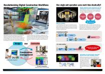
Revolutionizing Digital Construction Workflows One single unit operation saves work time drastically!! Drastic reduction of the investment cost, the working hours and the number of workers! Robotic total station and full dome laser scanner got integrated into GTL-1000 ! In addition to the investment cost, GTL-1000 improves the workflows. It gives you more benefits. Investment cost Full dome Laser Scanner Robotic Auto Tracking Total Station Efficient workflow In a conventional way, it was required to use total station and laser scanner separately at the same site. Once we tried to work with total...
Open the catalog to page 2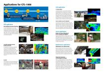
Applications for GTL-1000 Civil application BIM Solution 3D As-built data i-Construction Planning Creating 3D design data based on the collected As-built point cloud data Comparison between registered point cloud data and 3D design data BIM application BIM (Building Information Modeling) i-Construction which is to promote the productivity improvements of the construction sites in Japan by Japanese Ministry of Land, Infrastructure and Transport. (MLIT) Laser scanner, UAV technologies have been leveraged for terrain survey, progress and deliverable management. You can remarkably save the construction...
Open the catalog to page 3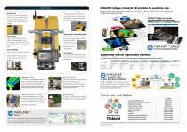
MAGNET Collage connects 3D solution to seamless site. Rotation type, High speed, high accurate scan GTL-1000 can complete the full dome scan in about 1 minute. You can collect 3D point cloud data quickly. Surface accuracy is 5mm at 10 meter so that it fits the architectural construction. Data storage on SD card Data storage is done on SD card. The points measured by total station and 3D point cloud data captured by scanner are both stored on SD card as the package file. Auto-tracking Layout with auto-tracking expands your workflow. One man operation with autotracking navigates you to the design...
Open the catalog to page 4All TOPCON catalogs and technical brochures
 RL-H5A
2 Pages
 CR-G5-C
1 Page
 GM-50
GM-502 Pages
 PG-S1
PG-S11 Page
 G5-A1
G5-A11 Page
 HiPer VR
4 Pages
 HiPer HR
4 Pages
 TP-L4 series
2 Pages
 DS series
4 Pages
 AT-B series
2 Pages
 Net-G5
1 Page
 Corporate Profile 2015
16 Pages
 Tesla
Tesla4 Pages
 IP-S3 HD1
4 Pages
 ScanMaster
2 Pages
 IP-S2 Lite
4 Pages
 GPT-3500LN / LNW
2 Pages
 NET-G3A Catalogue
2 Pages
 SRL-35 Catalogue
2 Pages
 CR-G5 Catalogue
2 Pages
 PN-A5 Catalogue
2 Pages
 LN-100 Catalogue
4 Pages
 MS05AXII / MS1AXII Catalogue
4 Pages
 MS Series Catalogue
2 Pages
 GTS-250 Series Catalogue
4 Pages
 GLS-2000
8 Pages
 SiteHunter Catalogue
4 Pages
 MAGNET Enterprise Catalogue
9 Pages
 LS-B10/B10W Catalogue
2 Pages
 AT-B Series Catalogue
2 Pages
 DT-200/200L Catalogue
4 Pages
 SRL-35 Heavy-Duty UHF Radio
2 Pages
 TSshield
2 Pages
 LS-B10/RD-10W SERIES
2 Pages
 FC-250 field controller
1 Page
 DS Direct aiming Station
4 Pages
 hiper pro
2 Pages
 ScsnMaster CAD Link
2 Pages
 TG-3
TG-32 Pages
 Euro 112T
2 Pages
 G3 160T
2 Pages
 HiPer Ga/Gb
2 Pages
 GLS-1500
8 Pages
 ES Catalogue
4 Pages
 OS Catalogue
4 Pages
 PS Series
4 Pages
 IS Catalogue
4 Pages
 GMS-2Pro
4 Pages
 GB-1000/500
2 Pages
 GRS-1
GRS-14 Pages
 Hyper II
2 Pages
 3D Laser Scanner GLS-1500
4 Pages
 Slope Lasers RL-100 1S/2S
2 Pages
 TP-L4 series PIPE LASER
2 Pages


Archived catalogs
 FC-2000 DATA COLLECTOR
2 Pages
 AT-G series AUTO LEVEL
2 Pages


- Management software solution
- Automation software solution
- Analysis software solution
- Measuring machine
- Windows software
- Computer-aided design software
- Cloud-based software
- Design software solution
- 3D software solution
- Measurement software
- Interface software
- Development software
- Creation software
- 2D software
- 3D scanning system
- Data acquisition software
- Modeling software
- Measurement scanner
- Radio receiver