Catalog excerpts

IP-S2 HD IP-S2 HD – Mobile Mapping System Add New Value to Your GIS Database with Geo-referenced 3D Images n ltimate density, long range scanning U n anoramic plus high resolution P cameras n ual Frequency GNSS Tracking D n igh Accuracy 6-Axis IMU Integration H n nternal or external Wheel Encoders I for Odometry and Tracking
Open the catalog to page 1
IP-S2 3D Mobile Mapping System with Velodyne® Laser Scanner IP-S2 HD IP-S2 HD is the ultimate solution when minimizing field work and obtaining maximum detail in a single run is important. IP-S2 HD provides the greatest point cloud density and longest range available today. The unique arrangement of lasers minimizes scanning shades and scans objects from multiple sides in a single pass. Four optional high resolution cameras locally enhance the resolution of the panoramic images, enabling the user to read small texts on traffic signs or other roadside features. Topcon's IP-S2 mobile mapping...
Open the catalog to page 2
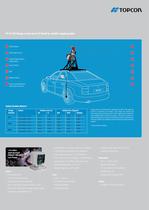
IP-S2 HD brings a new level of detail to mobile mapping data 1 GNSS Antenna 1 2 360° Digital Camera 2 3 Optional high resolution detail cameras 3 4 Laser scanners 4 5 IMU 5 6 Wheel encoders 6 7 Sensor mount folds down when system not in use 7 Vehicle Position Metrics* Outage System Duration Position error (m) 2D H 0 s IP-S2 (AG58 - 1°/Hr) 0.015 0.025 0.020 0.020 0.040 IP-S2 (AG60 - 3°/Hr) 0.015 0.025 0.025 0.025 0.050 15 s IP-S2 (AG58 - 1°/Hr) 0.020 0.025 0.020 0.020 0.045 Outage results are determined by calculating the RMS of the maximum errors for a minimum of 30 outages. Each outage was...
Open the catalog to page 3
The Leader in Positioning Technology ... SPECIFICATIONS Topcon Positioning Systems is the worldwide leading IP-S2 HD developer and manufacturer of precision positioning GNSS COMPONENT equipment and offers the widest selection of innovative precision GPS systems, laser, optical surveying, and Tracking 20 satellites, all-in-view, L1, GPS, L1/L2 GPS, L1/L2 GLONASS, L1/L2 GPS + L1/L2 GLONASS, WAAS, MSAS, EGNOS machine control products. Low Signal Tracking Down to 30 dBHz Cold Start < 60 sec sites and from rolling farmland to inner city utility projects, Topcon Positioning Systems creates...
Open the catalog to page 4All TOPCON EUROPE POSITIONING catalogs and technical brochures
-
RL-SV2S
2 Pages
-
FC-6000
4 Pages
-
3D CONSTRUCTION
32 Pages
-
2D / 3D Excavator Control
2 Pages
-
IS-1 Series
9 Pages
-
FS-1 series
4 Pages
-
IMAGEnet i-base
2 Pages
-
OMS-800 Series
8 Pages
-
SP-1P
8 Pages
-
KR-1W
2 Pages
-
CA-800
16 Pages
-
SL-D Series
16 Pages
-
SL-2G
4 Pages
-
SL-D701
2 Pages
-
SL-D701
8 Pages
-
TRC-50DX
8 Pages
-
TRC-NW8 series
8 Pages
-
3D OCT
12 Pages
-
DRI OCT Triton series
20 Pages
-
GT SERIES
4 Pages
-
GR-5
4 Pages
-
3D-MC MAX
4 Pages
-
X-53
2 Pages
-
X-53i
2 Pages
-
DynaRoad
4 Pages
-
Topcon Tierra
4 Pages
-
DL series
4 Pages
-
Robotic Total Stations
4 Pages
-
Dozer GPS + Control
4 Pages
-
Dozer LPS control
4 Pages
-
MACHINE CONTROL CATALOGUE
16 Pages
-
Dozer Laser Control
4 Pages
-
LASER CATALOGUE
12 Pages
-
3D Mobile Mapping System
6 Pages
-
ScanMaster - Data Management
4 Pages
-
TopSURV7
4 Pages
-
Topcon Tesla RTK
4 Pages
-
IP-S2 Compact
8 Pages
-
ImageMaster
4 Pages
-
Survey / Mapping CATALOGUE
28 Pages
-
IS Imaging Station
4 Pages
-
Field Controller (FC-250)
4 Pages
-
Laser Scanner (GLS-1500)
4 Pages
Archived catalogs
-
Crossline Laser (LC-2,LC-4X)
4 Pages
-
Laser Range
8 Pages
-
GPS+Receivers (HiPer Pro)
4 Pages
-
GPS+Receivers (Hiper Series)
6 Pages
-
Leaflet FC-200
2 Pages
-
Leaflet ATG-Series
4 Pages


