Catalog excerpts

ImageMaster ImageMaster - Office Software Imaging Software n Clear and easy user interface n Combine Survey data, Pointclouds and Photogrammetric projects n Manage multiple models using multiple source data n Generate 3D models for measure ment, mapping and interpretation n Produce models with accuracies upto 0.4 mm
Open the catalog to page 1
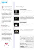
T opcon’s ImageMaster: seamlessly integrate Features of ImageMaster digital imagery with 3D data measured using your chosen survey tool, be it Imaging Station, Laser Scanner or Digital camera. Topcon bring you the software solution to man- Designed to interface with the IS age 3D data measured using our Capture Reality Control the Imaging Station via WiFi and conduct your survey from the range of products. comfort of your office or site vehicle. Alternatively import data collected “onboard” and view this data with value added image information to ImageMaster gives you the tools to work...
Open the catalog to page 2
ImageMaster - 3D Data management and photogrammetric software Easy to use, Imaging software for combining survey data, pointclouds and photogrammetric projects. 1 2 3 4 5 6 7 1 Many viewing options 2 Photogrammetric tools 3 Easy data manipulation 5 Functional modeling options 6 Simple project navigation 7 Layered data Image Master applications: The advanced features: – Mining – Creating sections – Aerial Photogrammetry – Creating contours – Architecture – Area and volume calculations – Archeaology – Distance measurements – Disaster monitoring/mapping – TIN model generation – Accident /crime...
Open the catalog to page 3
ImageMaster is available in three Version Features versions: l ImageMaster Pro ImageMaster Pro gives full access to Topcon’s For IS Pro STD IS Remote access control (Grid scan, point measurement, image capture) X X X Capture Reality range and provides the tools to DATA INPUT make Imaging effective in your workplace. Com- CSV X X X bine a GLS-1000, IS, 7000i and Digital camera DXF, TIN – X X with no limits, create 3D textured models or IS Scanning Data X X X produce linework from stereopair photos. Draw GPT-7000i Standard Mode data – X – elevations, compute volumes, create sections,...
Open the catalog to page 4All TOPCON EUROPE POSITIONING catalogs and technical brochures
-
RL-SV2S
2 Pages
-
FC-6000
4 Pages
-
3D CONSTRUCTION
32 Pages
-
2D / 3D Excavator Control
2 Pages
-
IS-1 Series
9 Pages
-
FS-1 series
4 Pages
-
IMAGEnet i-base
2 Pages
-
OMS-800 Series
8 Pages
-
SP-1P
8 Pages
-
KR-1W
2 Pages
-
CA-800
16 Pages
-
SL-D Series
16 Pages
-
SL-2G
4 Pages
-
SL-D701
2 Pages
-
SL-D701
8 Pages
-
TRC-50DX
8 Pages
-
TRC-NW8 series
8 Pages
-
3D OCT
12 Pages
-
DRI OCT Triton series
20 Pages
-
GT SERIES
4 Pages
-
GR-5
4 Pages
-
3D-MC MAX
4 Pages
-
X-53
2 Pages
-
X-53i
2 Pages
-
DynaRoad
4 Pages
-
Topcon Tierra
4 Pages
-
DL series
4 Pages
-
Robotic Total Stations
4 Pages
-
Dozer GPS + Control
4 Pages
-
Dozer LPS control
4 Pages
-
MACHINE CONTROL CATALOGUE
16 Pages
-
Dozer Laser Control
4 Pages
-
LASER CATALOGUE
12 Pages
-
3D Mobile Mapping System
6 Pages
-
ScanMaster - Data Management
4 Pages
-
TopSURV7
4 Pages
-
Topcon Tesla RTK
4 Pages
-
IP-S2 HD
4 Pages
-
IP-S2 Compact
8 Pages
-
Survey / Mapping CATALOGUE
28 Pages
-
IS Imaging Station
4 Pages
-
Field Controller (FC-250)
4 Pages
-
Laser Scanner (GLS-1500)
4 Pages
Archived catalogs
-
Crossline Laser (LC-2,LC-4X)
4 Pages
-
Laser Range
8 Pages
-
GPS+Receivers (HiPer Pro)
4 Pages
-
GPS+Receivers (Hiper Series)
6 Pages
-
Leaflet FC-200
2 Pages
-
Leaflet ATG-Series
4 Pages


