
Catalog excerpts
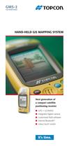
■ GPS + GLONASS ■ integrated digital camera ■ customized field software ■ internal Bluetooth > ֠ colour touch screen >
Open the catalog to page 1
TopPAD combines the power of ESRIs ArcPad Customized software > Advanced digital imaging Җ Integrated digital camera Collect, store and automatically link digital images as an attributes to GPS coordinate locations Dual constellation tracking ֖ Combine the coverage of GPS with the GLONASS system More satellites means: Better performance in tough, obstructed areas ֖ Consistently lower DOP values Multiple device inputs > with a special user interface and hardware support specifically de- signed for Topcon GIS mapping systems TopPAD - For the advanced GIS profes- sional Access to a variety of...
Open the catalog to page 2
The new BR-1 is the companion to the popular GMS-2 mapping/imaging device from Topcon. The BR-1 is designed to relay Coast Guard Beacon corrections wirelessly to the GMS-2 receiver for increased accuracy. Running on common rechargeable batteries to the GMS-2 the BR-1 will provide added flexibility and accuracy to the GMS-2 mapping system. > TopPAD software is a mobile GIS data collection system. It supports a multi-layer environment with industry-standard vector map and raster image display.Other primary features include: l Work in native shapefile formats eliminating the need to convert to...
Open the catalog to page 4
GMS-2 Number of channels 50 GPS + GLONASS L1 tracking DGPS accuracy 50 cm HRMS WAAS/EGNOS Yes L1 static function H: RMS 3 mm + 0,8 ppm V: RMS 4 mm + 1,0 ppm CORS beacon Yes with BR-1 Internal memory Flash 256 MB Processor / operating system 520 MHz Intel PXA270 Bulverde / Microsoft Windows CE 5.0 Onboard software TopPAD or TopSURV-GIS Office software Topcon Tools GIS Display Battery life 7.5 hrs while in GPS mode 3.5 240 x 320 color QVGA w / touch screen Ports Bluetooth, USB, serial, ANT and power Battery type Li-Ion battery, rechargeable / replaceable Dimensions 197 mm x 90 mm x 46 mm...
Open the catalog to page 5
Your local authorized Topcon distributor is: > grafit-werbeagentur.de T505EN >
Open the catalog to page 6All TOPCON EUROPE POSITIONING catalogs and technical brochures
-
 RL-SV2S
2 Pages
-
 FC-6000
4 Pages
-
 3D CONSTRUCTION
32 Pages
-
 2D / 3D Excavator Control
2 Pages
-
 IS-1 Series
9 Pages
-
 FS-1 series
4 Pages
-
 IMAGEnet i-base
2 Pages
-
 OMS-800 Series
8 Pages
-
 SP-1P
SP-1P8 Pages
-
 KR-1W
KR-1W2 Pages
-
 CA-800
16 Pages
-
 SL-D Series
16 Pages
-
 SL-2G
SL-2G4 Pages
-
 SL-D701
2 Pages
-
 SL-D701
8 Pages
-
 TRC-50DX
8 Pages
-
 TRC-NW8 series
8 Pages
-
 3D OCT
12 Pages
-
 DRI OCT Triton series
20 Pages
-
 GT SERIES
4 Pages
-
 GR-5
GR-54 Pages
-
 3D-MC MAX
4 Pages
-
 X-53
X-532 Pages
-
 X-53i
X-53i2 Pages
-
 DynaRoad
4 Pages
-
 Topcon Tierra
4 Pages
-
 DL series
4 Pages
-
 Robotic Total Stations
4 Pages
-
 Dozer GPS + Control
4 Pages
-
 Dozer LPS control
4 Pages
-
 MACHINE CONTROL CATALOGUE
16 Pages
-
 Dozer Laser Control
4 Pages
-
 LASER CATALOGUE
12 Pages
-
 3D Mobile Mapping System
6 Pages
-
 ScanMaster - Data Management
4 Pages
-
 TopSURV7
4 Pages
-
 Topcon Tesla RTK
4 Pages
-
 IP-S2 HD
4 Pages
-
 IP-S2 Compact
8 Pages
-
 ImageMaster
4 Pages
-
 Survey / Mapping CATALOGUE
28 Pages
-
 IS Imaging Station
4 Pages
-
 Field Controller (FC-250)
4 Pages
-
 Laser Scanner (GLS-1500)
4 Pages


Archived catalogs
-
 Crossline Laser (LC-2,LC-4X)
4 Pages
-
 Laser Range
8 Pages
-
 GPS+Receivers (HiPer Pro)
4 Pages
-
 GPS+Receivers (Hiper Series)
6 Pages
-
 Leaflet FC-200
2 Pages
-
 Leaflet ATG-Series
4 Pages


