H7
1 /2Pages
H7
1 /2Pages
Catalog excerpts

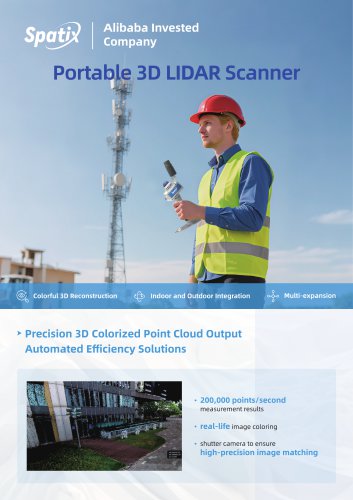
Alibaba Invested Company > Precision 3D Colorized Point Cloud Output Automated Efficiency Solutions • 200,000 points/second measurement results • real-life image coloring • shutter camera to ensure high-precision image matching
Open the catalog to page 1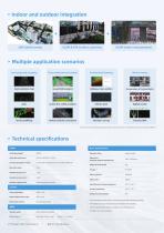
UAV aerial survey SLAM & RTK surface scanning SLAM Indoor measurement Three-dimensional analysis Architectural drawing Urban Forestry Conservation of Cultural Relics visual field analysis Railway cross-section power line safety analysis interior plan Digital Assets mine backfilling vehicle collision simulation elevation survey *Some post-processing applications require the purchase of additional industry-specific software.► Technical specifications LIDAR Basic specifications LIDAR Wavelength 905nm Operation Mode LIDAR Eye Safety Level CLASS 1 (IEC60825-1:2014) Scanning Range(@ 100 KLX) 0.1 ~40...
Open the catalog to page 2All SpatiX catalogs and technical brochures
 Q800
Q8005 Pages
 Q700
Q7005 Pages
 SpatiX
11 Pages
 SpatiX CORS Solution
29 Pages
 X5
X55 Pages
 X3
X35 Pages
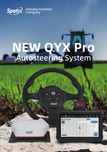 QYX Pro
4 Pages
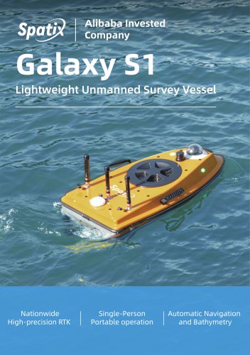 S1
S14 Pages
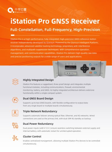 iStation Pro GNSS Receiver
2 Pages
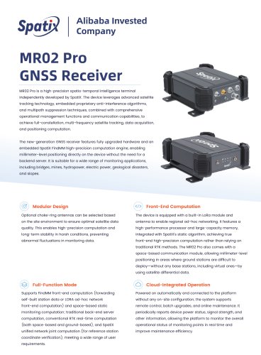 MR02 Pro
2 Pages
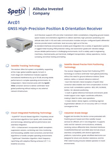 Arc01 Receiver
2 Pages
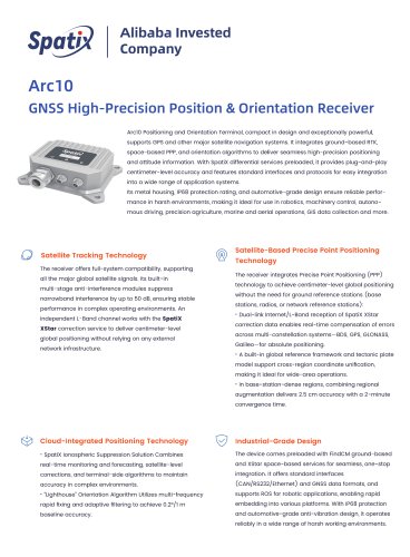 Arc10 Receiver
2 Pages
 MX01
MX012 Pages
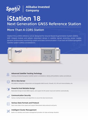 iStation18
2 Pages
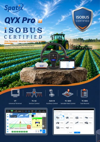 ISOBUS
2 Pages
- 3D scanning system
- Industrial control system
- SpatiX GNSS receiver
- Inspection scanner
- Compact receiver
- Industrial receiver
- Digital control system
- Rugged receiver
- Monitoring control system
- Serial receiver
- Automatic control system
- Wireless receiver
- SpatiX RTK receiver
- USB receiver
- Portable scanner
- SpatiX surveying receiver
- GPS receiver
- Multi-frequency receiver
- Bluetooth receiver
- Tracking receiver