


- Products
- Catalogs
- News & Trends
- Exhibitions
Axis3_Product_Brochure

Axis3_Product_Brochure
The Axis3 is a 12-channel L1 DGPS receiver designed for GIS and mapping applications. It supports internal beacon, L-Band (OmniSTAR VBS), and WAAS/EGNOS corrections, and is paired with a Windows® CE data collector running IMap software. It is suitable for various applications including accident reconstruction, agriculture, archaeology, emergency management, forestry, irrigation, landscape, resource mapping, utility mapping, and wetland delineation.
- Receiver: Operates at 1.575 GHz (L1) with <1 m horizontal accuracy, featuring 12 channels and 3 internal DGPS corrections.
- Internal L-Band Sensor: Frequency range of 1.525 to 1.585 GHz, with manual or automatic tuning and sensitivity of 120 dBm for <10-3 BER.
- Physical Characteristics: Receiver weighs 0.8 kg, antenna weighs 0.5 kg, and can withstand a 2.0 m pole drop.
- Environmental Conditions: Operates between -32° C to +74° C, with storage temperatures from -40° C to +85° C, and 95% non-condensing humidity.
- Power Requirements: Requires +9.5 to +48 VDC input, consumes <6.5 W, and operates up to 12 hours on 950 mAh Lithium rechargeable batteries.
- Supports multiple feature types and allows data output customization with an ASCII Output Wizard.
- Enables navigation to waypoints, data points, basemap features, coordinates, and points along a line.
- Compatible with data formats such as SHP, MIF, DXF, DGN, TIF, JPG, and DOQ.
- Offers image trimming, compression, and geo-referencing capabilities with IMap Office.
The Axis3 works with various Windows® CE based electronic field books and PDAs, including HP Handheld PCs, Juniper Systems Allegro CX™, SOKKIA SDR8100, and Panasonic Toughbook 01.
- Includes post-processing capabilities for position refinement.
- Features LED indicators for power, GPS lock, and DGPS lock.
- Designed to eliminate the need for external differential receivers or antennas.
For support and inquiries, contact regional offices in Canada, China, Europe, Japan, South Korea, Latin America, North America, Oceania, and Singapore.
Catalog excerpts

GIS SURVEYING INSTRUMENTS Axis3 with IMap L1 DGPS System Your Complete GIS & Mapping Solution >
Open the catalog to page 1
SOKKIAs Axis3 is a high-performance, 12-channel, L1 DGPS receiver with three types of real-time corrections to provide you with reliable and accurate positioning information for GIS/Mapping data collection. Whether you need beacon or satellite-based correctional data (L-band or WAAS/EGNOS) to complete your job, Axis3 provides you with the tools to accomplish any task. Accurate Efficient Achieve accurate position information with 3 types of real-time corrections. (Beacon, L-band and WAAS/EGNOS). Eliminate the need for external differential receivers or antennas with 3 types of internal corrections...
Open the catalog to page 2
IMap offers comprehensive GIS mapping tools with a remarkably simple interface and intuitive workflow. Get up-to- the-second positional information, including easy-to-interpret graphical status displays and quality indicators, ensuring accurate data collection and navigation. IMap consists of IMap data collection software, a Windows > CE data collector and IMap Office Η an optional office software suite and companion to IMap. IMap data collection software works with a variety of industry standard Windows > CE operating systems, while IMap Office works within the familiar PC Windows environment....
Open the catalog to page 3
The Axis3 system interfaces with a wide range of Windows > CE based electronic field books and commercially available PDAs, which allows for system customization and user flexibility. PDAs come in an array of configurations, ranging from entry-level devices with basic function keys and touchscreens to advanced units with high-resolution touchscreens and thumb-size keyboards. Electronic field books with progressive keyboard layouts, intelligent software and high-resolution touchscreens provide reliable data collection in the harshest of environments. IMap Compatibility Ε HP Handheld PCs Juniper...
Open the catalog to page 4
Axis3 with IMap is a complete mapping and data acquisition system that provides accurate, real-time positioning for GIS data collection. The lightweight, yet rugged, components are easy to use and provide valuable mapping and database functionality. Combined with IMap data collection software and IMap Office, the Axis3 system is ideal for a variety of applications, including accident reconstruction, landscape surveys and resource mapping. Axis3 System 12-channel, L1 DGPS receiver Օ Internal beacon, L-Band (OmniSTAR VBS) and WAAS/EGNOS corrections Windows > ծ CE data collector with IMap software...
Open the catalog to page 5All SOKKIA catalogs and technical brochures
 GCX3
GCX34 Pages
 GRX3
GRX34 Pages
 iM-50 Series
2 Pages
 SCH 5000
4 Pages
 CX Total Station Series
4 Pages
 DT x40
2 Pages
 GCX2
GCX24 Pages
 GSX2
GSX22 Pages
 Automatic Levels
2 Pages
 SDL1X
SDL1X2 Pages
 DT series
2 Pages
 SDL30 Digital Level
6 Pages
 SDL50 Digital Level
3 Pages
 GNR5 GNSS Reference Receiver
2 Pages
 GRX2 GNSS Receiver
4 Pages
 Planix 10S
2 Pages
 SHC236
2 Pages
 MESA Field Tablet
2 Pages
 SET60 Series
1 Page
 FX Advanced Total Station
4 Pages
 GHX2 RTK Network Rover
4 Pages
 SATELLINE-EASy Pro
2 Pages
 TSshield
2 Pages
 B20 / B30 / B40
2 Pages
 SHC25 / SHC25A Catalogue
2 Pages
 NET05 AX NET1 AX
2 Pages
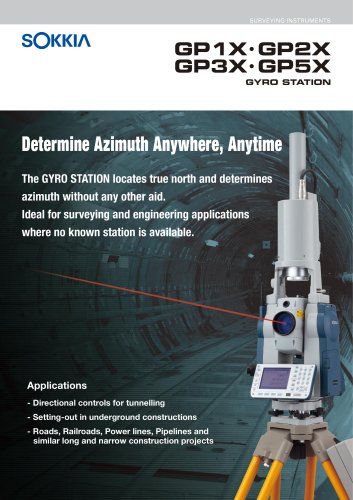 GP1 X GP2X GP3 X GP5X
2 Pages
 GYRO X II
2 Pages
 SRX catalogue
2 Pages
 Supplies & Accessories
44 Pages
 SHC250
2 Pages
 LP415S Leveling Laser
2 Pages
 GSR2700 IS
2 Pages
 SHC2500
4 Pages
 SP1 Pipe Laser
2 Pages
 LP410 Leveling Laser
2 Pages
 GSR2600
2 Pages
 GRX1 GNSS Receiver
2 Pages
 GYROX
GYROX2 Pages
 LP415_Brochure
2 Pages
 GSR1700 CSX
2 Pages
 GSR2700ISX_Brochure
2 Pages


Archived catalogs
 B Series
6 Pages
 S-10
S-102 Pages
 SDG1
SDG12 Pages
 LP30A / LP31A
4 Pages
 NET05X
2 Pages
 SETX
SETX8 Pages
 GIR1600
4 Pages
 DT Series
2 Pages
 50X
50X2 Pages
 50RX
50RX4 Pages
 Carlson_Product_Brochure
2 Pages
 AllegroCX_Product_Brochure
5 Pages
 Carlson600+_Product_Brochure
3 Pages
 GSR2650_LB_Brochure
2 Pages
 GIR1450_Brochure
2 Pages
 RadianIS_Product_Brochure
6 Pages

- Radio receiver
- GNSS receiver
- PDA
- Compact receiver
- Rugged receiver
- Serial receiver
- Multi-channel receiver
- Wireless receiver
- RTK receiver
- Handheld GNSS computer
- USB receiver
- Handheld GPS computer
- Touch screen handheld computer
- Rugged handheld computer
- SOKKIA total station
- Laser level
- Surveying receiver
- Precision level
- Receiver with integrated antenna
- GPS receiver