- Catalogs
- SatLab Geosolutions AB
- SatLab/Airborne LiDAR System/SUL1
- Company
- Products
- Catalogs
- News & Trends
- Exhibitions
SatLab/Airborne LiDAR System/SUL1
1 /2Pages

SatLab/Airborne LiDAR System/SUL1
1 /2Pages
Catalog excerpts
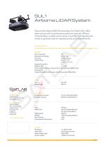
SUL1 Airborne LiDAR System Featuring the latest LiDAR 3D technology, the SatLab SUL1 offers high accuracy with its performance pulse and scan rate. Without compromising in quality and accuracy, it provides high density point clouds to generate data for mapping quickly and more efficiently. Data Specifications SENSOR No. of Channels Measurement Range Accuracy Field of View 16 Up to 100m ±3cm (typical) Hz: 0.1° - 0.4° V: 30° (-15° to 15° V: 2° Angular Resolution 5 - 20Hz Rotation Rate Time of flight distance measurement with calibrated reflectivities Dual returns Integrated web server for easy monitoring...
Open the catalog to page 2All SatLab Geosolutions AB catalogs and technical brochures
 SatLab/ADCP/ HydroFlow
4 Pages
 SatLab/GNSS Receiver/ Njord
2 Pages
 SatLab/USV/ HydroBoat 990
4 Pages
 SatLab/USV/ HydroBoat 1200
4 Pages
 SatLab/USV/ HydroBoat 1500
4 Pages
 Eyr-Brochure-EN-20230626-s
4 Pages
 SL7-Brochure-EN-20230629-s
2 Pages
 Freyja-Brochure-EN
2 Pages
 SatLab/GNSS Receiver/ SL700
2 Pages
 SatLab/GNSS Receiver/ SL900
2 Pages
 SatLab/GNSS Receiver/ SL800
2 Pages
 SatLab/GNSS Receiver/ SL600
6 Pages
 SatLab/Software/ Satsurv
2 Pages
 SatLab/Rugged Pad/ SL86
2 Pages
 SatLab/Rugged Tablet/ SL11
2 Pages


Archived catalogs

Related Searches
- HS CAD software
- HS cloud software
- HS touch screen tablet
- HS wireless tablet
- HS rugged tablet
- Measurement software
- HS Bluetooth tablet
- HS WiFi tablet
- HS GNSS tablet
- HS industrial tablet
- HS Windows tablet
- HS GPS tablet
- HS Android tablet
- EDM software
- HS engineering software
- HS waterproof tablet
- HS 4 GB tablet
- 2D software
- HS radio receiver
- Environmental monitoring system
*Prices are pre-tax. They exclude delivery charges and customs duties and do not include additional charges for installation or activation options. Prices are indicative only and may vary by country, with changes to the cost of raw materials and exchange rates.