
- Catalogs
- Oxford Technical Solutions Ltd.
- WayFinder Navigation System

- Company
- Products
- Catalogs
- News & Trends
- Exhibitions
WayFinder Navigation System
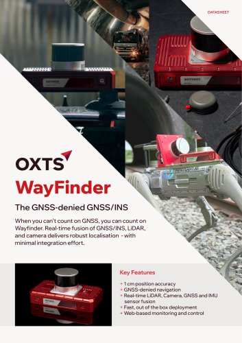
WayFinder Navigation System
- GNSS-denied navigation capability.
- Real-time sensor fusion of LiDAR, Camera, GNSS, and IMU.
- Fast deployment and web-based monitoring and control.
- Position accuracy: 1.5 m (SPS), 0.4 m (DGPS), 0.01 m (RTK).
- Altitude accuracy: 0.015 m (RTK).
- Velocity accuracy: 0.05 km/h (RMS).
- Roll & pitch accuracy: 0.02° (1σ).
- True heading accuracy: 0.05° (1σ).
- GNSS outage duration: 60 seconds.
- Position accuracy: 1.10 m (real-time), 0.03 m (LiDAR map aided).
- Altitude accuracy: 0.50 m (real-time), 0.03 m (LiDAR map aided).
- Velocity accuracy: 0.07 m/s (real-time), 0.01 m/s (LiDAR map aided).
- Roll & pitch accuracy: 0.03° (real-time), 0.02° (post-process).
- True heading accuracy: 0.12° (real-time), 0.05° (post-process).
- Dimensions: 280 x 160 x 130 mm.
- Mass: 3.25 kg.
- Input voltage: 10 - 28 V dc.
- Power consumption: 28 W.
- Internal storage: 32 GB (INS) + 250 GB.
- Operating temperature: -15° to 40° C.
- Environmental protection: IP67.
- Ethernet: 10/100 Base-T [x3].
- Serial: 1 x RS232.
- USB: USB-A 3.0 [x2].
- Digital I/O: Quadrature wheelspeed input, PPS input/output, Trigger input/output [x2].
- Accelerometers and Gyros: MEMS technology.
- Range: 8 g (accelerometers), 490 °/s (gyros).
- Bias stability: 0.005 mg (accelerometers), 0.8 °/hr (gyros).
- Supports GPS L1, L2 (QZSS), GLONASS L1, L2, BeiDou B1, B2, Galileo E1, E5.
- Single/dual antenna capability.
- ITAR-free.
Catalog excerpts

WayFinder The GNSS-denied GNSS/INS When you can’t count on GNSS, you can count on Wayfinder. Real-time fusion of GNSS/INS, LiDAR, and camera delivers robust localisation - with minimal integration effort. Key Features + 1 cm position accuracy + GNSS-denied navigation + Real-time LiDAR, Camera, GNSS and IMU sensor fusion + Fast, out of the box deployment + Web-based monitoring and control
Open the catalog to page 1
Technical specification Model WayFinder Single/dual antenna? Both ITAR-free? Yes Performance specification with GNSS [1] Value 1.5 m SPS Altitude 0.015 m RTK Velocity (RMS) 0.05 km/h Roll & pitch (1a) 0.02° Real-time Post-process Post-process with OXTS LiDAR Boost Odometry [3] GNSS outage duration 60 s 60 s OXTS IMU10 sensors Dimensions 280 x 160 x 130 mm Type Accelerometers Gyros Mass 3.25 kg Input voltage 10 - 28 V dc Technology MEMS Random walk 0.012 m/s/Vhr 0.12 °/Vhr Ethernet 10/100 Base-T [x3] Serial 1 x RS232 Quadrature wheelspeed input Digital I/O PPS input/output Vibration 0.1g/Hz 5-500...
Open the catalog to page 2All Oxford Technical Solutions Ltd. catalogs and technical brochures
 Panpro Case Study
2 Pages
 Dronezone SRL Case Study
2 Pages
 Ordnance Survey Case Study
2 Pages
 xRED GNSS/INS
2 Pages
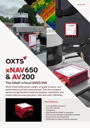 xNAV650 / AV200 GNSS/INS
2 Pages
 RT3000 v4 DO-160 GNSS/INS
2 Pages
 RT1003 v2 GNSS/INS Datasheet
2 Pages
 RT3000 v4 GNSS/INS Datasheet
2 Pages

- OXTS inertial navigation system
- OXTS GNSS inertial navigation system
- High-accuracy inertial navigation system
- Lightweight inertial navigation system
- Miniature inertial navigation system
- UAV inertial navigation system
- Inertial navigation system with integrated GPS
- ITAR-free inertial navigation system
- CAN inertial navigation system
- OEM inertial navigation system
- Ethernet inertial navigation system
- Built-in inertial navigation system
- Serial inertial navigation system
- TTL inertial navigation system