- Catalogs
- Oxford Technical Solutions Ltd.
- Ordnance Survey Case Study
- Company
- Products
- Catalogs
- News & Trends
- Exhibitions
Ordnance Survey Case Study
1 /2Pages

Ordnance Survey Case Study
1 /2Pages
Catalog excerpts

CASE STUDY Ordnance Survey Ordnance Survey partners with OXTS to create a scalable and reliable mobile mapping and point cloud data collection system. PROJECT AIM Ordnance Survey historically used expensive highgrade technology to create accurate, georeferenced point cloud maps for feature identification and classification. Though effective, the solution wasn’t manageable or sustainable for the Ordnance Survey’s long term data collection programme. The team required a lower-cost setup that was simple to use and could easily scale, while still delivering the required levels of accuracy and reliability. SUMMARY Company: Ordnance Survey Industry: Public Sector Country: United Kingdom Website: www.os.uk OXTS Hardware: + Build a mobile mapping solution that could create georeferenced 3D point clouds of the environment. + Design the system to be small enough to mount on one of the Ordnance Survey’s small survey vehicles. Boresight Calibration + Find a method of synchronising localisation and LiDAR data without relying on ground control points. + Ensure the system was as affordable as possible while still performing to the required standard. OXTS Software: OXTS Georeferencer gx/ix tight-coupling Other Technology:
Open the catalog to page 1
THE SOLUTION Ordnance Survey engaged with our UKbased channel partner, Datron Technology, and designed a solution including a Velodyne VLP-16 LiDAR, 8 x 360-degree cameras (with redundancy for future sensor fusion) and an OXTS xNAV650 GNSS/INS. The solution is mounted on a Streetdrone Twizy which is a self-driving capable vehicle. The xNAV650 combines MEMS IMU sensors, survey-grade GNSS receivers, and advanced calibration and data processing capabilities that enable the Ordnance Survey to capture highly accurate position, navigation (heading, pitch and roll) and timing measurements. In particular,...
Open the catalog to page 2All Oxford Technical Solutions Ltd. catalogs and technical brochures
 Panpro Case Study
2 Pages
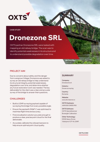 Dronezone SRL Case Study
2 Pages
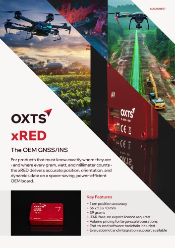 xRED GNSS/INS
2 Pages
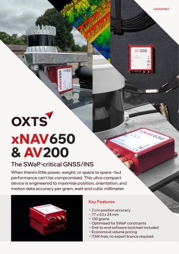 xNAV650 / AV200 GNSS/INS
2 Pages
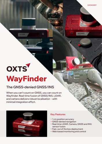 WayFinder Navigation System
2 Pages
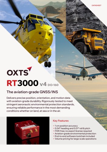 RT3000 v4 DO-160 GNSS/INS
2 Pages
 RT1003 v2 GNSS/INS Datasheet
2 Pages
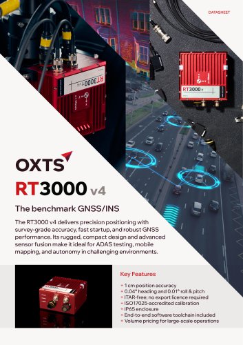 RT3000 v4 GNSS/INS Datasheet
2 Pages
- INS
- GNSS inertial navigation system
- High-accuracy inertial navigation system
- Lightweight inertial navigation system
- Miniature inertial navigation system
- UAV inertial navigation system
- Inertial navigation system with integrated GPS
- ITAR-free inertial navigation system
- CAN inertial navigation system
- OEM inertial navigation system
- Ethernet inertial navigation system
- Built-in inertial navigation system
- Serial inertial navigation system
- TTL inertial navigation system