- Catalogs
- Oxford Technical Solutions Ltd.
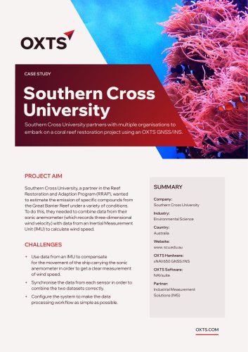
- Dronezone SRL Case Study
- Company
- Products
- Catalogs
- News & Trends
- Exhibitions
Dronezone SRL Case Study
1 /2Pages
Dronezone SRL Case Study
1 /2Pages
Catalog excerpts

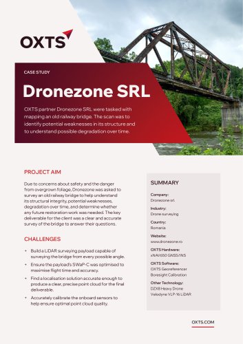
CASE STUDY Dronezone SRL OXTS partner Dronezone SRL were tasked with mapping an old railway bridge. The scan was to identify potential weaknesses in its structure and to understand possible degradation over time. PROJECT AIM Due to concerns about safety and the danger from overgrown foliage, Dronezone was asked to survey an old railway bridge to help understand its structural integrity, potential weaknesses, degradation over time, and determine whether any future restoration work was needed. The key deliverable for the client was a clear and accurate survey of the bridge to answer their questions. SUMMARY Company: Dronezone srl. Industry: Drone surveying Country: Romania Website: www.dronezone.ro + Build a LiDAR surveying payload capable of surveying the bridge from every possible angle. OXTS Hardware: + Ensure the payload’s SWaP-C was optimised to maximise flight time and accuracy. OXTS Software: + Find a localisation solution accurate enough to produce a clear, precise point cloud for the final deliverable. + Accurately calibrate the onboard sensors to help ensure optimal point cloud quality. xNAV650 GNSS/INS OXTS Georeferencer Boresight Calibration Other Technology: DZX8 Heavy Drone Velodyne VLP-16 LiDAR
Open the catalog to page 1
THE SOLUTION Dronezone chose a Velodyne VLP-16 LiDAR sensor for the payload, built onto its own DZX8 Heavy Drone. For localization, Dronezone chose the xNAV650 from OXTS, supported by OXTS Georeferencer, our LiDAR point cloud georeferencing software. Weighing just 130 g and measuring 77 x 63 x 24 mm, the xNAV650 met the SWaP-C requirements of the project while still providing the accuracy required to confidently produce a 3D point cloud of the bridge. To further improve the quality of the final point cloud, Dronezone used the boresight calibration capabilities of OXTS Georeferencer to calibrate...
Open the catalog to page 2All Oxford Technical Solutions Ltd. catalogs and technical brochures
 Panpro Case Study
2 Pages
 Ordnance Survey Case Study
2 Pages
 xRED GNSS/INS
2 Pages
 xNAV650 / AV200 GNSS/INS
2 Pages
 WayFinder Navigation System
2 Pages
 RT3000 v4 DO-160 GNSS/INS
2 Pages
 RT1003 v2 GNSS/INS Datasheet
2 Pages
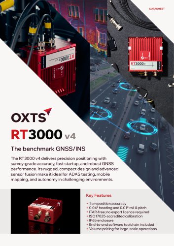 RT3000 v4 GNSS/INS Datasheet
2 Pages
- INS
- GNSS inertial navigation system
- High-accuracy inertial navigation system
- Lightweight inertial navigation system
- Miniature inertial navigation system
- UAV inertial navigation system
- Inertial navigation system with integrated GPS
- ITAR-free inertial navigation system
- CAN inertial navigation system
- OEM inertial navigation system
- Ethernet inertial navigation system
- Built-in inertial navigation system
- Serial inertial navigation system
- TTL inertial navigation system