Catalog excerpts

The OEM Laser Scanning System that Meets the Needs of Rugged Applications Part of the OEM product family from Teledyne Optech, the TLS-M3 combines the measurement efficiency of our renowned tripod based lidar systems with a complete internal sensors package and solid API software. The TLS-M3 was designed to focus on the most aggressive applications, with a weather-proof housing, internal sensors including: heat system, inclinometer, digital compass and a long-range capability that can reach 2000 m. Use TLS-M3 for permanent monitoring applications, marine and land mobile projects for high quality scans through a solid API software package that allows complete unit control, real time data streaming, data processing and system diagnostics feedback for the best results in data quality and scan efficiency. TLS-M3 is compatible with the most used software in the market for data collection and data processing. FEATURES » Two models: Middle Range and Long Range capability » Internal Hot swappable batteries » External powering options » Tilt compensator » Digital compass » Internal heat system » Ext. camera capability » Marine application housing » Easy in-field upgrades » Cold weather package REMOTE APPLICATIONS Marine Mobile Mapping » Coastal survey » Structure survey » Port and harbour survey » Wreck surveying Land Mobile Mapping » Asset management » As-Built/As-Is survey » Clash detections survey Real time Monitoring » Permanent installations » Vol
Open the catalog to page 1
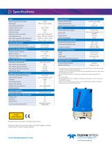
Specifications Laser Imaging System Range measurement principle External camera DSLR White-balancing DSLR Laser safety classification 2 5 Sample collection rate Export format of ext. camera Intensity recording Number of returns recorded Power supply input voltage Battery type Laser repetition rate Battery power 1 Max. range capacity @ 90% reflectivity Max. range capacity @ 20% reflectivity Minimum range Yes with auto trigger Power consumption 9 to 32-V DC Internal, hot swappable Li-Ion batteries 2.5 hours 60 W Operation Characteristics Angular measurement resolution Max. sample density...
Open the catalog to page 2All Optech catalogs and technical brochures
-
Galaxy PRIME Plus
4 Pages
-
Galaxy PRIME
4 Pages
-
Galaxy T2000
4 Pages
-
CM2000
2 Pages
-
CL-360
4 Pages
-
T2000
4 Pages
-
Lynx Camera
2 Pages
-
Corridor Mapping
2 Pages
-
PEGASUS HA500
2 Pages
-
Lidar bathymetry
1 Pages
-
ORION M/C 300
1 Pages
-
Lynx Mobile Mapper
2 Pages
-
ALTM Product Comparison
2 Pages
-
Optech CZMIL
2 Pages
-
GEMINI
2 Pages
-
LYNX Brochure
16 Pages
-
ORION H/M/C 300
2 Pages
-
ILRIS Terrestrial Solutions
16 Pages
-
ILRIS - LR
2 Pages
-
Optech Hydrofusion
2 Pages
-
Cavity Monitoring System
2 Pages
-
AIRBORNE BROCHURE
16 Pages
-
AQUARIUS
2 Pages
Archived catalogs
-
ILRIS Product Catalog
4 Pages
-
ALTM NAV Software
1 Pages
-
Space Lidar Systems
2 Pages
-
CMS Wireless
2 Pages
-
SHOALS-1000 Product Brochure
4 Pages
-
SHOALS-3000 Product Brochure
2 Pages
-
Rollei AIC Digital Camera
2 Pages
-
DSS 322 Digital Camera
2 Pages
-
ALTM Gemini
2 Pages
-
ALTM Gemini 167
2 Pages


