

PEGASUS HA500

PEGASUS HA500
- Dual output laser system for enhanced density capability.
- High laser sampling rate for improved XY point distribution efficiency.
- Extended operational envelope for versatile applications.
- Drop-in sensor design for unrestricted field of view (FOV) usage.
- High accuracy and precision independent of pulse rate, enabled by iFLEX™ technology.
- Advanced inertial and Virtual Reference System processing for improved navigation and data accuracy.
- Optech LMS lidar pre-processing software for automated rectification and real-time point display.
- Operational Envelope: 150-5000 m AGL, nominal.
- Laser Wavelength: 1064 nm.
- Horizontal Accuracy: 1/5,500 x altitude, 1 σ.
- Elevation Accuracy: <5-20 cm, 1 σ.
- Laser Repetition Rate: Programmable, 100-500 kHz.
- Scan Width (FOV): Programmable, 0-75°.
- Scan Frequency: Programmable, 0-140 Hz.
- Beam Divergence: 0.25 mrad (1/e).
- Roll Compensation: Programmable, ±37°.
- Vertical Target Separation: <0.7 m.
- Range Capture: Up to 4 range measurements.
- Intensity Capture: Up to 4 intensity returns per pulse.
- Image Capture: 5 MP interline camera (standard); 60 MP full frame (optional).
- Data Storage: Removable SSD (SATA II).
- Power Requirements: 28 V, 800 W, 30 A.
- Dimensions and Weight: Sensor: 630 x 540 x 450 mm; 65 kg. Control rack: 650 x 590 x 490 mm; 46 kg.
- Operating Temperature: -10°C to +35°C.
- Relative Humidity: 0-95% non-condensing.
Catalog excerpts
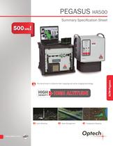
PEGASUS HA500 Summary Specification Sheet The benchmark in airborne lidar mapping and active imaging technology. HIGH at HIGH ALTITUDE DENSITY Urban Modeling Asset Management Topographic Mapping ALTM Pegasus
Open the catalog to page 1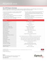
PEGASUS HA500 The ALTM Pegasus Advantage Pegasus is ideally suited for applications that require maximum collection efficiency in a wide FOV design, while maintaining enhanced target detail and maximum ground density with high range accuracy and precision. yy Dual output laser system for maximum density capability yy laser sampling rate for enhanced efficiency in XY High point distribution yy Extended operating envelope yy “Drop-in” sensor design for unrestricted use of advertised FOV in deep portal installations yy accuracy and precision independent of pulse rate, High enabled by Optech’s iFLEX™...
Open the catalog to page 2All Optech catalogs and technical brochures
 Galaxy PRIME Plus
4 Pages
 Galaxy PRIME
4 Pages
 Galaxy T2000
4 Pages
 CM2000
2 Pages
 CL-360
4 Pages
 T2000
T20004 Pages
 TLS-M3
2 Pages
 Lynx Camera
2 Pages
 Corridor Mapping
2 Pages
 Lidar bathymetry
1 Page
 ORION M/C 300
1 Page
 Lynx Mobile Mapper
2 Pages
 ALTM Product Comparison
2 Pages
 Optech CZMIL
2 Pages
 GEMINI
2 Pages
 LYNX Brochure
16 Pages
 ORION H/M/C 300
2 Pages
 ILRIS Terrestrial Solutions
16 Pages
 ILRIS - LR
2 Pages
 Optech Hydrofusion
2 Pages
 Cavity Monitoring System
2 Pages
 AIRBORNE BROCHURE
16 Pages
 AQUARIUS
2 Pages


Archived catalogs
 Space Lidar Systems
2 Pages
 Rollei AIC Digital Camera
2 Pages
 DSS 322 Digital Camera
2 Pages
 ALTM Gemini
2 Pages
 CMS Wireless
2 Pages
 ILRIS Product Catalog
4 Pages
 SHOALS-1000 Product Brochure
4 Pages
 ALTM NAV Software
1 Page
 SHOALS-3000 Product Brochure
2 Pages
 ALTM Gemini 167
2 Pages


- Real-time software
- Cloud-based software
- Quality software
- 3D scanning system
- Measurement scanner
- CAM software
- Portable scanner
- Software suite
- Office software
- Fixed bracket
- Post-processing software
- LIDAR sensor
- Integrated scanner
- Surveying software
- Wireless scanner
- Profile scanner
- Gimbal
- Management software suite
- Automation software suite
- Monitoring software suite