Lidar bathymetry
1 /1Page

Lidar bathymetry
1 /1Page
Catalog excerpts
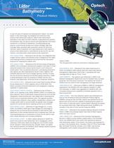
Product History In over 35 years of research and development, Optech, the world leader in lidar technology, has designed and delivered many airborne lidar bathymeter systems. Optech lidar bathymeters specialize in the rapid and safe collection of georeferenced position and elevation data, as well as camera and hyperspectral information suitable for a multitude of disciplines, including engineering, science, environmental studies and military strategy. High area coverage rates, seamless data acquisition across the land/sea interface, ease of operation and rapid deployment make Optech’s airborne lidar bathymeters a cost-effective survey tool for use with medium- and deep-water vessel-based survey equipment. 2012 Optech CZMIL – Delivered to the US Navy, this integrated lidarimagery sensor system and software suite is designed for the highly automated generation of physical and environmental information products for mapping the coastal zone. 2012 Optech CZMIL – Delivered to the US Army Corps of Engineers (USACE), this multisystem development program culminates in three advanced systems that improve performance in surf zones and turbid waters. They incorporate advances in processing bathymetric lidar signals and lidar/hyperspectral sensor fusion, together with hardware features such as an enlarged aperture receiver (4 times the size of previous sensors) and doubled spatial resolution. CZMIL is being developed under the auspices of USACE and the Joint Airborne Lidar Bathymetry Technical Center of Expertise (JALBTCX). 2010 SHOALS 3000 – Delivered to the United Arab Emirates Military Survey Department in 2010, together with an ALTM 3100, this system provides enhanced bathymetric and topographic mapping capability in coastal areas. 2005 SHOALS 3000TH (CHARTS) – Delivered to the US Navy in 2005, as an upgrade to the USACE SHOALS 1000T. It increased the data collection rate to 3,000 depth measurements/sec and 20,000 topographic measurements/sec. Also added were a hyperspectral camera and an expanded software suite. This upgrade provides increased data collection rates, seafloor classification software and a larger swath width to accommodate the greater area coverage required for world-wide littoral mapping carried out by JALBTCX. 2005 SHOALS 1000T – Delivered to Fugro-Pelagos Inc. in early 2005, the SHOALS 1000T gave Fugro-Pelagos the advantage of being the first commercial service provider to add airborne lidar bathymetry to their already extensive list of mapping tools. Now the most appropriate tool or combination of tools can be used to meet client needs efficiently and increase profitability. 2003 SHOALS 1000T – In 2003, Optech delivered to USACE the world’s first airborne lidar bathymeter with a topographic option, collecting 1,000 water depth soundings/sec and 10,000 coastal terrain elevation measurements/sec. Smaller, faster, and lighter than previous systems, the SHOALS 1000T deploys rapidly anywhere in the world from a variety of aircraft. Optech CZMIL: The new-generation airborne mulit-sensor mapping system 2003 SHOALS 1000 – Delivered to the Japan Coast Guard in 2003, the SHOALS 1000 collects data that meets International Hydrographic Organization (IHO) Order 1 standards with area coverage rates as high as 70 km2 /hour. 1995 HAWKEYE – Two systems were delivered in 1995 to the Swedish Hydrographic Department and the Swedish Navy via Saab Dynamics, the local prime contractor. The systems are similar to SHOALS and are used for both hydrography and target detection. 1994 SHOALS 200 – Delivered to USACE in 1994 for hydrographic applications, the SHOALS 200 was originally installed in a Bell 212 helicopter. In 1998 it was upgraded to a SHOALS 400, with increased measurement capability to facilitate operation from a fixed-wing aircraft. 1988 ALARMS – This mine detection system was developed and built for the US Defense Advanced Research Projects Agency (DARPA). During the first Gulf War, Optech was selected by the US government as the only firm capable of developing this system on short notice. In less than seven months Optech delivered the system for successful field trials. Flight-testing has shown ALARMS to be valuable in the area of mine counter-measures (MCM). 1988 FLASH – Delivered to the Swedish Defense Research Institute (FOA) in 1988, this prototype system was used to detect objects within the water column. 1984 LARSEN 500 – Delivered to the Canadian Hydrographic Service in 1984 to survey shallow coastal water in the Canadian Arctic, the LARSEN 500 is the world’s first operational airborne lidar bathymeter system. Once proven, the system was deployed for surveys in the Canadian Arctic. Canadian Chart #7750 of Cambridge Bay, Northwest Territories, Canada—circa 1985—was the first hydrographic chart created using airborne lidar bathymetry. Optech Incorporated 300 Interchange Way • Vaughan ON • Canada L4K 5Z8 • Tel: +1 905 660 0808 • Fax: +1 905 660 0829 © Optech Incorporated. E&OE. Information subject to change without notice. Printed in Canada. 121011
Open the catalog to page 1All Optech catalogs and technical brochures
 Galaxy PRIME Plus
4 Pages
 Galaxy PRIME
4 Pages
 Galaxy T2000
4 Pages
 CM2000
2 Pages
 CL-360
4 Pages
 T2000
T20004 Pages
 TLS-M3
2 Pages
 Lynx Camera
2 Pages
 Corridor Mapping
2 Pages
 PEGASUS HA500
2 Pages
 ORION M/C 300
1 Page
 Lynx Mobile Mapper
2 Pages
 ALTM Product Comparison
2 Pages
 Optech CZMIL
2 Pages
 GEMINI
2 Pages
 LYNX Brochure
16 Pages
 ORION H/M/C 300
2 Pages
 ILRIS Terrestrial Solutions
16 Pages
 ILRIS - LR
2 Pages
 Optech Hydrofusion
2 Pages
 Cavity Monitoring System
2 Pages
 AIRBORNE BROCHURE
16 Pages
 AQUARIUS
2 Pages


Archived catalogs
 Space Lidar Systems
2 Pages
 Rollei AIC Digital Camera
2 Pages
 DSS 322 Digital Camera
2 Pages
 ALTM Gemini
2 Pages
 CMS Wireless
2 Pages
 ILRIS Product Catalog
4 Pages
 SHOALS-1000 Product Brochure
4 Pages
 ALTM NAV Software
1 Page
 SHOALS-3000 Product Brochure
2 Pages
 ALTM Gemini 167
2 Pages


- Liebherr real-time software
- Liebherr cloud software
- Liebherr quality software
- 3D scanning system
- Measurement scanner
- CAM software
- Portable scanner
- Office software
- Fixed holder
- Post-processing software
- LIDAR sensor
- Integrated scanner
- Surveying software
- Profile scanner
- Gimbal
- Management software suite
- Automation software suite
- Wireless scanner
- Monitoring software suite