Catalog excerpts

Galaxy CM2000 Corridor Mapper Low flying sensor that captures corridors and context with the highest single-pass point density The new CM2000 is designed to drive maximum efficiency in all corridor surveying environments. From electric utilities, roads and rail to pipelines, a programmable field of view and 2 million points per second puts all measurements on the ground and delivers unsurpassed resolution. The CM2000’s tight laser footprint produces accurate and detailed modeling of complex and partial targets such as electrical towers, wires and conductors. As with all Galaxy models, the Galaxy CM2000— has the smallest form factor for maximum platform flexibility. Transmission Tower Capture Detection of Distribution Wires » Post storm tower/wire » Vegetation management damage assessment » Road and rail network surveys » lectric and cellular E APPLICATIONS network asset management » Pipeline change detection Seamlessly Integrated Cameras
Open the catalog to page 1
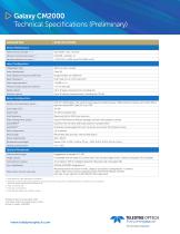
Galaxy CM2000 Technical Specifications (Preliminary) PARAMETER Sensor Performance Performance envelope 1, 2, 3, 4 Absolute horizontal accuracy 2, 3 Absolute elevation accuracy 2, 3 Laser Configuration Topographic laser Laser classification Pulse repetition frequency (effective) Beam divergence Laser range precision 5 Minimum target separation distance Range capture Up to 8 range measurements, including last Intensity capture Up to 8 intensity measurements, including last (12-bit) Sensor Configuration Position and orientation system POS AV™ AP60 (OEM); 220-channel dual frequency GNSS...
Open the catalog to page 2All Optech catalogs and technical brochures
-
Galaxy PRIME Plus
4 Pages
-
Galaxy PRIME
4 Pages
-
Galaxy T2000
4 Pages
-
CL-360
4 Pages
-
T2000
4 Pages
-
TLS-M3
2 Pages
-
Lynx Camera
2 Pages
-
Corridor Mapping
2 Pages
-
PEGASUS HA500
2 Pages
-
Lidar bathymetry
1 Pages
-
ORION M/C 300
1 Pages
-
Lynx Mobile Mapper
2 Pages
-
ALTM Product Comparison
2 Pages
-
Optech CZMIL
2 Pages
-
GEMINI
2 Pages
-
LYNX Brochure
16 Pages
-
ORION H/M/C 300
2 Pages
-
ILRIS Terrestrial Solutions
16 Pages
-
ILRIS - LR
2 Pages
-
Optech Hydrofusion
2 Pages
-
Cavity Monitoring System
2 Pages
-
AIRBORNE BROCHURE
16 Pages
-
AQUARIUS
2 Pages
Archived catalogs
-
ILRIS Product Catalog
4 Pages
-
ALTM NAV Software
1 Pages
-
Space Lidar Systems
2 Pages
-
CMS Wireless
2 Pages
-
SHOALS-1000 Product Brochure
4 Pages
-
SHOALS-3000 Product Brochure
2 Pages
-
Rollei AIC Digital Camera
2 Pages
-
DSS 322 Digital Camera
2 Pages
-
ALTM Gemini
2 Pages
-
ALTM Gemini 167
2 Pages


