GEOLITIX - Technical Sheet
1 /7Pages

GEOLITIX - Technical Sheet
1 /7Pages
Catalog excerpts
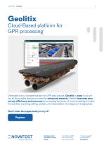
Cloud-Based platform for GPR processing Developed to be a complete solution for GPR data analysis, Geolitix is easy to use yet has all the complex features you need for advanced projects. Geolitix improves your survey efficiency and accuracy by harnessing the power of cloud computing to enable the seamless importing, editing, analysis, and interpretation of underground imaging data. Engineering Solutions Contact us for: purchase, rental, quote. Via Albertini, 36/F8 c/o Gross Ancona 60131 Ancona (AN)
Open the catalog to page 1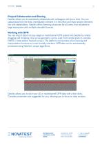
NOVATEST - Geolitix Project Collaboration and Sharing Geolitix allows you to seamlessly collaborate with colleagues with just a click. You can upload data from the field, immediately interpret it in the office and share project elements live with stakeholders. Geolitix offers licencing structures for all users, from students to large enterprises with multiple sharable licences. Working with GPR You can import data from any single or multichannel GPR system into Geolitix by simply dragging and dropping. Any survey geometry can be used, from simple grids to complex GNSS or total-station tracked...
Open the catalog to page 2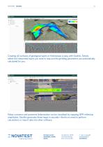
Creating 3D surfaces of geological layers or thicknesses is easy with Geolitix. Simply select the interpreted layers you want to map and the gridding parameters are automatically calculated for you. Rebar corrosion and pavement delamination can be visualised by mapping GPR reflection amplitudes. Geolitix generates these maps in seconds—there’s no need to perform calculations or import data into other software. Engineering Solutions Contact us for: purchase, rental, quote. Via Albertini, 36/F8 c/o Gross Ancona 60131 Ancona (AN)
Open the catalog to page 3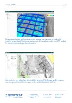
For some applications, such as rebar or void mapping, you may need to create a 3D model of a radar target. Geolitix can easily create 3D isosurface models from GPR profiles for a better understanding of discrete targets. Add context to your subsurface data by adding layers with CAD maps, satellite imagery, your own georeferenced drone images or other spatial datasets in grid files. Engineering Solutions Contact us for: purchase, rental, quote. Via Albertini, 36/F8 c/o Gross Ancona 60131 Ancona (AN)
Open the catalog to page 4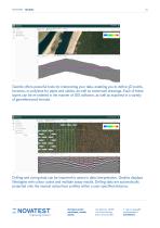
NOVATEST - Geolitix Geolitix offers powerful tools for interpreting your data, enabling you to define 3D points, horizons, or polylines for pipes and cables, as well as vectorised drawings. Each of these layers can be re-ordered in the manner of GIS software, as well as exported in a variety of georeferenced formats. Drilling and coring data can be imported to assist in data interpretation. Geolitix displays lithologies with colour codes and multiple assay results. Drilling data are automatically projected onto the nearest subsurface profiles within a user-specified distance. Contact us for:...
Open the catalog to page 5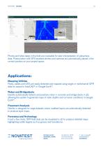
NOVATEST - Geolitix Photos and notes taken in the field are invaluable for later interpretation of subsurface data. Photos taken with GPS-enabled phones and cameras are automatically placed in the correct position on your project space. Applications: Mapping Utilities Pipes, cables and USTs are easily detected and mapped using single or multichannel GPR data for output to AutoCAD® or Google Earth™. Rebar and Bridgedecks Geolitix automatically detects and positions rebar in concrete and bridge decks in 3D, allowing the system to generate maps of rebar depths and corrosion conditions in Google...
Open the catalog to page 6
NOVATEST - Geolitix Railbed Analysis Large multichannel GPR datasets can be easily processed and interpreted to show the depth and texture of ballast. Geological Mapping Data from low-frequency GPR systems can be interpreted in a 3D-aware environment to build exportable geological models. Drone GPR Data from airborne GPR surveys can be processed with discrete targets and horizons displayed in 3D and exported to Google Earth™. Register now on the Geolitix platform and start exploring its endless possibilities! Register now Contact us for: purchase, rental, quote. Via Albertini, 36/F8 c/o Gross...
Open the catalog to page 7All Novatest catalogs and technical brochures
 NOVALog 3.0 - Tehnical Sheet
4 Pages
 Woodtester - Technical Sheet
2 Pages
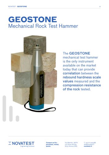 Geostone - Technical Sheet
3 Pages
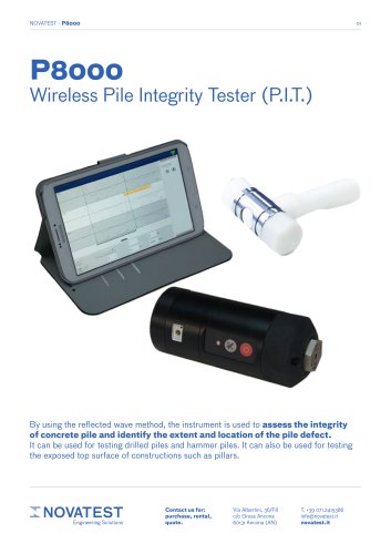 P8000 - Technical Sheet
2 Pages
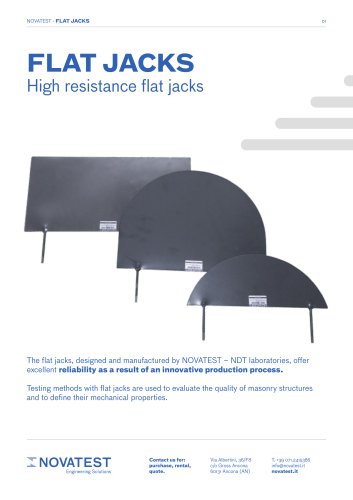 Flat Jacks - Technical Sheet
2 Pages
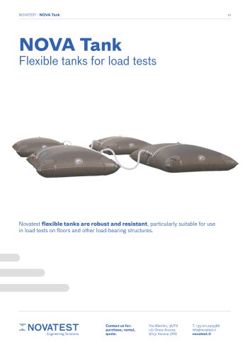 NOVATank
3 Pages
 U.S.A. E74 - Technical Sheet
2 Pages
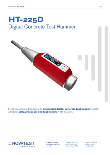 HT-225D - Technical Sheet
2 Pages
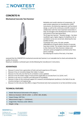
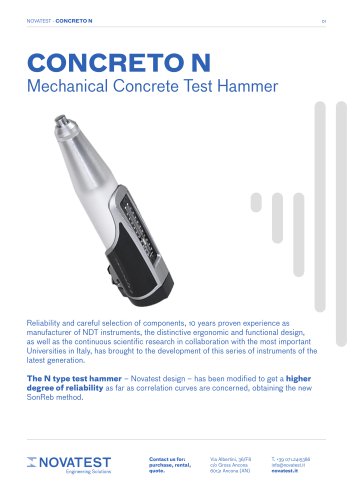 CONCRETO N - Technical Sheet
3 Pages
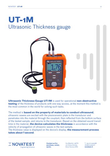 UT-1M - Technical Sheet
7 Pages
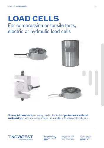 Load Cells - Technical Sheet
2 Pages
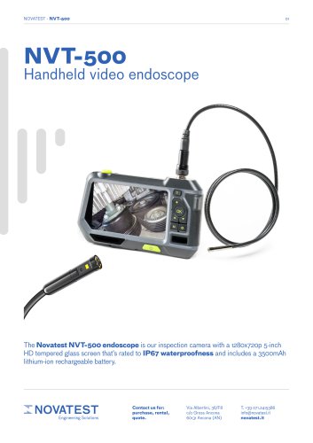 NVT-500 - Technical Sheet
2 Pages
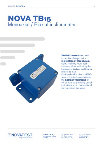 NOVA TB15 - Technical Sheet
3 Pages
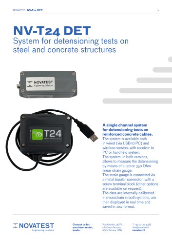 NV-T24 DET - Technical Sheet
3 Pages
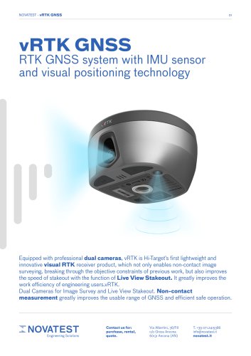 vRTK GNSS - Technical Sheet
6 Pages
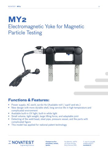 MY2 - Technical Sheet
2 Pages
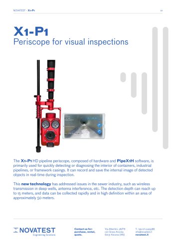 X1-P1 - Technical Sheet
4 Pages
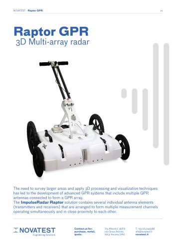 GPR Raptor - Technical Sheet
7 Pages
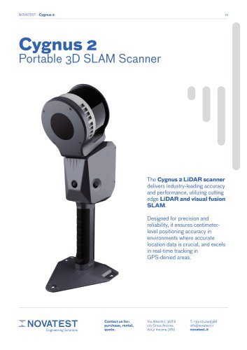 CYGNUS 2 - Technical Sheet
4 Pages
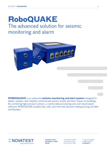 RoboQUAKE - Technical Sheet
3 Pages
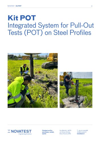 Kit POT - Technical Sheet
5 Pages
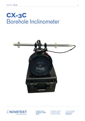 CX-3C - Technical Sheet
4 Pages
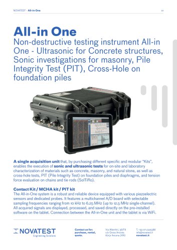 ALL-IN-ONE - Technical Sheet
6 Pages
 uBlox - Technical Sheet
3 Pages
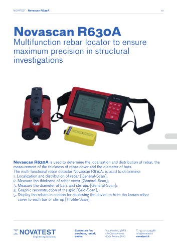 Novascan R630A - Technical Sheet
11 Pages
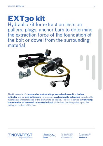 EXT30 kit - Technical Sheet
2 Pages
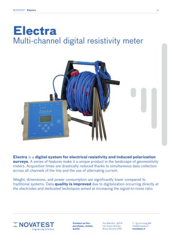 Electra - Technical Sheet
5 Pages
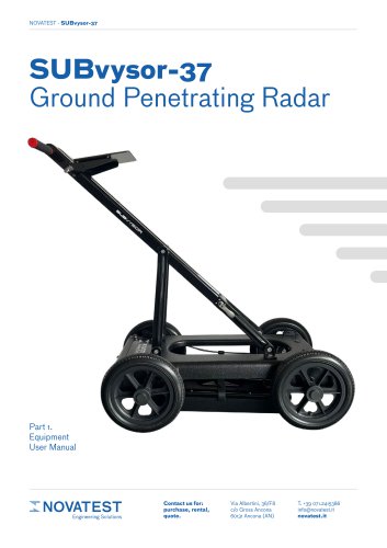 SUBvysor-37 GPR User Manual
29 Pages
 GPR SUBvysor - Technical Sheet
12 Pages
 GPR Logger - User Manual
94 Pages
 Mapper 3D - User Manual
43 Pages
 iBoat BS3 USV
1 Page
 Qmini A10
2 Pages
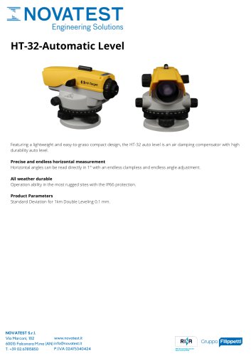 HT-32-Automatic Level
1 Page
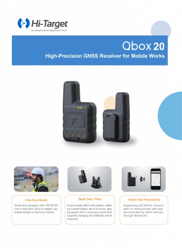 Qbox-20
2 Pages
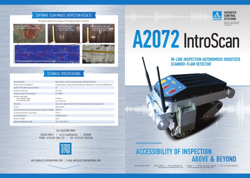 А2072 IntroScan
2 Pages
 iRTK5 GNSS RTK SYSTEM
2 Pages


Archived catalogs
 Products Overview NDT
16 Pages
 MICRODRONES
181 Pages
 IHand30
2 Pages
 iBoat BS3 USV
2 Pages
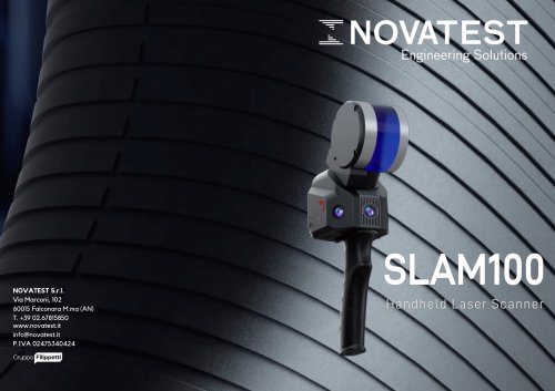 SLAM100
2 Pages
- Vessel
- Test machine
- Digital imager
- Nora load cell
- Industrial camera module
- Data logger
- Nora analysis software
- Measuring machine
- Infrared imager
- Nora tension/compression load cell
- Monitoring camera system
- Nora steel load cell
- Cloud-based software
- Calibration system
- Indentation hardness tester
- Level probe
- Liquid level sensor
- USB camera module
- Detection camera system
- Nora stainless steel load cell