MIRA HDR
1 /6Pages

MIRA HDR
1 /6Pages
Catalog excerpts

MIRA HDR 3D IMAGING RADAR ARRAY Large scale 3D GPR mapping The professional choice for large scale 3D GPR mapping
Open the catalog to page 1
The MIRA HDR is designed to produce superb data quality at high speeds. The wide coverage and the highest channel density on the market means fewer passes and higher resolution. The MIRA HDR can collect quality data at highway speeds. At lower speeds the excess data is stacked, producing clearer data while still having the ability to cover tens of hectares per day. The MALÅ HDR technology produces data with significantly lower noise levels, compared to traditional GPR systems. As illustrated in the graph below, a lower noise floor gives a wider bandwidth when compared to conventional time-interleaved...
Open the catalog to page 2
MIRAsoft HDR MIRAsoft HDR is our easy to use data acquisition software for the MIRA HDR system. It enables you to monitor the performance and data collection in detail. The software assists in keeping the correct speed and course, showing you real-time slice views and swath coverage on top of moving maps, available both on- and offline. High precision synchronization MIRA HDR uses an integrated internal GPS receiver for exact time-stamping of each individual data point (trace). Any external device utilizing PPS time can be synchronized with the GPR data, e.g. positioning devices, video recordings...
Open the catalog to page 3
Custom antenna array The flexible solution, providing 132 possible data channels and a minimum channel spacing of 6.5 cm, delivers 32-bit data with the highest resolution on the market. It is certified according to EC/FCC/ IC and is housed in a rugged IP65 casing. Utilizing unique HDR technology allows for the collection of precise, high resolution data with the capability to record down to a depth of approximately five meters, depending on ground conditions. The system enables any combination between the individual receiver and transmitter antennas used in the array; an important tool when measuring...
Open the catalog to page 4
ROAD SURVEYS To analyse roads, bridgedecks and railways, you have to be able to keep up. That is why the MIRA HDR is built to operate at highway speeds. The channel configuration assists in covering a wide swath, meaning you need fewer passes to complete a survey. UTILITY DETECTION The MIRA HDR is the perfect solution for large area mapping of underground metallic and/or non-metallic utilities such as pipes, cables, conduits and ducts. Create detailed 3D maps of the subsurface with the highest resolution on the market and avoid causing damage to installations while excavating.
Open the catalog to page 5
ARCHAEOLOGICAL PROSPECTING Because of its high resolution, the MIRA HDR can produce very detailed images of small archaeological features, such as pits, postholes and hearths. It has the ability to cover 2-3 hectares of land per day in a non-destructive way, which makes it a very cost effective tool. CAVITY DETECTION Map the underlying geology to identify dangerous features such as sinkholes. The MIRA HDR antenna technology detects both larger and smaller cavities, allowing you to contain and address cavities before they collapse.
Open the catalog to page 6All Mala catalogs and technical brochures
 GeoDrone 600
1 Page
 WalkTEM & GroundTEM
3 Pages
 MIRA HDR Field Trailer
1 Page
 Ground Explorer
4 Pages
 Easy Locator Core
4 Pages
 GeoDrone 80
1 Page
 Easy Locator
2 Pages
 MALÅ MIRA 16
2 Pages
 MIRA Compact
1 Page


Archived catalogs
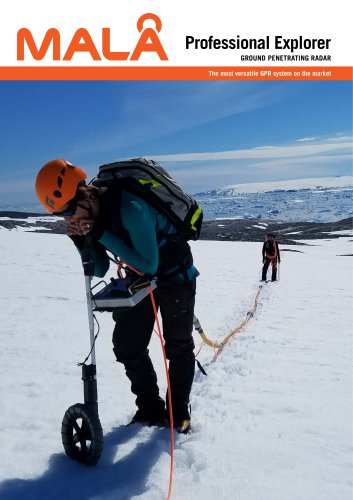
 Professional Explorer
3 Pages