
- Catalogs
- Leica Geosystems
- Leica Zeno Mobile Data Sheet

Leica Zeno Mobile Data Sheet

Leica Zeno Mobile Data Sheet
- Data Collection: Projects can be set up quickly without additional software. The app supports multi-collect functions, allowing simultaneous capture of multiple features.
- Device Compatibility: Compatible with selected Android smartphones and tablets (v6.0 or higher) and connects to Leica GNSS devices for high-accuracy data collection.
- Integration and Synchronization: Data can be uploaded and synchronized with Esri ArcGIS Online and Enterprise. Supports cloud services for data import/export.
- Advanced Tools: Includes stakeout tools for precise location, cable detection device connectivity, and laser rangefinder support for measuring inaccessible points.
- User Interface: Features an intuitive menu wheel, clear GNSS status bar, and minimal UI elements for a map-centric experience.
- Project Management: Allows on-the-fly project creation and management using familiar tools like Microsoft Excel or Zeno Office.
- Data Capture: Supports capturing points, lines, and polygons with GNSS, manual digitizing, and complex feature editing. Offers static point averaging and streaming for enhanced accuracy.
- Professional Features: Multi-collect, stakeout, and compatibility with cable locators and laser rangefinders are available in professional versions.
- Coordinate Systems: Extensive support for global coordinate systems, geoid models, and RTK profiles for improved accuracy.
- File Format Support: Compatible with SHP, ASCII, KML, DWG, DXF, GeoTIFF, TIFF, JPG, PNG, BMP formats.
Catalog excerpts

Leica Zeno Mobile Intuitive data capture Leica Zeno Mobile is an Android™ app available on selected Android smartphones and tablets. Interaction with Zeno Mobile is simple and intuitive, providing advanced functionality without the need for extensive training. Supports selected smartphones and tablets with Android v6.0 or higher Connect to Leica GNSS devices to utilise high accuracy data collection Simple and intuitive user interface and workflows with minimum training required Different versions of Zeno Mobile available depending on your needs Import and export data to cloud service Multi-touch support for easy map orientation Use OpenStreetMap or your own background maps instantly via WMS/WFS Supports wide range of GIS and CAD data formats Connect to HxGN SmartNet to improve GNSS measurements with smart positioning technology through RTK or post processing Zeno Mobile saves you time in the field by enabling you to capture more data quicker. Data collection projects can be setup on the fly without the need for other software Upload and synchronise data with Esri ArcGIS Online and ArcGIS Enterprise Capture multiple features at the same time using the multi-collect function Connect to cable detection devices Stakeout tool for precision location Connect to laser rangefinders to measure inacc
Open the catalog to page 1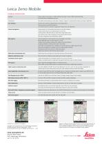
Leica Zeno Mobile TECHNICAL SPECIFICATIONS Standard Project creation, data capture, complex editing, data import / export, WMS, smart positioning, Esri ArcGIS Online compatibility and more. All standard functionality plus multi-collect, stakeout, support for cable detection devices and laser rangefinders. User interface Intuitive menu wheel for editing features and attribute entry. Clear and easy-to-read GNSS status bar. UI & buttons kept to a minimum to guarantee a map centric user experience. Project management Create projects on the fly without the need for any other software. Create projects...
Open the catalog to page 2All Leica Geosystems catalogs and technical brochures
 Leica Captivate DS EN
2 Pages
 Leica Pegasus TRK100
4 Pages
 Leica Cyclone 3DR Data Sheet
2 Pages
 Leica GR30 & GR50
4 Pages
 Leica GR30 / GR50 Data Sheet
2 Pages
 Leica LOC8 DS EN
2 Pages
 Leica Rugby CLA-ctive & CLH
2 Pages
 Leica GM30 FLY en
2 Pages
 Leica GM30 DS en
2 Pages
 Leica RTC360 LT Data Sheet
2 Pages
 Leica Flexline TS10 DS EN
2 Pages
 Leica Flexline Series DS EN
2 Pages
 ScanCrete Solution Flyer
2 Pages
 Leica Disto & Leica Lino
32 Pages
 Leica iCON PA10 DS
4 Pages
 Leica PowerBlade Flyer
2 Pages
 Leica MCH100 Flyer
2 Pages
 Leica iCON grade Brochure
8 Pages
 Pegasus Backpack BRO
6 Pages
 Leica Zeno Connect Flyer
2 Pages
 Pegasus Manager BRO
4 Pages
 Pegasus Swift DS
2 Pages
 Pegasus Swift BRO
6 Pages
 Pegasus Two Ultimate BRO
3 Pages
 Pegasus Two Ultimate DS
2 Pages
 Leica DS2000 starter kit FLY
2 Pages
 Leica Viva GS10 Data Sheet
2 Pages
 Leica Piper Series
2 Pages
 Leica BLK2GO Spec Sheet
2 Pages
 Leica Viva GS14 Data Sheet
2 Pages
 Leica iCONsite foremen
2 Pages
 Leica iCON gps 80 Contractor
6 Pages
 Leica iCON gps 80 OEM
6 Pages
 Leica iCON build
4 Pages
 Leica iCON site Brochure
4 Pages
 Leica GS07 DS EN
2 Pages
 Leica GS18 DS EN
2 Pages
 Leica CS20 DS EN
2 Pages
 Leica CS30 DS EN
2 Pages
 Leica CS35 DS EN
2 Pages
 Leica Infinity Data Sheet
2 Pages
 Leica Viva GS16 Data Sheet
2 Pages
 Leica GS18 I data sheet
2 Pages
 Leica TS16 DS
2 Pages
 Leica TS13 DS EN
2 Pages
 Leica Nova TS60 DS EN
2 Pages
 Leica Nova MS60 DS EN
2 Pages
 Leica FlexLine TS07
1 Page
 Leica ULTRA DS
2 Pages
 Leica ULTRA BRO
4 Pages
 Detection Campus BRO
4 Pages
 Leica TruView Cloud Flyer
2 Pages
 Leica Rugby 600 Series
4 Pages
 Leica Cyclone Cloud Flyer
2 Pages
 Leica CloudWorx for AutoCAD
2 Pages
 Leica iCON gps 60
4 Pages
 Leica iCON gps 70 Series
4 Pages
 Leica M-Com Brochure
4 Pages
 Leica GS18 T GNSS RTK Rover
4 Pages
 Leica ConX Flyer
2 Pages
 Leica Active Assist Flyer
2 Pages
 Leica iCON CC80 Flyer
2 Pages
 Leica iCON roller Flyer
2 Pages
 Leica PowerDigger Lite Flyer
2 Pages
 Leica LS Digital Levels
3 Pages
 Leica GeoMoS Brochure
3 Pages
 Leica AR10
2 Pages
 Leica GM10
2 Pages
 Leica AR25
2 Pages
 Leica GeoMoS Adjustment
2 Pages
 Leica GeoMoS Now
2 Pages
 Leica AR20 Flyer
2 Pages
 Leica Nova TS60
3 Pages
 Leica VADASE
2 Pages
 Leica iCON grade iGG4
4 Pages
 Leica iCON telematics
2 Pages
 AR25 Choke Ring Antenna
2 Pages
 Leica Nova TM50
4 Pages
 Leica TM6100A
6 Pages
 Leica Digicat i-Series
8 Pages
 Leica Absolute Tracker AT402
16 Pages
 Leica T-Scan TS50A brochure
4 Pages
 Leica TDRA6000
8 Pages
 Leica 3D Disto
22 Pages
 Leica Geo Office
3 Pages
 Leica Viva
5 Pages
 Leica SmartWorx Viva
3 Pages
 PROTECT by Leica Geosystems
8 Pages
 Leica Digicat xf-Series
12 Pages
 Leica NA2 / NAK2
8 Pages


Archived catalogs
 Leica Viva GS25 Data Sheet
2 Pages
 Leica Zeno GIS
3 Pages
 Leica Exchange Flyer
2 Pages
 Leica Viva GS15 Data Sheet
2 Pages
 Leica Viva GS15 Brochure
4 Pages
 Leica Nova MS60 Brochure
3 Pages
 Leica Viva TS16 Brochure
3 Pages
 Leica Viva GS16 Brochure
4 Pages
 Leica iCONstruct Software
2 Pages
 Leica iCON CC66
2 Pages
 Leica iCON builder 60
4 Pages
 Leica iCONtrol
4 Pages
 Leica iCON robot 60
4 Pages
 Leica iCON robot 50
2 Pages
 Leica Infinity Brochure
4 Pages
 Leica FlexLine TS02plus
2 Pages
 Leica Zeno 20 Brochure
5 Pages
 Leica DX Manager Flyer
2 Pages
 Leica Detection Campus
2 Pages
 Leica Detection Solutions
4 Pages
 Leica ULTRA
4 Pages
 Construction Catalogue
84 Pages
 Leica MultiWorx Data Sheet
2 Pages


- Digital imager
- Management software solution
- Automation software solution
- Process software
- Real-time software
- Windows software
- Computer-aided design software
- Cloud-based software
- Control software
- Touch screen tablet
- Wireless tablet
- Design software solution
- Monitoring software solution
- Rugged tablet
- 3D software solution
- Measurement software
- Interface software
- WiFi tablet
- Visualization software solution
- Quality software