
- Catalogs
- Leica Geosystems
- Leica Viva GS10 Data Sheet

Leica Viva GS10 Data Sheet

Leica Viva GS10 Data Sheet
Catalog excerpts

Leica Viva GS10 Data sheet Engaging software Infinitely bridging the field to the office Customer care only a click away The Leica Viva GNSS GS10 receiver is accompanied with the revolutionary Captivate software, turning complex data into the most realistic and workable 3D models. With easy-to-use apps and familiar touch technology, all forms of measured and design data can be viewed in all dimensions. Leica Captivate spans industries and applications with little more than a simple swipe, regardless of whether you work with GNSS, total stations or both. Leica Infinity imports and combines data from your GNSS, total station and level instruments for one final and accurate result. Processing has never been made easier when all your instruments work in tandem to produce precise and actionable information. Through Active Customer Care (ACC), a global network of experienced professionals is only a click away to expertly guide you through any problem. Eliminate delays with superior technical service, finish jobs faster with excellent consultancy support, and avoid costly site revisits with online service to send and receive data directly from the field. Control your costs with a tailored Customer Care Package, giving you peace of mind you’re covered anywhere, anytime.
Open the catalog to page 1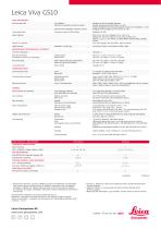
Leica Viva GS10 GNSS TECHNOLOGY Self-learning GNSS Leica RTKplus SmartLink (worldwide correction service) SmartLink fill (worldwide correction service) Continuous check of RTK solution Leica SmartCheck Adaptive on-the-fly satellite selection Remote precise point positioning (3 cm 2D)1 Initial convergence to full accuracy typically 18 min, Re-convergence <1 min Bridging of RTK outages up to 10 min (3 cm 2D)1 Reliability 99.99% GPS (L1, L2, L2C, L5), Glonass (L1, L2, L2C, L32), BeiDou (B1, B2, B32), Galileo (E1, E5a, E5b, Alt-BOC, E62), QZSS (L1, L2C, L5, L62), NavIC L53, SBAS (WAAS, EGNOS, MSAS,...
Open the catalog to page 2All Leica Geosystems catalogs and technical brochures
 Leica Captivate DS EN
2 Pages
 Leica Pegasus TRK100
4 Pages
 Leica Cyclone 3DR Data Sheet
2 Pages
 Leica GR30 & GR50
4 Pages
 Leica GR30 / GR50 Data Sheet
2 Pages
 Leica LOC8 DS EN
2 Pages
 Leica Rugby CLA-ctive & CLH
2 Pages
 Leica GM30 FLY en
2 Pages
 Leica GM30 DS en
2 Pages
 Leica RTC360 LT Data Sheet
2 Pages
 Leica Flexline TS10 DS EN
2 Pages
 Leica Flexline Series DS EN
2 Pages
 ScanCrete Solution Flyer
2 Pages
 Leica Disto & Leica Lino
32 Pages
 Leica iCON PA10 DS
4 Pages
 Leica PowerBlade Flyer
2 Pages
 Leica MCH100 Flyer
2 Pages
 Leica iCON grade Brochure
8 Pages
 Pegasus Backpack BRO
6 Pages
 Leica Zeno Mobile Data Sheet
2 Pages
 Leica Zeno Connect Flyer
2 Pages
 Pegasus Manager BRO
4 Pages
 Pegasus Swift DS
2 Pages
 Pegasus Swift BRO
6 Pages
 Pegasus Two Ultimate BRO
3 Pages
 Pegasus Two Ultimate DS
2 Pages
 Leica DS2000 starter kit FLY
2 Pages
 Leica Piper Series
2 Pages
 Leica BLK2GO Spec Sheet
2 Pages
 Leica Viva GS14 Data Sheet
2 Pages
 Leica iCONsite foremen
2 Pages
 Leica iCON gps 80 Contractor
6 Pages
 Leica iCON gps 80 OEM
6 Pages
 Leica iCON build
4 Pages
 Leica iCON site Brochure
4 Pages
 Leica GS07 DS EN
2 Pages
 Leica GS18 DS EN
2 Pages
 Leica CS20 DS EN
2 Pages
 Leica CS30 DS EN
2 Pages
 Leica CS35 DS EN
2 Pages
 Leica Infinity Data Sheet
2 Pages
 Leica Viva GS16 Data Sheet
2 Pages
 Leica GS18 I data sheet
2 Pages
 Leica TS16 DS
2 Pages
 Leica TS13 DS EN
2 Pages
 Leica Nova TS60 DS EN
2 Pages
 Leica Nova MS60 DS EN
2 Pages
 Leica FlexLine TS07
1 Page
 Leica ULTRA DS
2 Pages
 Leica ULTRA BRO
4 Pages
 Detection Campus BRO
4 Pages
 Leica TruView Cloud Flyer
2 Pages
 Leica Rugby 600 Series
4 Pages
 Leica Cyclone Cloud Flyer
2 Pages
 Leica CloudWorx for AutoCAD
2 Pages
 Leica iCON gps 60
4 Pages
 Leica iCON gps 70 Series
4 Pages
 Leica M-Com Brochure
4 Pages
 Leica GS18 T GNSS RTK Rover
4 Pages
 Leica ConX Flyer
2 Pages
 Leica Active Assist Flyer
2 Pages
 Leica iCON CC80 Flyer
2 Pages
 Leica iCON roller Flyer
2 Pages
 Leica PowerDigger Lite Flyer
2 Pages
 Leica LS Digital Levels
3 Pages
 Leica GeoMoS Brochure
3 Pages
 Leica AR10
2 Pages
 Leica GM10
2 Pages
 Leica AR25
2 Pages
 Leica GeoMoS Adjustment
2 Pages
 Leica GeoMoS Now
2 Pages
 Leica AR20 Flyer
2 Pages
 Leica Nova TS60
3 Pages
 Leica VADASE
2 Pages
 Leica iCON grade iGG4
4 Pages
 Leica iCON telematics
2 Pages
 AR25 Choke Ring Antenna
2 Pages
 Leica Nova TM50
4 Pages
 Leica TM6100A
6 Pages
 Leica Digicat i-Series
8 Pages
 Leica Absolute Tracker AT402
16 Pages
 Leica T-Scan TS50A brochure
4 Pages
 Leica TDRA6000
8 Pages
 Leica 3D Disto
22 Pages
 Leica Geo Office
3 Pages
 Leica Viva
5 Pages
 Leica SmartWorx Viva
3 Pages
 PROTECT by Leica Geosystems
8 Pages
 Leica Digicat xf-Series
12 Pages
 Leica NA2 / NAK2
8 Pages


Archived catalogs
 Leica Viva GS25 Data Sheet
2 Pages
 Leica Zeno GIS
3 Pages
 Leica Exchange Flyer
2 Pages
 Leica Viva GS15 Data Sheet
2 Pages
 Leica Viva GS15 Brochure
4 Pages
 Leica Nova MS60 Brochure
3 Pages
 Leica Viva TS16 Brochure
3 Pages
 Leica Viva GS16 Brochure
4 Pages
 Leica iCONstruct Software
2 Pages
 Leica iCON CC66
2 Pages
 Leica iCON builder 60
4 Pages
 Leica iCONtrol
4 Pages
 Leica iCON robot 60
4 Pages
 Leica iCON robot 50
2 Pages
 Leica Infinity Brochure
4 Pages
 Leica FlexLine TS02plus
2 Pages
 Leica Zeno 20 Brochure
5 Pages
 Leica DX Manager Flyer
2 Pages
 Leica Detection Campus
2 Pages
 Leica Detection Solutions
4 Pages
 Leica ULTRA
4 Pages
 Construction Catalogue
84 Pages
 Leica MultiWorx Data Sheet
2 Pages


- Digital imager
- Management software solution
- Automation software solution
- Process software
- Real-time software
- Windows software
- Computer-aided design software
- Cloud-based software
- Control software
- Touch screen tablet
- Wireless tablet
- Design software solution
- Monitoring software solution
- Rugged tablet
- 3D software solution
- Measurement software
- Interface software
- WiFi tablet
- Visualization software solution
- Quality software