
- Catalogs
- Leica Geosystems
- Leica RTC360 LT Data Sheet

Leica RTC360 LT Data Sheet

Leica RTC360 LT Data Sheet
The Leica RTC360 LT is a high-speed 3D laser scanner designed for efficient and precise reality capture. It features a measuring rate of up to 1 million points per second and an advanced HDR imaging system, enabling the creation of colored 3D point clouds in under 2 minutes. The device supports semi-automated targetless field registration and seamless data transfer from site to office, enhancing productivity.
Specifications
- Performance: Completes a full dome scan and spherical HDR image in less than 3 minutes at 6mm resolution at 10m. It automatically removes moving objects and allows for targetless checking of angular parameters.
- Scanning: Utilizes high-speed, high dynamic time of flight with Waveform Digitising technology. It has a 360° horizontal and 300° vertical field of view, with a range from 0.5 to 130 meters and a speed of up to 1,000,000 points per second.
- Imaging: Equipped with a 36 MP 3-camera system capturing 432 MPx raw data for a 360° x 300° spherical image. It supports automatic HDR with 5 brackets.
- Navigation Sensors: Includes IMU-based tilt accuracy, altimeter, compass, and GNSS.
- Operation: Features a touch-screen control and supports remote control via the Leica Cyclone FIELD 360 app for mobile devices. It includes integrated wireless LAN and data storage on a 256 GB USB 3.0 flash drive.
- Design & Physical: Constructed with an aluminum frame, it measures 120 mm x 240 mm x 230 mm and weighs 5.2 kg. It supports quick mounting on a lightweight tripod.
- Power: Powered by two internal rechargeable Li-Ion batteries, providing up to 4 hours of operation. An external AC adapter is also available.
- Environmental: Operates in temperatures from -5° to +40°C, with extended low temperature operation possible to -10°C. It has IP54 dust and humidity protection.
Customer Care
Leica Geosystems offers Customer Care Packages (CCPs) to ensure equipment maintenance and software updates. The myWorld @ Leica Geosystems portal provides 24/7 access to information.
Notes
All specifications are subject to change. Accuracy specifications are based on a 68% confidence level according to the Guide of the Expression of Uncertainty in Measurement.
Catalog excerpts
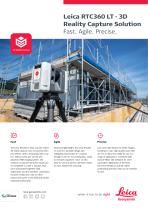
Leica RTC360 LT - 3D Reality Capture Solution Fast. Agile. Precise. 3D Reality Capture The Leica RTC360 LT laser scanner makes 3D reality capture more economical than ever before. With a measuring rate of up to 1 million points per second and advanced HDR imaging system, the creation of coloured 3D point clouds can be completed in under 2 minutes. Plus, semi-automated targetless field registration and the seamless, automated transfer of data from site to office reduce time spent in the field and further maximise productivity. Small and lightweight, the Leica RTC360 LT scanner’s portable design and collapsible tripod mean it’s compact enough to fit into most backpacks, ready to be taken anywhere. Once on-site, easy-to-use one-button operation makes for fast, hassle-free scanning. Low noise data allows for better images, resulting in crisp, high-quality scans that are rich in detail and ready for use in a range of applications. Combined with Cyclone FIELD 360 software for semiautomated registration in the field, the Leica RTC360 LT scanner offers outstanding precision that can be checked on-site.
Open the catalog to page 1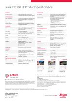
Leica RTC360 LT Product Specifications GENERAL High-speed 3D laser scanner with integrated HDR spherical imaging system Data acquisition <3 mins for complete full dome scan and spherical HDR image at 6mm @ 10 m resolution Double scan Field procedure for targetless checking of angular parameters Mobile devices Leica Cyclone FIELD 360 app for iOS and Android tablet computers and smartphones including: - Remote control of scan functions - 2D & 3D data viewing - Tagging - Visual alignment of scans Integrated wireless LAN (802.11 b/g/n) Leica MS256, 256 GB exchangeable USB 3.0 flash drive Automatic...
Open the catalog to page 2All Leica Geosystems catalogs and technical brochures
 Leica Captivate DS EN
2 Pages
 Leica Pegasus TRK100
4 Pages
 Leica Cyclone 3DR Data Sheet
2 Pages
 Leica GR30 & GR50
4 Pages
 Leica GR30 / GR50 Data Sheet
2 Pages
 Leica LOC8 DS EN
2 Pages
 Leica Rugby CLA-ctive & CLH
2 Pages
 Leica GM30 FLY en
2 Pages
 Leica GM30 DS en
2 Pages
 Leica Flexline TS10 DS EN
2 Pages
 Leica Flexline Series DS EN
2 Pages
 ScanCrete Solution Flyer
2 Pages
 Leica Disto & Leica Lino
32 Pages
 Leica iCON PA10 DS
4 Pages
 Leica PowerBlade Flyer
2 Pages
 Leica MCH100 Flyer
2 Pages
 Leica iCON grade Brochure
8 Pages
 Pegasus Backpack BRO
6 Pages
 Leica Zeno Mobile Data Sheet
2 Pages
 Leica Zeno Connect Flyer
2 Pages
 Pegasus Manager BRO
4 Pages
 Pegasus Swift DS
2 Pages
 Pegasus Swift BRO
6 Pages
 Pegasus Two Ultimate BRO
3 Pages
 Pegasus Two Ultimate DS
2 Pages
 Leica DS2000 starter kit FLY
2 Pages
 Leica Viva GS10 Data Sheet
2 Pages
 Leica Piper Series
2 Pages
 Leica BLK2GO Spec Sheet
2 Pages
 Leica Viva GS14 Data Sheet
2 Pages
 Leica iCONsite foremen
2 Pages
 Leica iCON gps 80 Contractor
6 Pages
 Leica iCON gps 80 OEM
6 Pages
 Leica iCON build
4 Pages
 Leica iCON site Brochure
4 Pages
 Leica GS07 DS EN
2 Pages
 Leica GS18 DS EN
2 Pages
 Leica CS20 DS EN
2 Pages
 Leica CS30 DS EN
2 Pages
 Leica CS35 DS EN
2 Pages
 Leica Infinity Data Sheet
2 Pages
 Leica Viva GS16 Data Sheet
2 Pages
 Leica GS18 I data sheet
2 Pages
 Leica TS16 DS
2 Pages
 Leica TS13 DS EN
2 Pages
 Leica Nova TS60 DS EN
2 Pages
 Leica Nova MS60 DS EN
2 Pages
 Leica FlexLine TS07
1 Page
 Leica ULTRA DS
2 Pages
 Leica ULTRA BRO
4 Pages
 Detection Campus BRO
4 Pages
 Leica TruView Cloud Flyer
2 Pages
 Leica Rugby 600 Series
4 Pages
 Leica Cyclone Cloud Flyer
2 Pages
 Leica CloudWorx for AutoCAD
2 Pages
 Leica iCON gps 60
4 Pages
 Leica iCON gps 70 Series
4 Pages
 Leica M-Com Brochure
4 Pages
 Leica GS18 T GNSS RTK Rover
4 Pages
 Leica ConX Flyer
2 Pages
 Leica Active Assist Flyer
2 Pages
 Leica iCON CC80 Flyer
2 Pages
 Leica iCON roller Flyer
2 Pages
 Leica PowerDigger Lite Flyer
2 Pages
 Leica LS Digital Levels
3 Pages
 Leica GeoMoS Brochure
3 Pages
 Leica AR10
2 Pages
 Leica GM10
2 Pages
 Leica AR25
2 Pages
 Leica GeoMoS Adjustment
2 Pages
 Leica GeoMoS Now
2 Pages
 Leica AR20 Flyer
2 Pages
 Leica Nova TS60
3 Pages
 Leica VADASE
2 Pages
 Leica iCON grade iGG4
4 Pages
 Leica iCON telematics
2 Pages
 AR25 Choke Ring Antenna
2 Pages
 Leica Nova TM50
4 Pages
 Leica TM6100A
6 Pages
 Leica Digicat i-Series
8 Pages
 Leica Absolute Tracker AT402
16 Pages
 Leica T-Scan TS50A brochure
4 Pages
 Leica TDRA6000
8 Pages
 Leica 3D Disto
22 Pages
 Leica Geo Office
3 Pages
 Leica Viva
5 Pages
 Leica SmartWorx Viva
3 Pages
 PROTECT by Leica Geosystems
8 Pages
 Leica Digicat xf-Series
12 Pages
 Leica NA2 / NAK2
8 Pages


Archived catalogs
 Leica Viva GS25 Data Sheet
2 Pages
 Leica Zeno GIS
3 Pages
 Leica Exchange Flyer
2 Pages
 Leica Viva GS15 Data Sheet
2 Pages
 Leica Viva GS15 Brochure
4 Pages
 Leica Nova MS60 Brochure
3 Pages
 Leica Viva TS16 Brochure
3 Pages
 Leica Viva GS16 Brochure
4 Pages
 Leica iCONstruct Software
2 Pages
 Leica iCON CC66
2 Pages
 Leica iCON builder 60
4 Pages
 Leica iCONtrol
4 Pages
 Leica iCON robot 60
4 Pages
 Leica iCON robot 50
2 Pages
 Leica Infinity Brochure
4 Pages
 Leica FlexLine TS02plus
2 Pages
 Leica Zeno 20 Brochure
5 Pages
 Leica DX Manager Flyer
2 Pages
 Leica Detection Campus
2 Pages
 Leica Detection Solutions
4 Pages
 Leica ULTRA
4 Pages
 Construction Catalogue
84 Pages
 Leica MultiWorx Data Sheet
2 Pages


