
- Catalogs
- Leica Geosystems
- Leica GR30 & GR50

Leica GR30 & GR50

Leica GR30 & GR50
The Leica GR30 and GR50 are advanced GNSS reference servers designed to meet current and future GNSS technology demands. They offer 555 channels for comprehensive satellite signal tracking and are equipped with industry-leading frequency spectrum analysis and interference mitigation capabilities.
The GR30 and GR50 feature SmartTrack+ technology for resilient signal tracking, supporting up to 555 GNSS channels. They are designed for high performance with upgradable software to accommodate future signals. The Smart Server Solution ensures reliable operation with redundant communication and power supply, smart-logging capabilities, and a user-friendly web interface.
The onboard RefWorx firmware provides an intuitive web interface for easy control and support. It includes optional tools like Leica VADASE and Site Monitor, supporting diverse GNSS reference station and monitoring needs.
The Leica Spider products offer solutions from single base stations to comprehensive RTK networks, ensuring consistent high-quality data. Active Assist provides online support for troubleshooting and diagnostics.
The GR30 and GR50 are designed for flexible installation with purpose-built casing and secure connectivity options. They include user-level access controls, encryption, and integrated firewall for high security.
These servers support internal and external data storage options, with automated file management and protection. They offer robust communication capabilities, including Ethernet, radio, cellular modem, WLAN, and Bluetooth, with support for multiple data streams and formats.
The GR30 and GR50 feature low power consumption and intelligent power management, supporting multiple power sources and providing up to 24 hours of backup power.
They can receive correction data for RTK positioning and include VADASE for autonomous fast motion detection, enhancing monitoring capabilities.
Leica Geosystems, part of Hexagon, continues to innovate in geospatial technology, providing reliable and future-proof solutions for professionals across various industries.
Catalog excerpts

Leica GR30 & GR50 Versatile solutions for today and tomorrow
Open the catalog to page 1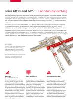
Leica GR30 and GR50 – Continuously evolving The Leica Geosystems’ innovative and industry-leading technology for GNSS reference stations and networks continues to evolve, meeting rapidly changing GNSS technology demands. Exceeding GNSS signal needs today and tomorrow by supplying 555 channels, plus providing industry-leading frequency spectrum analysis, automatic interference detection with notification and interference mitigation makes Leica GR30 and GR50 reference servers the ultimate future-proof investments. Part of the Leica Geosystems’ GNSS solution, Leica GR30 and GR50 provide cutting-edge...
Open the catalog to page 2
SMART FOR HIGH SECURITY Viewer/manager/administrator user levels and web interface restrictions together with HTTPs and SSL/TLS encryption prevent unauthorised access to the receiver. Integrated firewall and IP address filtering provide additional layers of security. FLEXIBLE INSTALLATIONS FLEXIBLE INSTALLATION SMART DATA STORAGE AND CLEAN UP Purpose built casing with rubber bumpers Internal removable SD card memory, up to 32 GB Wall or rack mount kit simplify fixed installation FTP server and automated FTP/SFTP file push Easily attaches to a tripod for campaign setup GR50 with external USB hard...
Open the catalog to page 3
Revolutionising the world of measurement and survey for nearly 200 years, Leica Geosystems creates complete solutions for professionals across the planet. Known for premium products and innovative solution development, professionals in a diverse mix of industries, such as surveying and engineering, safety and security, building and construction, and power and plant, trust Leica Geosystems to capture, analyse and present smart geospatial data. With the highest-quality instruments, sophisticated software, and trusted services, Leica Geosystems delivers value every day to those shaping the future...
Open the catalog to page 4All Leica Geosystems catalogs and technical brochures
 Leica Captivate DS EN
2 Pages
 Leica Pegasus TRK100
4 Pages
 Leica Cyclone 3DR Data Sheet
2 Pages
 Leica GR30 / GR50 Data Sheet
2 Pages
 Leica LOC8 DS EN
2 Pages
 Leica Rugby CLA-ctive & CLH
2 Pages
 Leica GM30 FLY en
2 Pages
 Leica GM30 DS en
2 Pages
 Leica RTC360 LT Data Sheet
2 Pages
 Leica Flexline TS10 DS EN
2 Pages
 Leica Flexline Series DS EN
2 Pages
 ScanCrete Solution Flyer
2 Pages
 Leica Disto & Leica Lino
32 Pages
 Leica iCON PA10 DS
4 Pages
 Leica PowerBlade Flyer
2 Pages
 Leica MCH100 Flyer
2 Pages
 Leica iCON grade Brochure
8 Pages
 Pegasus Backpack BRO
6 Pages
 Leica Zeno Mobile Data Sheet
2 Pages
 Leica Zeno Connect Flyer
2 Pages
 Pegasus Manager BRO
4 Pages
 Pegasus Swift DS
2 Pages
 Pegasus Swift BRO
6 Pages
 Pegasus Two Ultimate BRO
3 Pages
 Pegasus Two Ultimate DS
2 Pages
 Leica DS2000 starter kit FLY
2 Pages
 Leica Viva GS10 Data Sheet
2 Pages
 Leica Piper Series
2 Pages
 Leica BLK2GO Spec Sheet
2 Pages
 Leica Viva GS14 Data Sheet
2 Pages
 Leica iCONsite foremen
2 Pages
 Leica iCON gps 80 Contractor
6 Pages
 Leica iCON gps 80 OEM
6 Pages
 Leica iCON build
4 Pages
 Leica iCON site Brochure
4 Pages
 Leica GS07 DS EN
2 Pages
 Leica GS18 DS EN
2 Pages
 Leica CS20 DS EN
2 Pages
 Leica CS30 DS EN
2 Pages
 Leica CS35 DS EN
2 Pages
 Leica Infinity Data Sheet
2 Pages
 Leica Viva GS16 Data Sheet
2 Pages
 Leica GS18 I data sheet
2 Pages
 Leica TS16 DS
2 Pages
 Leica TS13 DS EN
2 Pages
 Leica Nova TS60 DS EN
2 Pages
 Leica Nova MS60 DS EN
2 Pages
 Leica FlexLine TS07
1 Page
 Leica ULTRA DS
2 Pages
 Leica ULTRA BRO
4 Pages
 Detection Campus BRO
4 Pages
 Leica TruView Cloud Flyer
2 Pages
 Leica Rugby 600 Series
4 Pages
 Leica Cyclone Cloud Flyer
2 Pages
 Leica CloudWorx for AutoCAD
2 Pages
 Leica iCON gps 60
4 Pages
 Leica iCON gps 70 Series
4 Pages
 Leica M-Com Brochure
4 Pages
 Leica GS18 T GNSS RTK Rover
4 Pages
 Leica ConX Flyer
2 Pages
 Leica Active Assist Flyer
2 Pages
 Leica iCON CC80 Flyer
2 Pages
 Leica iCON roller Flyer
2 Pages
 Leica PowerDigger Lite Flyer
2 Pages
 Leica LS Digital Levels
3 Pages
 Leica GeoMoS Brochure
3 Pages
 Leica AR10
2 Pages
 Leica GM10
2 Pages
 Leica AR25
2 Pages
 Leica GeoMoS Adjustment
2 Pages
 Leica GeoMoS Now
2 Pages
 Leica AR20 Flyer
2 Pages
 Leica Nova TS60
3 Pages
 Leica VADASE
2 Pages
 Leica iCON grade iGG4
4 Pages
 Leica iCON telematics
2 Pages
 AR25 Choke Ring Antenna
2 Pages
 Leica Nova TM50
4 Pages
 Leica TM6100A
6 Pages
 Leica Digicat i-Series
8 Pages
 Leica Absolute Tracker AT402
16 Pages
 Leica T-Scan TS50A brochure
4 Pages
 Leica TDRA6000
8 Pages
 Leica 3D Disto
22 Pages
 Leica Geo Office
3 Pages
 Leica Viva
5 Pages
 Leica SmartWorx Viva
3 Pages
 PROTECT by Leica Geosystems
8 Pages
 Leica Digicat xf-Series
12 Pages
 Leica NA2 / NAK2
8 Pages


Archived catalogs
 Leica Viva GS25 Data Sheet
2 Pages
 Leica Zeno GIS
3 Pages
 Leica Exchange Flyer
2 Pages
 Leica Viva GS15 Data Sheet
2 Pages
 Leica Viva GS15 Brochure
4 Pages
 Leica Nova MS60 Brochure
3 Pages
 Leica Viva TS16 Brochure
3 Pages
 Leica Viva GS16 Brochure
4 Pages
 Leica iCONstruct Software
2 Pages
 Leica iCON CC66
2 Pages
 Leica iCON builder 60
4 Pages
 Leica iCONtrol
4 Pages
 Leica iCON robot 60
4 Pages
 Leica iCON robot 50
2 Pages
 Leica Infinity Brochure
4 Pages
 Leica FlexLine TS02plus
2 Pages
 Leica Zeno 20 Brochure
5 Pages
 Leica DX Manager Flyer
2 Pages
 Leica Detection Campus
2 Pages
 Leica Detection Solutions
4 Pages
 Leica ULTRA
4 Pages
 Construction Catalogue
84 Pages
 Leica MultiWorx Data Sheet
2 Pages


- Digital imager
- Management software solution
- Automation software solution
- Process software
- Real-time software
- Windows software
- Computer-aided design software
- Cloud-based software
- Control software
- Touch screen tablet
- Wireless tablet
- Design software solution
- Monitoring software solution
- Rugged tablet
- 3D software solution
- Measurement software
- Interface software
- WiFi tablet
- Visualization software solution
- Quality software