
- Catalogs
- Leica Geosystems
- Leica Captivate DS EN

Leica Captivate DS EN

Leica Captivate DS EN
- 3D Visualization: Offers a stunning 3D viewer to visualize and interact with data from multiple sources, including live stream imagery with data overlay.
- User Interface: Features a consistent and customizable interface with swipe and tap functionality for easy navigation and interaction.
- Status Information: Provides real-time status updates and additional information with simple taps.
- Data Management: Facilitates quick job creation, management, import, export, and supports various data formats like IFC, DWG/DXF, XML, and ASCII.
- Online Connectivity: Utilizes internet connectivity for data transfer, GNSS corrections, and customer support through services like GeoCloud Drive and Leica ConX.
- Quality Control: Allows full customization of work methods and quality parameters to meet required standards.
- Sensor Compatibility: Compatible with a variety of sensors and supports efficient data collection routines.
- Coding and Linework: Extensive options for CAD-ready data collection directly in the field.
- Stake Routines: Offers customizable 2D, 3D, or directional-based stakeout graphics and instructions.
- In-field Computations: Includes COGO options, live surface and volume computations, and surface comparison routines.
Catalog excerpts

Leica Captivate Datasheet Leica Captivate is a user-friendly and customisable surveying field software that helps you tackle any measurement task. Whether collecting, viewing or sharing data, everything is done in one software with precise 2D views, 3D models and easy-to-use apps. Leica Captivate‘s industry and task-focused apps are designed for a range of measurement applications with Leica GNSS smart antennas, Total Stations and MultiStations, and the Leica AP20 AutoPole. In addition to enhancing the efficiency of data collection and use, Leica Captivate also empowers collaboration by supporting industry standard formats and data sharing via numerous cloud services. Prepare & Connect Measure & Stake Process & Report Share & Deliver Integrated cloud data services, support of industry data formats, and easy to use visualisation and preparation tools all combine to ensure you have the latest project data and the required data insight to be ready for any measurement task. Measure easily and effectively with powerful coding, advanced collection, customisable displays, and 3D visualisation. Stake points, surfaces, lines, and alignments faster with clear graphical and audible guidance, automated routines, and tailored workflows. Onboard computations, real-time comparisons, and data analysis allow you to create results in the field. Create quality assurance and project documentation with the ability to produce reports for all apps, data, and tasks. Create deliverables in one of the predefined formats, or present your data your way, with customisable stylesheets. Share your data, exports, and reports at any stage to deliver high-quality results using integrated cloud data services.
Open the catalog to page 1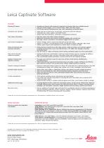
Leica Captivate Software FEATURES Stunning 3D viewer • Visualise and interact with measured, imported, and control data from multiple sources • View live stream imagery, from a camera feed or WMS, with data overlay • Full 3D view control (including zoom, pan, orbit, windowing, and profile views) Consistent user interface • Swipe and tap to switch jobs, choose apps, and interact with the software • Customise your views, options, and home-screen • System-wide fluid transitions, animations, and graphical assistance Clear status information • Real-time status information always displayed • Additional...
Open the catalog to page 2All Leica Geosystems catalogs and technical brochures
 Leica Pegasus TRK100
4 Pages
 Leica Cyclone 3DR Data Sheet
2 Pages
 Leica GR30 & GR50
4 Pages
 Leica GR30 / GR50 Data Sheet
2 Pages
 Leica LOC8 DS EN
2 Pages
 Leica Rugby CLA-ctive & CLH
2 Pages
 Leica GM30 FLY en
2 Pages
 Leica GM30 DS en
2 Pages
 Leica RTC360 LT Data Sheet
2 Pages
 Leica Flexline TS10 DS EN
2 Pages
 Leica Flexline Series DS EN
2 Pages
 ScanCrete Solution Flyer
2 Pages
 Leica Disto & Leica Lino
32 Pages
 Leica iCON PA10 DS
4 Pages
 Leica PowerBlade Flyer
2 Pages
 Leica MCH100 Flyer
2 Pages
 Leica iCON grade Brochure
8 Pages
 Pegasus Backpack BRO
6 Pages
 Leica Zeno Mobile Data Sheet
2 Pages
 Leica Zeno Connect Flyer
2 Pages
 Pegasus Manager BRO
4 Pages
 Pegasus Swift DS
2 Pages
 Pegasus Swift BRO
6 Pages
 Pegasus Two Ultimate BRO
3 Pages
 Pegasus Two Ultimate DS
2 Pages
 Leica DS2000 starter kit FLY
2 Pages
 Leica Viva GS10 Data Sheet
2 Pages
 Leica Piper Series
2 Pages
 Leica BLK2GO Spec Sheet
2 Pages
 Leica Viva GS14 Data Sheet
2 Pages
 Leica iCONsite foremen
2 Pages
 Leica iCON gps 80 Contractor
6 Pages
 Leica iCON gps 80 OEM
6 Pages
 Leica iCON build
4 Pages
 Leica iCON site Brochure
4 Pages
 Leica GS07 DS EN
2 Pages
 Leica GS18 DS EN
2 Pages
 Leica CS20 DS EN
2 Pages
 Leica CS30 DS EN
2 Pages
 Leica CS35 DS EN
2 Pages
 Leica Infinity Data Sheet
2 Pages
 Leica Viva GS16 Data Sheet
2 Pages
 Leica GS18 I data sheet
2 Pages
 Leica TS16 DS
2 Pages
 Leica TS13 DS EN
2 Pages
 Leica Nova TS60 DS EN
2 Pages
 Leica Nova MS60 DS EN
2 Pages
 Leica FlexLine TS07
1 Page
 Leica ULTRA DS
2 Pages
 Leica ULTRA BRO
4 Pages
 Detection Campus BRO
4 Pages
 Leica TruView Cloud Flyer
2 Pages
 Leica Rugby 600 Series
4 Pages
 Leica Cyclone Cloud Flyer
2 Pages
 Leica CloudWorx for AutoCAD
2 Pages
 Leica iCON gps 60
4 Pages
 Leica iCON gps 70 Series
4 Pages
 Leica M-Com Brochure
4 Pages
 Leica GS18 T GNSS RTK Rover
4 Pages
 Leica ConX Flyer
2 Pages
 Leica Active Assist Flyer
2 Pages
 Leica iCON CC80 Flyer
2 Pages
 Leica iCON roller Flyer
2 Pages
 Leica PowerDigger Lite Flyer
2 Pages
 Leica LS Digital Levels
3 Pages
 Leica GeoMoS Brochure
3 Pages
 Leica AR10
2 Pages
 Leica GM10
2 Pages
 Leica AR25
2 Pages
 Leica GeoMoS Adjustment
2 Pages
 Leica GeoMoS Now
2 Pages
 Leica AR20 Flyer
2 Pages
 Leica Nova TS60
3 Pages
 Leica VADASE
2 Pages
 Leica iCON grade iGG4
4 Pages
 Leica iCON telematics
2 Pages
 AR25 Choke Ring Antenna
2 Pages
 Leica Nova TM50
4 Pages
 Leica TM6100A
6 Pages
 Leica Digicat i-Series
8 Pages
 Leica Absolute Tracker AT402
16 Pages
 Leica T-Scan TS50A brochure
4 Pages
 Leica TDRA6000
8 Pages
 Leica 3D Disto
22 Pages
 Leica Geo Office
3 Pages
 Leica Viva
5 Pages
 Leica SmartWorx Viva
3 Pages
 PROTECT by Leica Geosystems
8 Pages
 Leica Digicat xf-Series
12 Pages
 Leica NA2 / NAK2
8 Pages


Archived catalogs
 Leica Viva GS25 Data Sheet
2 Pages
 Leica Zeno GIS
3 Pages
 Leica Exchange Flyer
2 Pages
 Leica Viva GS15 Data Sheet
2 Pages
 Leica Viva GS15 Brochure
4 Pages
 Leica Nova MS60 Brochure
3 Pages
 Leica Viva TS16 Brochure
3 Pages
 Leica Viva GS16 Brochure
4 Pages
 Leica iCONstruct Software
2 Pages
 Leica iCON CC66
2 Pages
 Leica iCON builder 60
4 Pages
 Leica iCONtrol
4 Pages
 Leica iCON robot 60
4 Pages
 Leica iCON robot 50
2 Pages
 Leica Infinity Brochure
4 Pages
 Leica FlexLine TS02plus
2 Pages
 Leica Zeno 20 Brochure
5 Pages
 Leica DX Manager Flyer
2 Pages
 Leica Detection Campus
2 Pages
 Leica Detection Solutions
4 Pages
 Leica ULTRA
4 Pages
 Construction Catalogue
84 Pages
 Leica MultiWorx Data Sheet
2 Pages


- Digital imager
- Management software solution
- Automation software solution
- Process software
- Real-time software
- Windows software
- Computer-aided design software
- Cloud-based software
- Control software
- Touch screen tablet
- Wireless tablet
- Design software solution
- Monitoring software solution
- Rugged tablet
- 3D software solution
- Measurement software
- Interface software
- WiFi tablet
- Visualization software solution
- Quality software