


PQWT Water Detector
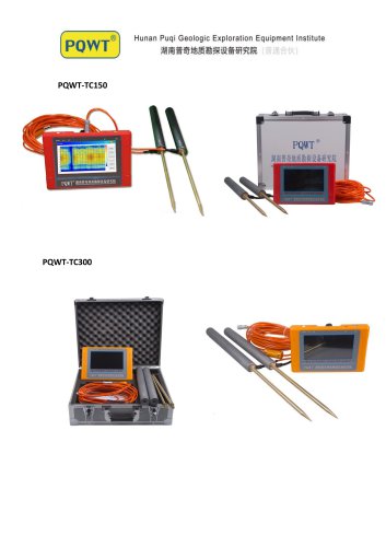
PQWT Water Detector
- Dual-mode function combining acoustic vibration with spectrum technology for accurate leakage detection.
- Rough and accurate measurement settings to quickly locate leaks.
- Noise control headset and wind-proof sensor design.
- Available in five languages: English, Turkish, Italian, Russian, and Arabic.
- User-friendly operation, learnable in 5 minutes, with 24-hour professional technical guidance.
- Two-year warranty.
- Models: PQWT-TC150, PQWT-TC300, PQWT-TC500, PQWT-S150, PQWT-S300, PQWT-S500.
- Depth capabilities range from 100 to 500 meters depending on the model.
- Frequency options include single, triple, and multiple frequencies up to 56.
- 8-channel system with a 7-inch HD touch screen display.
- Measurement range from 0mV to 2000mV.
- Stand-by time of 8-10 hours with a rechargeable lithium battery.
- Weight: 9kg, with carton dimensions of 40*20*46CM.
- Analyze curve graphs to identify potential drilling points by observing patterns such as "V", "L", "W", and "A" shapes, which indicate low potential difference data and high water probability.
- Profile maps use color coding to indicate resistivity: blue for low (water), yellow for medium (rock), and red for high (cavity or hard rock).
- Combining curve and map data helps identify optimal drilling locations, particularly in rock cracks where water is likely to accumulate.
Catalog excerpts
Hunan Puqi Geologic Exploration Equipment Institute
Open the catalog to page 1
Puqi Geologic Exploration Equipment Institute
Open the catalog to page 3
PQWT-M mobile water detector for 100/200/400m
Open the catalog to page 4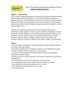
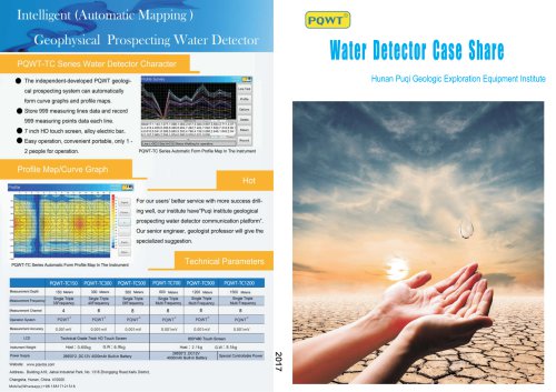
Hunan Puqi Geologic Exploration Equipment InstitutePQWT-TC Water Detector PQWT automatic mapping water detector is based on the Earth's electromagnetic field as the field source, based on the difference in the conductivity of different underground geological structures, and by studying the variation law of the electric field components at different frequencies to study the geological structure and changes, to find groundwater resources by scientific method. Changes in geological structure are displayed in real-time through multiple curves. Automatic form mapping geological profile by one key...
Open the catalog to page 5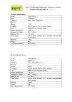
Hunan Puqi Geologic Exploration Equipment Institute Technical Specifications
Open the catalog to page 6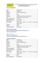
Hunan Puqi Geologic Exploration Equipment Institute Technical Specifications
Open the catalog to page 7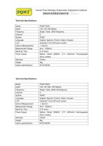
Hunan Puqi Geologic Exploration Equipment Institute Technical Specifications
Open the catalog to page 8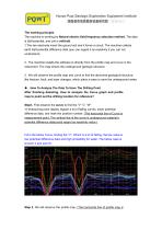
Hunan Puqi Geologic Exploration Equipment Institute The working principle The machine is working by Natural electric field frequency selection method. The data is Self-potential, and unit is millivolt. 1 .The two electrode insert the ground soil and it forms a circuit, The machine collects earth Self-potential difference data (you can regard it as resistivity if you can not understand) 2. The machine installs the software to directly from the profile map and curve in the instrument. The map shows the underground geologic structure. 3. We will observe the profile map and curve to find the abnormal...
Open the catalog to page 9
measurement point, The vertical line of profile map is measurement depth) 1. Blue, light blue just meaning it is low resistivity, like water, soft mud, and some mineral are all low resistivity, so not just this kind of color is water; 2. Yellow means the middle resistivity, like rock or something; 3. Red means the high resistivity, like the cavity or hard rock; So not each color could stand for anything, the map just could help us to analysis the geological structure, need to combine the local geological, that's the reason We hope before using this machine, please measure the drilled well at...
Open the catalog to page 10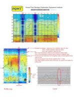
Hunan Puqi Geologic Exploration Equipment Institute Geologic knowledge: water/mud—low resistivity—stand for blue Rock —middle resistivity—stand for yellow fautt Cave—high resistivity-stand for Red From map:Horizontal is measure point;Vertical is detect depth From Curve:Horizontal is measure point;Vertical is resistivity value As all know the whole Rock will not gather water,it should gather at the crack of rock. From Curve, 13point is lot of lower resisitivity like "v" shap. From Map,13point is at the crack of the rock, so 13point is the better for drilling well.
Open the catalog to page 11All Hunan Puqi Geologic Exploration Equipment Institute (Common Partnership) catalogs and technical brochures
 Water Detector Case Share
52 Pages
- Industrial detector
- Leak monitor
- Portable detector
- Gas leak detector
- Detector with digital display
- Process detector
- Real-time detector
- Portable leak detector
- Liquid leak detector
- Leak detector with integrated display
- Automatic detector
- Water leak detector
- LED detector
- Power detector
- Detector with LCD display
- Acoustic leak detector
- Electronic leak detector
- Leak detector with digital display
- Calibration detector
- Cable detector