- Catalogs
- High Sense Solutions Inc.
- GridGIS Map Creator brochure
GridGIS Map Creator brochure
1 /7Pages
GridGIS Map Creator brochure
1 /7Pages
Catalog excerpts

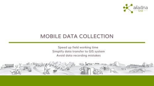
MOBILE DATA COLLECTION Speed up field working time Simplify data transfer to GIS system Avoid data recording mistakes
Open the catalog to page 1
Network tracing campaign GridGIS Map Creator
Open the catalog to page 2
Portable equipment MRT 700 Underground cable and pipe locator
Open the catalog to page 3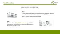
Work Procedure TRANSMITTER CONNECTION Step 1 Connect transmitter, directly to the network to be traced, through crocodile clamps or induction clamp. In case of difficult access, use built-in internal antenna to inject signal. Step 2 On the tablet, with GridGIS Map Creator app, link the tracer device via bluetooh, configure and georeference the injection point location.
Open the catalog to page 4
Work Procedure TRACING Step 3 Start tracing, press and hold "Auto" button on tracer control panel and automatically a new point along with GPS position, depth, amount of signal (mA), etc. will be registered. Repeat this operation point by point. Step 4 After finishing work, on GridGIS Map Creator app , press "Connect items" and select "Type of path". Save and generate a file compatible with any GIS that allows loading GeoJSON.
Open the catalog to page 5
Main features GridGIS Map Creator Record information of network traces and utility assets. Add photos of assets. Draw cable paths on map with GPS coordinates. Includes metadata information to each captured point: depth, amount of signal (mA), etc. Track work progress. Store in GeoJSON file, compatible with any GIS that allows loading it. Wireless Bluetooth connection with main advanced cable locators on the market.
Open the catalog to page 6All High Sense Solutions Inc. catalogs and technical brochures
 PERIJA Mini
6 Pages
 Apps Datasheet 2020
6 Pages
 MRT700
4 Pages
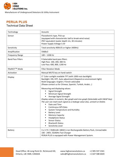
 PERIJA PLUS
3 Pages

- Generator
- Leak monitor
- Network software
- Liquid leak detector
- Pulse generator
- Water leak detector
- Acoustic leak detector
- Frequency generator
- Data transfer software
- Pipe leak detector
- Pipe locator
- External receiver
- Bluetooth software
- Portable generator
- Cable identifier
- Data logger leak detector
- GPS locator
- Underground pipe locator