- Catalogs
- High Sense Solutions Inc.
- Apps Datasheet 2020
Apps Datasheet 2020
1 /6Pages

Apps Datasheet 2020
1 /6Pages
Catalog excerpts

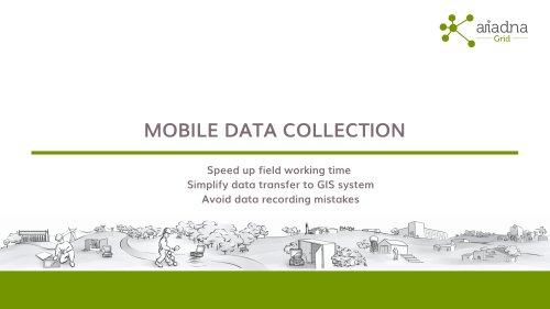
SIMPLIFY DATA TRANSFER AND AVOID MISTAKES SMART DATA COLLECTION SPEED UP FIELD WORK
Open the catalog to page 1
GridGIS Connect In order to manage efficiently the distribution network it is essential to have a precise and up-to-date knowledge of the topology data of the Low Voltage grid. GridGIS Connect app enables field personnel to work with the ILF G2 | ILF G2 Pro, phase and feeder identifiers, and store automatically identification results of electric meter link with Secondary Substation (SS) feeder and phase numbers. Through this application captured data is displayed, on a map view of the work area. After completing work, the results are exportable to the Utility GIS system in a quick and easy way....
Open the catalog to page 2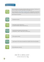
MAIN FEATURES Record information of Secondary Substation utility assets: SS Name, Transformer, LV Panel, LV Feeders, LV and MV cable types, MV Switchgear, etc. Record information of the ILF G2 | ILF G2 Pro device configuration: Central Device Coding, link between feeder number and Rogowski coil connection input number, etc. Record Meter ID and picture GPS Position of each reading point: Secondary Substation, Meters, Meter Boxes, etc. Log of Line Device detections with time stamp: Central Device - Phase - Feeder result + Date and hour Work progress tracking Import/export of GIS system compatible...
Open the catalog to page 3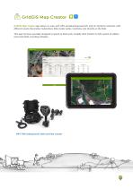
GridGIS Map Creator GridGIS Map Creator app allows to map with GPS aerial/underground MV and LV electrical networks with different assets (Secondary Substations (SS), feeder paths, manholes, etc) directly on the field. This app has been specially designed to speed up field work, simplify data transfer to GIS system of utilities and avoid data recording mistakes. MRT-700 Underground Cable and Pipe Locato
Open the catalog to page 4
MAIN FEATURES Record information of Secondary Substation utility assets: SS Name, Transformer, LV Panel, LV Feeders, LV and MV cable types, MV Switchgear, etc. Register network asset elements: manholes, power boxes, feeder pillars, etc. Draw cable paths on map with GPS coordinates Includes metadata information to each captured point, such as depth, amount of signal (mA), etc. Wireless Bluetooth connection with main advanced cable locators on the market, such as MRT-700 Underground Cable and Pipe Locator of Merytronic Import/export of GIS system compatible files: GeoJSON, KML, kMZ and Shapefile...
Open the catalog to page 5All High Sense Solutions Inc. catalogs and technical brochures
 PERIJA Mini
6 Pages
 GridGIS Map Creator brochure
7 Pages
 MRT700
4 Pages
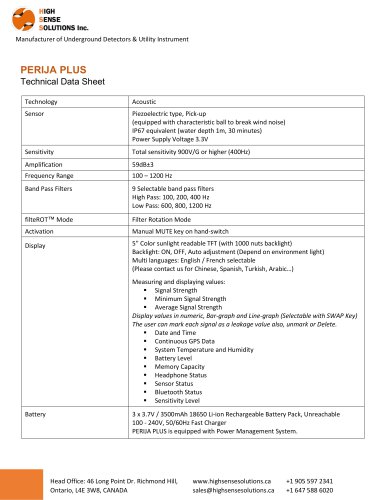
 PERIJA PLUS
3 Pages

- Generator
- Leak monitor
- Network software
- Liquid leak detector
- Pulse generator
- Water leak detector
- Acoustic leak detector
- Frequency generator
- Data transfer software
- Pipe leak detector
- Pipe locator
- External receiver
- Bluetooth software
- Portable generator
- Cable identifier
- Data logger leak detector
- GPS locator
- Underground pipe locator