
- Catalogs
- Hi-Target Surveying Instrument Co.,Ltd
- Hi-Target/ PPK Go Software for Phantom 4 RTK


- Company
- Products
- Catalogs
- News & Trends
- Exhibitions
Hi-Target/ PPK Go Software for Phantom 4 RTK

Hi-Target/ PPK Go Software for Phantom 4 RTK
The Hi-Target PPK GO is a precision add-on designed for the Phantom 4 RTK drone. It enhances the drone's capabilities by providing high-precision aerial photogrammetry with minimal or no ground control points (GCPs), reducing the time and cost of field operations.
- Ultimate Efficiency: The PPK method allows for high-precision photogrammetry with reduced reliance on GCPs, minimizing RTK fix loss and operational costs.
- Smart Selection of Full Constellation: The system supports GPS/GLONASS/Beidou/Galileo L1+L2+L5, ensuring reliable and accurate positioning even with weak satellite signals.
- PPK Engine & SDK Support: The core algorithm engine and SDK allow for customization of PPK solutions for various applications.
- Integrated CORS/Hi-RTP Station Data: The software integrates global CORS data sources, eliminating the need for a base station and reducing field workload and investment.
The system processes GNSS data, timestamps, and base files (RINEX) with base location in WGS84 format, ensuring comprehensive data handling for precise surveying tasks.
Catalog excerpts

M Hi -Target Surveying the World, Mapping the Future Hi-Target PPK GOPrecision Add-on for Phantom 4 RTK Hi-Target Surveying Instrument Co. Ltd ADD: Building 13, Tian'An Technology Zone HQ Center, No. 555, North of Panyu RD, Panyu District, 511400 Guangzhou, China. www.hi-target.com.cn +86-20-28688296 [email protected]
Open the catalog to page 1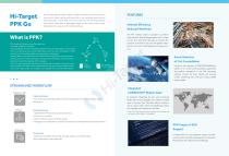
Hi-Target PPK Go The Hi-Target PPK Go Precision add-on enables P4R drones to achieve the most accurate and reliable camera positioning data in any coordinate system without measuring targets or GCPs. With up to 2cm accuracy on XYZ, the output text file with position information or geotagged images can be directly used in major photogrammetric mapping or 3D modeling software. What is PPK? PPK stands for Post-processing Kinematic and its typical workflow is as follows: During the flight, the UAV will geotag coordinates to each image based on its on-board GPS unit. At the same time, a base (a GNSS...
Open the catalog to page 2All Hi-Target Surveying Instrument Co.,Ltd catalogs and technical brochures
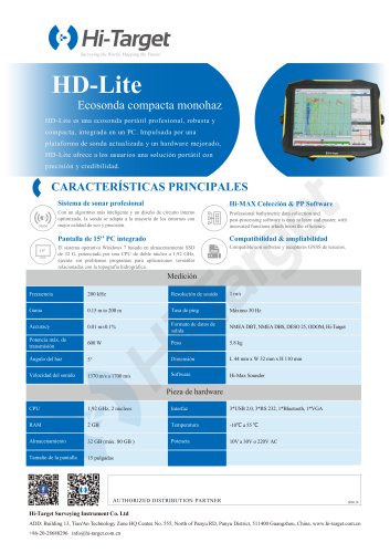 HD-Lite
1 Page
 Hi-Target/USV/ iBoat BS12
2 Pages
 Hi-Target catalog-20230907s
20 Pages
 Hi-Target/GNSS Receiver/V500
2 Pages
 Hi-Target/GNSS Receiver/vRTK
4 Pages
 Hi-Target/GNSS Receiver/V200
2 Pages
 Hi-Target/USV/ iBoat BS3
2 Pages
 Hi-Target/Auto Level/ HT-32
2 Pages




Archived catalogs

- Management software solution
- Analysis software solution
- Process software
- Real-time software
- Windows software
- Touch screen tablet
- Wireless tablet
- Rugged tablet
- Industrial software
- 3D software solution
- Interface software
- Bluetooth tablet
- WiFi tablet
- GNSS tablet
- Industrial tablet
- Android tablet
- Real-time monitoring module
- Waterproof tablet
- Measurement monitoring module
- Tablet with NFC reader