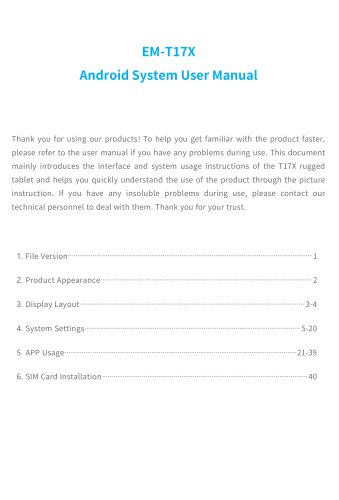
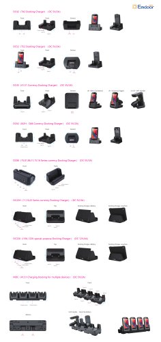
- Catalogs
- Emdoor Information Co., Ltd.
- EM-I86: Revolutionizing Outdoor Mapping Solutions for Precision Surveying and Mapping
- Company
- Products
- Catalogs
- News & Trends
- Exhibitions
EM-I86: Revolutionizing Outdoor Mapping Solutions for Precision Surveying and Mapping
1 /2Pages
EM-I86: Revolutionizing Outdoor Mapping Solutions for Precision Surveying and Mapping
1 /2Pages
Catalog excerpts

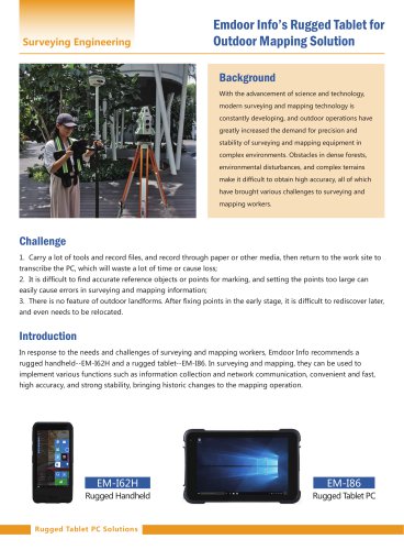
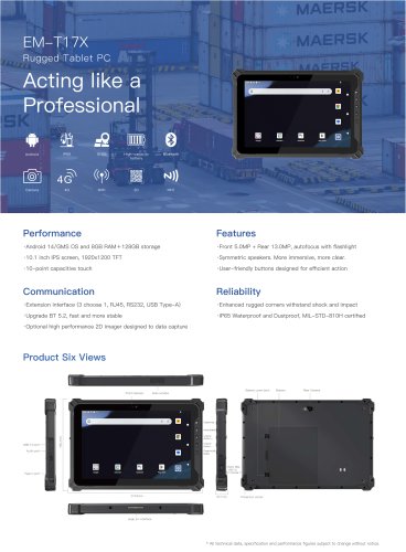
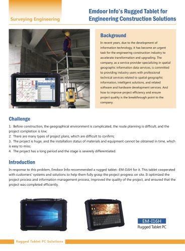
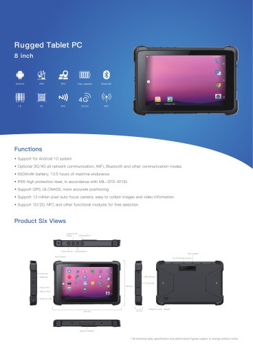
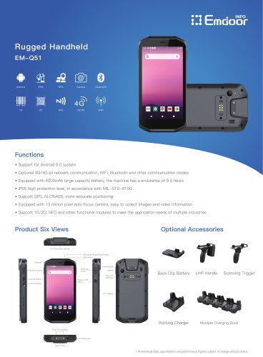
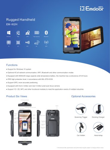
Surveying Engineering Emdoor Info’s Rugged Tablet for Outdoor Mapping Solution Background With the advancement of science and technology, modern surveying and mapping technology is constantly developing, and outdoor operations have greatly increased the demand for precision and stability of surveying and mapping equipment in complex environments. Obstacles in dense forests, environmental disturbances, and complex terrains make it difficult to obtain high accuracy, all of which have brought various challenges to surveying and mapping workers. Challenge 1. Carry a lot of tools and record files, and record through paper or other media, then return to the work site to transcribe the PC, which will waste a lot of time or cause loss; 2. It is difficult to find accurate reference objects or points for marking, and setting the points too large can easily cause errors in surveying and mapping information; 3. There is no feature of outdoor landforms. After fixing points in the early stage, it is difficult to rediscover later, and even needs to be relocated. Introduction In response to the needs and challenges of surveying and mapping workers, Emdoor Info recommends a rugged handheld--EM-I62H and a rugged tablet--EM-I86. In surveying and mapping, they can be used to implement various functions such as information collection and network communication, convenient and fast, high accuracy, and strong stability, bringing historic changes to the mapping operation. Rugged Handheld Rugged Tablet PC Solutions
Open the catalog to page 1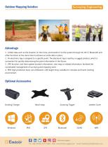
Outdoor Mapping Solution Surveying Engineering Advantage 1. Collect data such as the location on the move, and transfer it to the system through 4G, Wi-Fi, Bluetooth and other functions at the same time to achieve accurate data in place; 2. An electronic tag is assigned to a specific point. The electronic tag is read by a rugged product, which is convenient for quickly determining the point information in the future; 3. GPS function, real-time update location information, view map or related information, facilitate the coordinated management of surveying and mapping work; 4. IP65 high protection...
Open the catalog to page 2All Emdoor Information Co., Ltd. catalogs and technical brochures
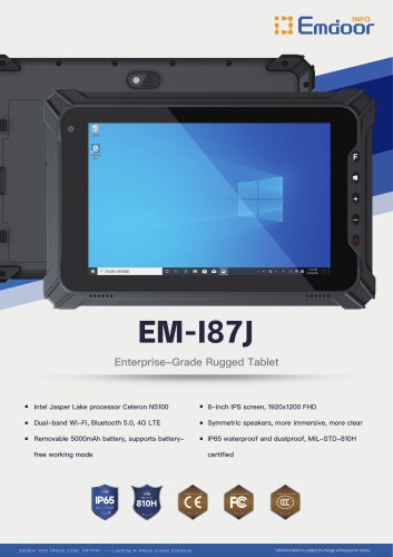
 EM-IS19J specification
3 Pages
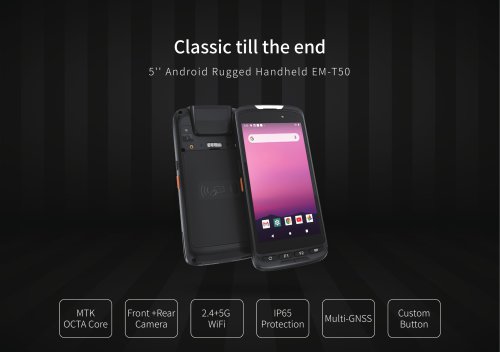
 EM-T50C
3 Pages
 EM-D10R successful case
3 Pages
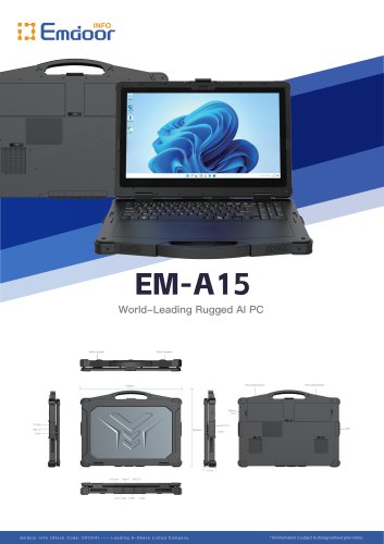 EM-A15
3 Pages
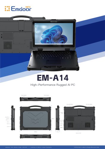 EM-A14
3 Pages
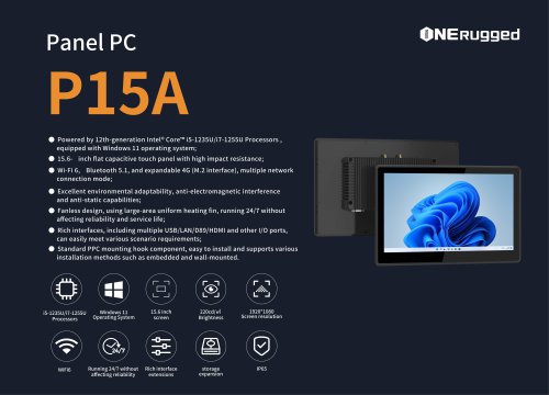
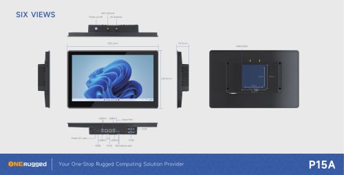 EM-P15A six views
1 Page
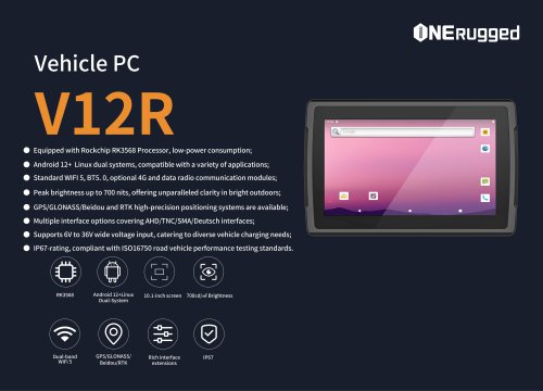
 EM-V12R USER MANUAL
2 Pages
 EM-P15A USER
2 Pages
 EM-P15A SPE
2 Pages
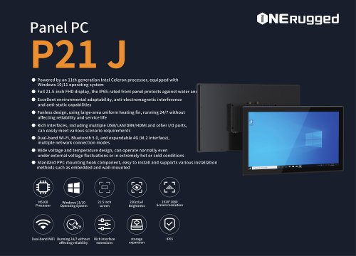
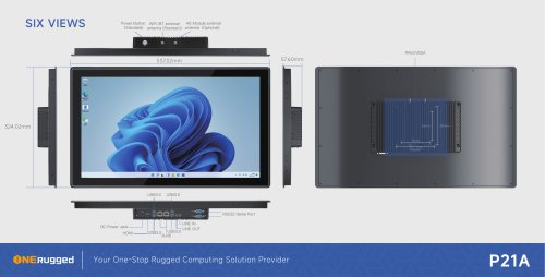 EM-P21A six views
1 Page
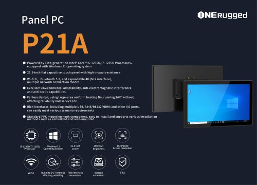 EM-P21A SPE
2 Pages
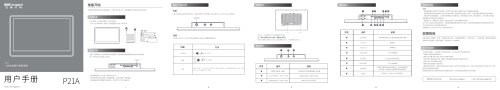 EM-P21A user
2 Pages
 EM-V82T-EMC
13 Pages
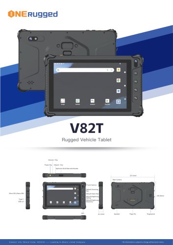 EM-V82T spe
4 Pages
 P2 PRO
2 Pages
 P2 PRO-SPE
2 Pages
 M82A- USER MANUAL
60 Pages
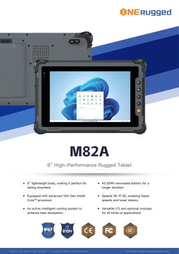 M82A-spe
2 Pages
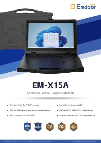
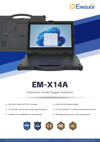
 EM-X15A User Manual
76 Pages
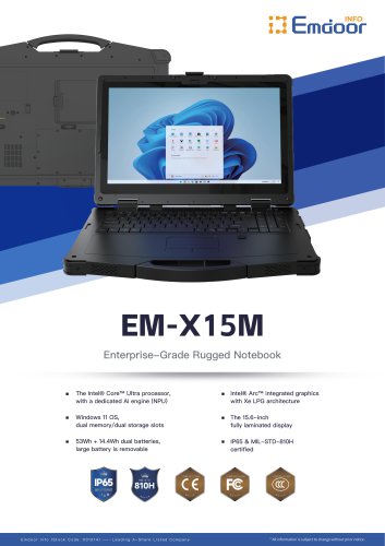
 EM-X15M Rugged AI PC uesr manual
76 Pages
 Emdoor Info. EM-I16J User Manual
57 Pages
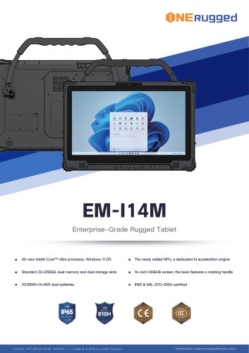 EM-I14M 14Inch Rugged AI PC
2 Pages
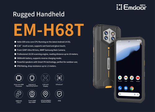
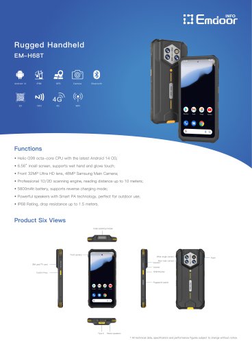 EM-H68T: Android 14 rugged PDA
2 Pages
 EM -I61J Rugged Handheld
19 Pages
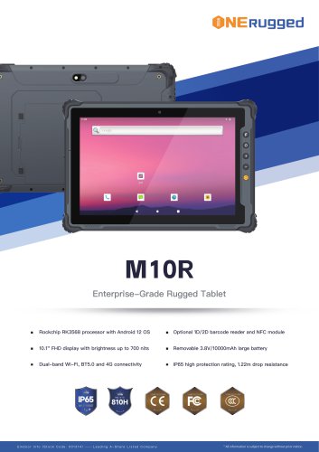 M10R Rugged Tablet RK3588
2 Pages
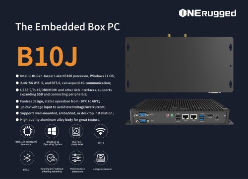 EM-B10J embedded box PC
3 Pages
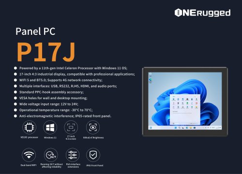 EM-P17J Panel PC
3 Pages
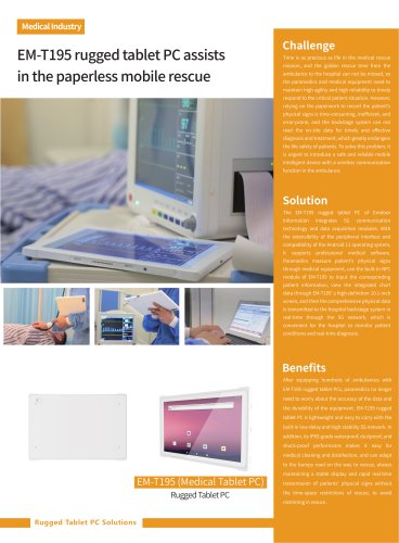
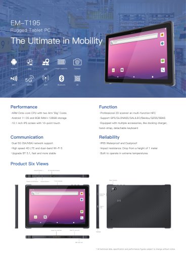 EM-T195 5G Rugged Tablet
2 Pages
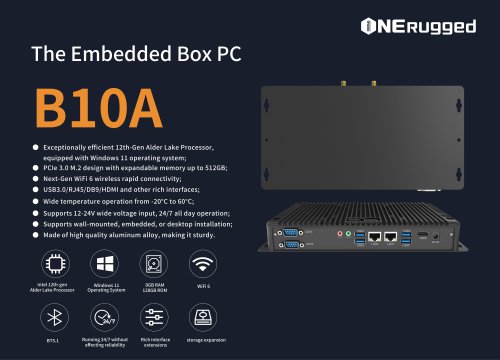 The Embedded Box PC-B10A
3 Pages
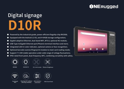 EM-D10R Digital signage
3 Pages
 EM-P1The Outdoor Rugged Phone
2 Pages
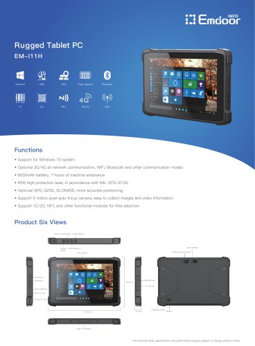 EM-I11H Rugged Tablet PC
2 Pages
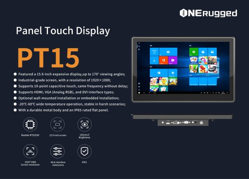
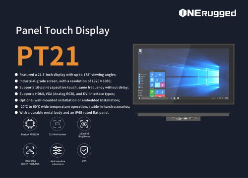 EM-PT21 Panel Touch Display
3 Pages
 Rugged Handheld H60T
2 Pages


- HS panel PC
- Display module
- HS industrial panel PC
- HS panel PC with touch screen
- HS fanless panel PC
- HS LCD panel PC
- LCD display panel
- HS IP65 panel PC
- Intel® Core™ panel PC
- VESA mounting panel PC
- Housed panel PC
- Industrial display panel
- Windows 10 panel PC
- HS Windows panel PC
- HS wireless panel PC
- HS touch screen tablet
- Intel® Celeron® panel PC
- HS wireless tablet
- HMI panel PC
- Touch screen display panel