
- Catalogs
- ComNav Technology Ltd.
- SV300 Unmanned Surface Vessel


- Company
- Products
- Catalogs
- News & Trends
- Exhibitions
SV300 Unmanned Surface Vessel
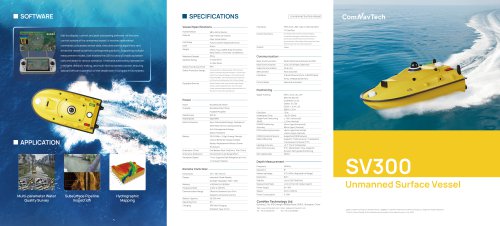
SV300 Unmanned Surface Vessel
The SV300 Unmanned Survey Vessel is designed for efficient and accurate surveying operations. It features a highly integrated main control system with a built-in high-precision GNSS positioning system, depth sounder, and vessel control software. The vessel supports multiple measurement modes and is equipped with an intelligent control system for autonomous operation in complex environments.
Specifications
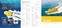
- Interfaces: PPM, RJ45, USB, Type-C, SIM Card Slot, TF Card Slot.
- Control Functions: Includes auto/manual sailing, route planning, and video display & recording.
- Vessel Specifications: Dimensions are 980 x 520 x 254mm, made from high-molecular carbon fiber and Kevlar fabric, with a fully curved M-shaped monohull.
- Safety Features: Automatic return in shallow water, 360° panoramic camera, and dual redundant anti-collision design.
- Equipable Devices: Optical cameras, lidar, echo sounder, water quality sensors, and more.
- Power: Brushless DC motor with a rated power of 900 W and a navigation speed of 7 m/s.
- Communication: Supports 4G, 2.4G, and radio communication with a SIM card slot.
- Positioning: GNSS+IMU for uninterrupted positioning, with high accuracy and fast initialization time.
Features
- Versatile Equipment Compatibility: Supports integration of various sensors and instruments.
- Automotive-grade Dual Lithium Battery Pack: Provides reliable, long-lasting power for extended operations.
- 360° Night Camera: Enhances navigation safety with real-time environmental immersion.
- Automatic Obstacle Avoidance: Millimeter-wave radar technology ensures safe operations by detecting obstacles and providing timely alerts.
Conclusion
The SV300 is a robust and versatile unmanned surface vessel designed for a wide range of surveying tasks. Its advanced features and high level of automation make it suitable for efficient and safe operations in various marine environments.
Catalog excerpts
Unmanned Surface Vessel o©o@o iSail is a display, control, and post-processing software. As the core control system of the unmanned vessel, it receives operational commands, processes sensor data, executes control algorithms, and commands, processes sensor data, executes control algorithms, and I drives the vessel to perform corresponding actions. Supporting multiple measurement modes, iSail enables the USV to carry out tasks automati- cally and adapt to various scenarios. It features autonomous perception intelligent decision-making, and multi-level automatic control, ensuring safe and efficient operation of the vessel even in complex environments Vessel Specifications- Material High-Molecular Carbon Fiber, Kevlar Fabric Hull Shape Fully Curved M-Shaped Monohull Weight Empty 7 kg, Loaded 30 kg (Including Base Station, Controller, and Battery) Weather Rating 3-class Wind Interfaces PPM, RJ45, USB, Type-C, SIM Card Slot, Control Functions One-Button Power On/Off, Auto/Manual Sailing, Cruise/Patrol/Navigation, Route Planning, Security Monitoring, Vessel/Remote Control Information Synchronization, Video Display & Recording, Main Video Window Swap, One-Click Video Screenshot System Linux Water Proof & Dust Proof IP67 Safety Protection Design Automatic Return in Shallow Water; 360° Panoramic Camera, Automatic Obstacle Avoidance, Forward ±120° Field of View; Detection Range 0.1-20m (Optional 40m Module Available), Full-Body Bumper Strip, Reinforced Hull Structure, Dual Redundant Anti-Collision Design Equipable Devices Optical Cameras, Lidar, Echo Sounder, Water Quality Sensors, Meteorological Sensors, Multi-Parameter Probes, Automatic Water Sampler, Side-Scan Sonar, Etc. SDK Open for Secondary Development Basic Communication Radio (Optional) & Network & CORS Data Communication 4G & 2.4G & Radio (Optional) SIM Card Slot Nano Card Slot Interfaces 2*RJ45 Ethernet Ports, 2*RS232 Serial Ports, 2*RS485 Serial Ports Control Mode Manual & Automatic Signal Tracking Rated Power Rated Speed Motor Protection Multi-parameter Water Subsurface Pipeline-Quality Survey Inspection Endurance (Time) Endurance (Distance) Navigation Speed Brushless DC Motor Brushless Direct Drive, Semi-Submersible Design; Waterproof Shaft Seal with Circulating Cooling; Anti-Entanglement Design; Debris-Resistant 33.6V 25Ah * 2 High-Energy-Density Lithium Batteries (Supports Rapid Battery Replacement Without Power Shutdown) One Battery Pack: 3h@2m/s, 7h@ 1.5m/s Economical Cruise Range 38 km 7 m/s; Supports Safe Navigation at 4 m/s in Turbulent Waters Remote Controller- Display Industrial-Grade Display, Communication Range Effective Distance Up to 3 Km, Supports 4G Remote Control Battery Capacity 20,000 mAh Charging 18W Fast Charging, Standard Type-C Port Single Point Positioning < 1.5m (Horizontal) CORS Correction Source Supported CORS Network Radio Differential Supports TT450 protocol / Transparent Heading Accuracy ±0.1° (1m at 1m Baseline) Roll / Pitch Accuracy 6°/h, 20s Rotation Time, Supports _Dynamic Self-guided Positioning_ Depth Measurement- Measuring Range 0.15-200m (Adjusted for Range) Measurement Rate ±1cm+0.1% D (D=Water Depth) Unmanned Surface Vessel ComNav Technology Ltd. Building 2, No. 618 Chengliu Middle Road,201801, Shanghai, China Web: www.comnavtech.com Email: [email protected] Tel : +86 21 64056796 Fax: +86 21 54309582 ©2025, ComNav Technology Ltd. All rights reserved. comVavTech is the official trade mark of ComNav Technology Ltd., registered in People’s Republic of China, EU, USA and Canada. All other trademarks are the property of their respective owners. (July, 2025).
Open the catalog to page 1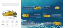
SV300 Unmanned Survey Vessel adopts a highly integrated main control design, featuring a built-in high-precision GNSS positioning system, depth sounder, and vessel control software, streamlining your surveying operations. Equipped with intelligent vessel control system, it offers a high level of automation, strong disturbance resistance, and excellent hull expandability. It can be fitted with echo sounders, side-scan sonar, water quality sensors, and other instruments, enabling efficient and accurate automatic collection, processing, and analysis of underwater terrain, multi-parameter water quality,...
Open the catalog to page 2All ComNav Technology Ltd. catalogs and technical brochures
 A100 Series Smart Antenna
2 Pages
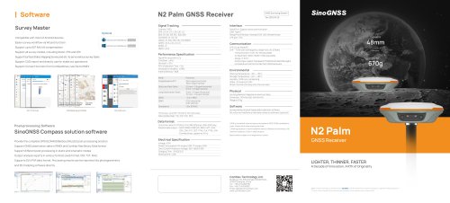 N2 Palm GNSS Receiver
2 Pages
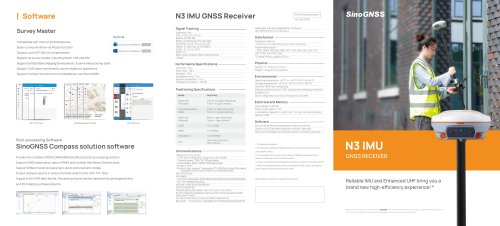 N3 IMU GNSS Receiver
2 Pages
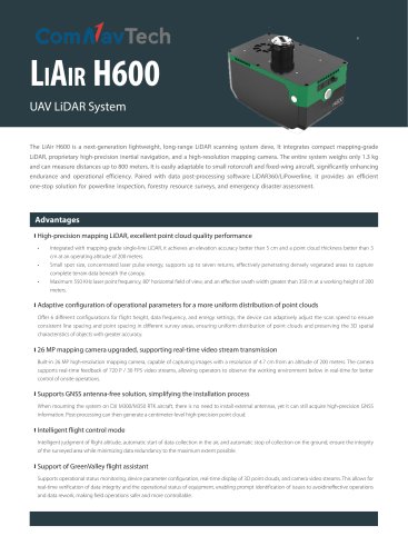 EN-LiAir H600
2 Pages
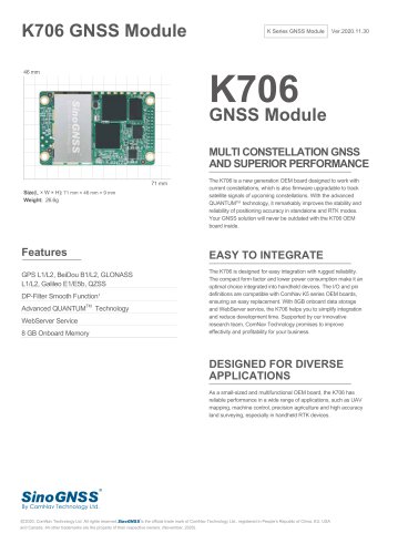 K706 GNSS Module
2 Pages
 SinoGNSS Jupiter Laser RTK
2 Pages
 K823 GNSS Module
2 Pages
 AT410 GNSS Antenna
2 Pages
 M900 GNSS Receiver
2 Pages
 U70 Datalink Module
1 Page
 Sinognss P6H Hanheld
2 Pages
 M100X GNSS Receiver
2 Pages
Archived catalogs
 AT500 Chock Ring Antenna
1 Page
 R200 Data Collector
2 Pages
 K700 GNSS Board
2 Pages
 K803 GNSS Module
2 Pages
 K705 GNSS OEM Board
2 Pages
 K708 GNSS OEM Board
2 Pages
 K706 GNSS OEM Board
2 Pages
 AT160 Helix Antenna
1 Page
 K726 GNSS OEM Board
2 Pages
 U50 Data Link Module
1 Page
 T300 Plus GNSS Receiver
2 Pages
 T300 GNSS Receiver_K8
2 Pages
 TS-C100 Total Station
2 Pages
 TS-C200 Total Station
2 Pages
 A100 Series Smart Antenna
2 Pages
 T20 Palm GNSS Receiver
2 Pages
 T30 IMU GNSS Receiver
2 Pages
 Z30 Portable GNSS Receiver
2 Pages
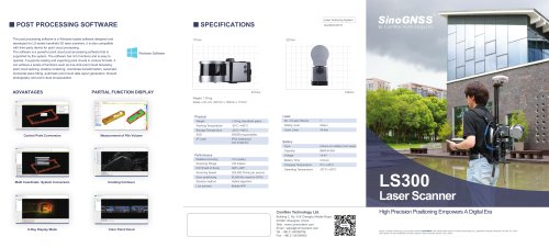
 LS300 Laser Scanning
2 Pages
 Venus Laser RTK
2 Pages
 Mars Laser RTK
2 Pages
 Mars Pro Laser RTK
2 Pages
 N2 GNSS Palm Receiver
2 Pages
 R60 Data Collector
2 Pages
 P8 Tablet
2 Pages
 AT360 Geodetic Antenna
1 Page
 N3 IMU GNSS Receiver
2 Pages
 M300 Pro 2023 GNSS Receiver
2 Pages
 AT600 Chock Ring Antenna
1 Page
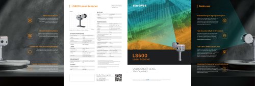 LS600 Laser Scanner
2 Pages
 AT190 Helix Antenna
1 Page
 AT340 Geodetic Antenna
1 Page
 R550 Data Collector
2 Pages
 R500 Data Collector
2 Pages
 G100 GNSS Receiver
2 Pages
 G200 GNSS Receiver
2 Pages
 M300 Plus GNSS Receiver
2 Pages
 T30 GNSS Receiver
2 Pages
 M300 Pro II GNSS Receiver
2 Pages
 T30 Surveying Solution
4 Pages
 T30 IMU Surveying Solution
4 Pages
 T300 Plus for UAV Solution
4 Pages
 CDL5 External Data Link
2 Pages
 M10 Mini GNSS Receiver
2 Pages
 T300 Plus GNSS Receiver
2 Pages
 P300 Series
2 Pages
 N5 IMU GNSS Receiver
2 Pages

- Management software solution
- Real-time software
- Windows software
- Computer-aided design software
- Cloud-based software
- Touch screen tablet
- Wireless tablet
- Design software solution
- Monitoring software solution
- Rugged tablet
- Interface software
- Bluetooth tablet
- WiFi tablet
- GNSS tablet
- Touch screen HMI
- Automated software
- Industrial tablet
- Windows tablet
- Network software
- GPS tablet