- Catalogs
- ComNav Technology Ltd.
- N5 IMU GNSS Receiver
- Company
- Products
- Catalogs
- News & Trends
- Exhibitions
N5 IMU GNSS Receiver
1 /2Pages

N5 IMU GNSS Receiver
1 /2Pages
Catalog excerpts

GNSS Surveying System Ver.2023.3.8 Signal Tracking Survey Master Microsurvey FieldGenius Android Compatible with most of Android devices Microsurvey FieldGenius Windows Easier survey workflow via Wizard function Support up to 60° IMU tilt compensation Support all survey modes, including Static, PPK and RTK Support Surface Stake, Mapping Survey and etc. to serve various survey tasks Correction data I/O: - RTCM 2.X, 3.X, CMR (GPS only), CMR+ (GPS only) Position data output: - ASCII: NMEA-0183 GSV, RMC, HDT, VHD, GGA, GSA, ZDA, VTG, GST; PTNL, PJK; PTNL, AVR; PTNL, GGK - ComNav Binary update to 20 Hz Performance Specifications Data Format Size(W × H): Φ 15.5 cm × 7.3 cm Weight: 1.2 kg with two batteries Cold start: <50 s Warm start: <30 s Hot start: <15 s Initialization time: <10 s Singal re-acquisition: <1.5 s Initialization reliability: >99.9% Support CAD import and directly use for stake out operations Support Convert function from ComNavBinary raw file to RINEX Environmental Operating temperature: -40 °C to + 65 °C (-40 °F to 149 °F) Storage temperature: -40 °C to + 85 °C (-40 °F to 185 °F) Humidity: 100% non-condensing Waterproof and dustproof: IP67, protected from temporary immersion to depth of 1 m Shock: Designed to survive a 2 m drop onto concrete Positioning Specifications Mode Provide the complete GPS/GLONASS/BeiDou/GALILEO post-processing solution Support GNSS observation data in RINEX and ComNav Raw Binary Data formats Support different post-processing in static and kinematic modes Output analysis reports in various formats (web format, DXF, TXT, KML) Supports DJI’s P4R data format. Processing results can be imported into photogrammetry and 3D modeling software directly SinoGNSS Compass solution software Post-processing Software Input voltage: 7-28 VDC Power consumption: 1.7 W5 Li-ion battery capacity: 2 × 3400 mAh, up to 25 hours typically Memory: 8 GB6 Real Time Kinematic CAD Basemap and Stake Long Observations Static Static and Fast Static 2. UHF modem is default configuration and it can be removed according to Software Survey Master Android-based data collection software Carlson SurvCE field data collection software (optional) MicroSurvey FieldGenius field data collection software (optional) your specific needs. 3. Integrated UHF ranges from 410 to 470 MHz. 4. Working distance of internal UHF varies in different environments, the 1 Serial port (7 pin Lemo) - Baud rates up to 921,600 bps Enhanced UHF modem2: Tx/Rx with full frequency range from 410-470 MHz3 - Transmit power: 0.5-2 W adjustable - Range: 15 km4 WIFI/4G modem - LTE-FDD: B1/B2/B3/B4/B5/B7/B8/B12/B13/B18/B19/B20/B25/B26/B28 - LTE-TDD: B38/B39/B40/B41 - WCDMA: B1/B2/B4/B5/B6/B8/B19 - GSM: B2/B3/B5/B8 Position data output rates: 1 Hz, 2 Hz, 5 Hz, 10 Hz, 20 Hz 2 LEDs (indicating Satellites Tracking and RTK Corrections data) 1 OLED Display and 2 Function buttons Bluetooth® : V 4.0 protocol, compatible with Windows OS and Android OS Calibration-free IMU integrated for Tilt Survey Up to 60°tilt with 2.5 cm accuracy 2023, ComNav Technology Ltd. All rights reserved. maximum distance is 15 Km in ideal situation. 5. Power consumption will increase if transmitting corrections via internal UHF. 6. 8GB is the default internal memory and optional 16GB, 32GB is available to order. Please clarify when placing the order. Specifications subject to change without notice. is the official trade mark of ComNav Technology Ltd., registered in People’s Republic of China, EU, USA and Canada. All other trademarks are the property of their respective owners. (March, 2023). N5 IMU RTK GNSS RECEIVER A reliable IMU RTK receiver you can really count on in the field!* *From our filed testing statistics, with the IMU will increasing over 20% sur
Open the catalog to page 1
Up to 60° tilting compensation, no need to center the bubble, enables to measure quickly and acquire the precise position easily. More Flexible R60 Data Collector 5.5 inch sunlight readable screen 1080P HD display Full constellations tracking Powerful tracking capability with 1198 Channels Support all current and future GNSS constellations Improved fixed rate by integrated with new anti-interference algorithm technology Enhanced OLED Display Sunlight readability for a clear, easy-to read viewing experience Handle all of surveying operations on screen freely Patent for design, ergonomic operation...
Open the catalog to page 2All ComNav Technology Ltd. catalogs and technical brochures
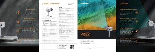 LS600 Laser Scanner
2 Pages
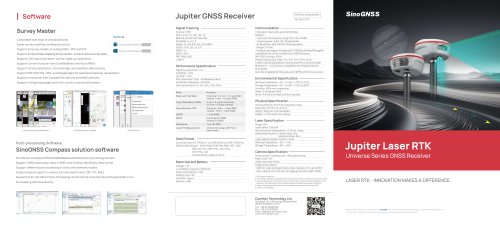 SinoGNSS Jupiter Laser RTK
2 Pages
 AT600 Chock Ring Antenna
1 Page
 M300 Pro 2023 GNSS Receiver
2 Pages
 K823 GNSS Module
2 Pages
 AT410 GNSS Antenna
2 Pages
 M900 GNSS Receiver
2 Pages
 U70 Datalink Module
1 Page
 N3 IMU GNSS Receiver
2 Pages
 AT360 Geodetic Antenna
1 Page
 P8 Tablet
2 Pages
 R60 Data Collector
2 Pages
 N2 GNSS Palm Receiver
2 Pages
 Mars Pro Laser RTK
2 Pages
 Mars Laser RTK
2 Pages
 Venus Laser RTK
2 Pages
 Sinognss P6H Hanheld
2 Pages
 M100X GNSS Receiver
2 Pages
 LS300 Laser Scanning
2 Pages
 Z30 Portable GNSS Receiver
2 Pages
 T30 IMU GNSS Receiver
2 Pages
 T20 Palm GNSS Receiver
2 Pages
 A100 Series Smart Antenna
2 Pages
 TS-C200 Total Station
2 Pages
 TS-C100 Total Station
2 Pages
 T300 GNSS Receiver_K8
2 Pages
 T300 Plus GNSS Receiver
2 Pages
 U50 Data Link Module
1 Page
 K726 GNSS OEM Board
2 Pages
 AT160 Helix Antenna
1 Page
 K706 GNSS OEM Board
2 Pages
 K708 GNSS OEM Board
2 Pages
 K705 GNSS OEM Board
2 Pages
 K803 GNSS Module
2 Pages
 K700 GNSS Board
2 Pages
 R200 Data Collector
2 Pages
 AT500 Chock Ring Antenna
1 Page
Archived catalogs
 AT190 Helix Antenna
1 Page
 AT340 Geodetic Antenna
1 Page
 R550 Data Collector
2 Pages
 R500 Data Collector
2 Pages
 G100 GNSS Receiver
2 Pages
 G200 GNSS Receiver
2 Pages
 M300 Plus GNSS Receiver
2 Pages
 T30 GNSS Receiver
2 Pages
 M300 Pro II GNSS Receiver
2 Pages
 T30 Surveying Solution
4 Pages
 T30 IMU Surveying Solution
4 Pages
 T300 Plus for UAV Solution
4 Pages
 CDL5 External Data Link
2 Pages
 M10 Mini GNSS Receiver
2 Pages
 T300 Plus GNSS Receiver
2 Pages
 P300 Series
2 Pages

- Management software solution
- Windows software
- Real-time software
- Computer-aided design software
- Cloud-based software
- Touch screen tablet
- Wireless tablet
- Design software solution
- Rugged tablet
- Monitoring software solution
- Interface software
- Bluetooth tablet
- WiFi tablet
- GNSS tablet
- Automated software
- Industrial tablet
- Touch screen HMI
- Windows tablet
- Network software
- IP65 tablet