
- Catalogs
- ComNav Technology Ltd.
- LS300 Laser Scanning


- Company
- Products
- Catalogs
- News & Trends
- Exhibitions
LS300 Laser Scanning

LS300 Laser Scanning
The LS300 Laser Scanning System by ComNav Technology Ltd. is a versatile and high-performance 3D laser scanning solution designed for both indoor and outdoor environments. It utilizes SLAM technology for real-time positioning and mapping without relying on GNSS, making it suitable for various applications such as smart city projects, underground facility digitization, and surveying.
Specifications
- Weight: 1.35 kg
- Scanning Range: 120 meters
- Field of View: 360° x 285°
- Scanning Speed: 320,000 points per second
- Relative Accuracy: 1 cm
- IP Code: IP54 waterproof and dustproof
- Battery: Lithium-ion, 98Wh/6.8Ah, 4 hours runtime
Software Features
The post-processing software is Windows-based and supports various point cloud formats. Key functionalities include:
- One-click point cloud denoising
- Point cloud splicing and shadow rendering
- Coordinate transformation and automatic plane fitting
- Automatic report generation and forward photography
Advantages
- Control Point Conversion and Multi-Coordinate System Conversion
- X-Ray Display Mode
- Measurement of Pile Volume and Creating Contours
- Color Point Cloud capabilities
Performance and Design
The LS300 features a rotating laser sensor probe with a sample rate of up to 0.32M points per second. It supports a large field of scan and high point accuracy. The system is designed with hot-swappable batteries for uninterrupted operation and a diverse system platform for easy integration with third-party devices.
Applications
The LS300 is suitable for a wide range of applications, including smart city development, agriculture, forestry, geology, and mapping. It offers a new visual experience with enhanced point cloud color functions, providing clear and immersive color effects.
Contact Information
ComNav Technology Ltd.
Building 2, No. 618 Chengliu Middle Road, 201801 Shanghai, China
Web: www.comnavtech.com
Email: [email protected]
Tel: +86 21 64056796
Fax: +86 21 54309582
Catalog excerpts

■ SPECIFICATIONS Laser Scanning System The post processing software is a Windows based software designed and developed for LS-series handheld 3D laser scanners, it is also compatible with third-party device for point cloud processing. The software is a powerful point cloud post-processing software that is supported by the system. The software has rich functions and is easy to operate. It supports loading and exporting point clouds in various formats. It can achieve a series of functions such as one-click point cloud denoising, point cloud splicing, shadow rendering, coordinate transformation, automatic horizontal plane fitting, automatic point cloud data report generation, forward photography and point cloud encapsulation. Windows Software ADVANTAGES PARTIAL FUNCTION DISPLAY 227mm 105mm Control Point Conversion Measurement of Pile Volume Multi Coordinate System Conversion Physical Weight 1.35 kg (handhold parts) and dustproof Performance Relative Accuracy 1cm (peak) Scanning Range 120 meters Scanning Speed 320,000 Points per second Scan positioning SLAM (No need for GPS) Solution method Hybrid algorithm Live preview Mobile APP Safety Level Class I Type Lithium ion battery (hot swap) Battery Time 4 hours X-Ray Display Mode Color Point Cloud ComNav Technology Ltd. Building 2, No. 618 Chengliu Middle Road, 201801 Shanghai, China Web : www.comnavtech.com Email : [email protected] Tel : +86 21 64056796 Fax : +86 21 54309582 High Precision Positioning Empowers A Digital Era ©2023, ComNav Technology Ltd. All rights reserved. SinoGNSS* is the official trade mark of ComNav Technology Ltd., registered in People’s Republic of China, EU, USA and Canada. All other trademarks are the property of their respective owners. (July, 2023).
Open the catalog to page 1
Interface Size Aviation Aluminum、ABS Aviation Aluminum、ABS Install Time Install Time Positioning Accuracy Horizontal Around 1cm Altitude Around 2cm The LS300 has a unique hybrid solving technology which can perform post processing for the previous data during the scanning. High precision data collected is more faster and efficiency ever before. APP Real Time Preview During operation, APP can browse point cloud data in real time which support multiple browsing interaction modes and more humn-computer interaction content. Diverse System Platform Multiplicity external ports can easily interface...
Open the catalog to page 2All ComNav Technology Ltd. catalogs and technical brochures
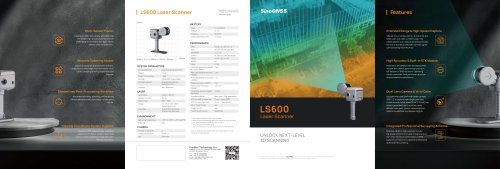 LS600 Laser Scanner
2 Pages
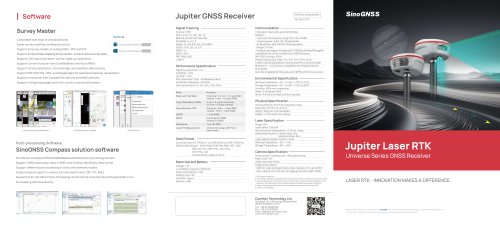 SinoGNSS Jupiter Laser RTK
2 Pages
 AT600 Chock Ring Antenna
1 Page
 M300 Pro 2023 GNSS Receiver
2 Pages
 K823 GNSS Module
2 Pages
 AT410 GNSS Antenna
2 Pages
 M900 GNSS Receiver
2 Pages
 U70 Datalink Module
1 Page
 N3 IMU GNSS Receiver
2 Pages
 AT360 Geodetic Antenna
1 Page
 P8 Tablet
2 Pages
 R60 Data Collector
2 Pages
 N2 GNSS Palm Receiver
2 Pages
 Mars Pro Laser RTK
2 Pages
 Mars Laser RTK
2 Pages
 Venus Laser RTK
2 Pages
 Sinognss P6H Hanheld
2 Pages
 M100X GNSS Receiver
2 Pages
 Z30 Portable GNSS Receiver
2 Pages
 T30 IMU GNSS Receiver
2 Pages
 T20 Palm GNSS Receiver
2 Pages
 A100 Series Smart Antenna
2 Pages
 TS-C200 Total Station
2 Pages
 TS-C100 Total Station
2 Pages
 T300 GNSS Receiver_K8
2 Pages
 T300 Plus GNSS Receiver
2 Pages
 U50 Data Link Module
1 Page
 K726 GNSS OEM Board
2 Pages
 AT160 Helix Antenna
1 Page
 K706 GNSS OEM Board
2 Pages
 K708 GNSS OEM Board
2 Pages
 K705 GNSS OEM Board
2 Pages
 K803 GNSS Module
2 Pages
 K700 GNSS Board
2 Pages
 R200 Data Collector
2 Pages
 AT500 Chock Ring Antenna
1 Page
Archived catalogs
 AT190 Helix Antenna
1 Page
 AT340 Geodetic Antenna
1 Page
 R550 Data Collector
2 Pages
 R500 Data Collector
2 Pages
 G100 GNSS Receiver
2 Pages
 G200 GNSS Receiver
2 Pages
 M300 Plus GNSS Receiver
2 Pages
 T30 GNSS Receiver
2 Pages
 M300 Pro II GNSS Receiver
2 Pages
 T30 Surveying Solution
4 Pages
 T30 IMU Surveying Solution
4 Pages
 T300 Plus for UAV Solution
4 Pages
 CDL5 External Data Link
2 Pages
 M10 Mini GNSS Receiver
2 Pages
 T300 Plus GNSS Receiver
2 Pages
 P300 Series
2 Pages
 N5 IMU GNSS Receiver
2 Pages

- Management software solution
- Real-time software
- Computer-aided design software
- Cloud-based software
- Touch screen tablet
- Design software solution
- Wireless tablet
- Monitoring software solution
- Rugged tablet
- Interface software
- Bluetooth tablet
- WiFi tablet
- GNSS tablet
- Automated software
- Industrial tablet
- Touch screen HMI
- Windows tablet
- Network software
- GPS tablet