
- Catalogs
- ComNav Technology Ltd.
- EN-LiAir H600


- Company
- Products
- Catalogs
- News & Trends
- Exhibitions
EN-LiAir H600
EN-LiAir H600
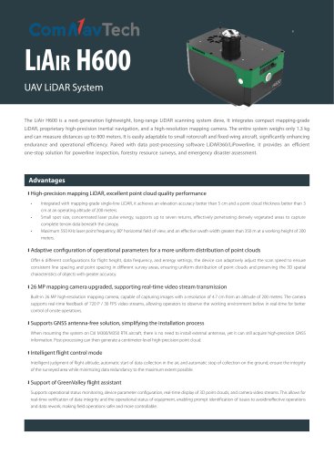
The LiAir H600 is a lightweight, long-range LiDAR scanning system designed for UAVs. Weighing only 1.3 kg, it integrates high-precision inertial navigation and a high-resolution mapping camera, capable of measuring distances up to 800 meters. It is adaptable to both rotorcraft and fixed-wing aircraft, enhancing operational efficiency for applications such as powerline inspection, forestry surveys, and disaster assessment.
- LiDAR Performance: Elevation accuracy better than 5 cm, point cloud thickness better than 3 cm at 200 meters altitude. Supports up to seven returns with a maximum laser point frequency of 550 KHz and an 80° horizontal field of view.
- Camera: 26 MP resolution, capable of real-time video stream transmission at 720 P / 30 FPS.
- Intelligent Flight Control: Automatic data collection start/stop based on altitude, minimizing data redundancy.
- Adaptive Configuration: Six configurations for flight height, data frequency, and energy settings to ensure uniform point cloud distribution.
- GNSS Support: Antenna-free solution for DJI M300/M350 RTK aircraft, providing high-precision GNSS data.
- Software: Includes GreenValley flight assistant for real-time monitoring and data verification.
- Accuracy: Vertical ±5 cm at 200 m.
- Weight: 1.3 kg.
- Power: 20~30 V, 50 W consumption.
- Storage: Standard 256 GB, maximum 512 GB TF Card.
- Operating Temperature: -20~50 ℃, Storage Temperature: -40~70 ℃.
- Protection Class: IP64.
- Wavelength: 1535 nm.
- Detection Range: 267 m at 10% reflectivity, 750 m at 80% reflectivity.
- FOV: 80°.
- Scan Rate: 100,000~550,000 pts/s.
- GNSS: GPS, GLONASS, Galileo, BDS.
- Azimuth Accuracy: 0.019°.
- IMU Data Frequency: 1000 Hz.
- Attitude Accuracy: 0.006°.
- Pixels: 26 MP.
- Focal Length: 16 mm / 24 mm (Equivalent).
- Image Resolution: 6252×4168.
- Control Software: GreenValley.
- Pre-Processing: LiGeoreference.
- Post-Processing: LiDAR360 / LiPowerline (Optional).
Catalog excerpts
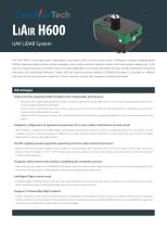
LiAir H600 UAV LiDAR System The LiAir H600 is a next-generation lightweight, long-range LiDAR scanning system deve, It integrates compact mapping-grade LiDAR, proprietary high-precision inertial navigation, and a high-resolution mapping camera. The entire system weighs only 1.3 kg and can measure distances up to 800 meters. It is easily adaptable to small rotorcraft and fixed-wing aircraft, significantly enhancing endurance and operational efficiency. Paired with data post-processing software LiDAR360/LiPowerline, it provides an efficient one-stop solution for powerline inspection, forestry resource surveys, and emergency disaster assessment. Advantages High-precision mapping LiDAR, excellent point cloud quality performance • • • Integrated with mapping-grade single-line LiDAR, it achieves an elevation accuracy better than 5 cm and a point cloud thickness better than 3 cm at an operating altitude of 200 meters. Small spot size, concentrated laser pulse energy, supports up to seven returns, effectively penetrating densely vegetated areas to capture complete terrain data beneath the canopy. Maximum 550 KHz laser point frequency, 80° horizontal field of view, and an effective swath width greater than 350 m at a working height of 200 meters. Adaptive configuration of operational parameters for a more uniform distribution of point clouds Offer 6 different configurations for flight height, data frequency, and energy settings, the device can adaptively adjust the scan speed to ensure consistent line spacing and point spacing in different survey areas, ensuring uniform distribution of point clouds and preserving the 3D spatial characteristics of objects with greater accuracy. 26 MP mapping camera upgraded, supporting real-time video stream transmission Built-in 26 MP high-resolution mapping camera, capable of capturing images with a resolution of 4.7 cm from an altitude of 200 meters. The camera supports real-time feedback of 720 P / 30 FPS video streams, allowing operators to observe the working environment below in real-time for better control of onsite operations. Supports GNSS antenna-free solution, simplifying the installation process When mounting the system on DJI M300/M350 RTK aircraft, there is no need to install external antennas, yet it can still acquire high-precision GNSS information. Post-processing can then generate a centimeter-level high-precision point cloud. Intelligent flight control mode Intelligent judgment of flight altitude, automatic start of data collection in the air, and automatic stop of collection on the ground, ensure the integrity of the surveyed area while minimizing data redundancy to the maximum extent possible. Support of GreenValley flight assistant Supports operational status monitoring, device parameter configuration, real-time display of 3D point clouds, and camera video streams. This allows for real-time verification of data integrity and the operational status of equipment, enabling prompt identification of issues to avoidineffective operations and data rework, making field operations safer and more controlla
Open the catalog to page 1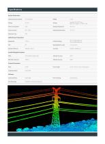
Specifications System Parameters System Accuracy (Vertical) Standard: 256 GB TF Card Maximum support: 512 GB TF Card Power Consumption Storage Temperature WiFi / USB-C Operating Temperature Protection Class LiDAR Sensor Parameters Wavelength Detection Range Repeatability Accuracy Scan Rate Azimuth Accuracy Attitude Accuracy Focal Length 16 mm / 24 mm ( Equiv. Focal Length ) Image Resolution Inertial Navigation System Camera Parameters Software Control Software
Open the catalog to page 2All ComNav Technology Ltd. catalogs and technical brochures
 A100 Series Smart Antenna
2 Pages
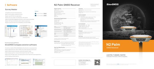 N2 Palm GNSS Receiver
2 Pages
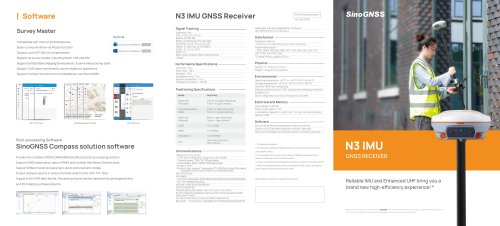 N3 IMU GNSS Receiver
2 Pages
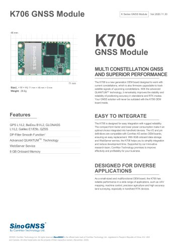 K706 GNSS Module
2 Pages
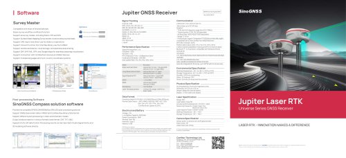 SinoGNSS Jupiter Laser RTK
2 Pages
 K823 GNSS Module
2 Pages
 AT410 GNSS Antenna
2 Pages
 M900 GNSS Receiver
2 Pages
 U70 Datalink Module
1 Page
 Sinognss P6H Hanheld
2 Pages
 M100X GNSS Receiver
2 Pages



Archived catalogs
 AT500 Chock Ring Antenna
1 Page
 R200 Data Collector
2 Pages
 K700 GNSS Board
2 Pages
 K803 GNSS Module
2 Pages
 K705 GNSS OEM Board
2 Pages
 K708 GNSS OEM Board
2 Pages
 K706 GNSS OEM Board
2 Pages
 AT160 Helix Antenna
1 Page
 K726 GNSS OEM Board
2 Pages
 U50 Data Link Module
1 Page
 T300 Plus GNSS Receiver
2 Pages
 T300 GNSS Receiver_K8
2 Pages
 TS-C100 Total Station
2 Pages
 TS-C200 Total Station
2 Pages
 A100 Series Smart Antenna
2 Pages
 T20 Palm GNSS Receiver
2 Pages
 T30 IMU GNSS Receiver
2 Pages
 Z30 Portable GNSS Receiver
2 Pages
 LS300 Laser Scanning
2 Pages
 Venus Laser RTK
2 Pages
 Mars Laser RTK
2 Pages
 Mars Pro Laser RTK
2 Pages
 N2 GNSS Palm Receiver
2 Pages
 R60 Data Collector
2 Pages
 P8 Tablet
2 Pages
 AT360 Geodetic Antenna
1 Page
 N3 IMU GNSS Receiver
2 Pages
 M300 Pro 2023 GNSS Receiver
2 Pages
 AT600 Chock Ring Antenna
1 Page
 LS600 Laser Scanner
2 Pages
 AT190 Helix Antenna
1 Page
 AT340 Geodetic Antenna
1 Page
 R550 Data Collector
2 Pages
 R500 Data Collector
2 Pages
 G100 GNSS Receiver
2 Pages
 G200 GNSS Receiver
2 Pages
 M300 Plus GNSS Receiver
2 Pages
 T30 GNSS Receiver
2 Pages
 M300 Pro II GNSS Receiver
2 Pages
 T30 Surveying Solution
4 Pages
 T30 IMU Surveying Solution
4 Pages
 T300 Plus for UAV Solution
4 Pages
 CDL5 External Data Link
2 Pages
 M10 Mini GNSS Receiver
2 Pages
 T300 Plus GNSS Receiver
2 Pages
 P300 Series
2 Pages
 N5 IMU GNSS Receiver
2 Pages

- Management software solution
- Real-time software
- Windows software
- Computer-aided design software
- Cloud-based software
- Touch screen tablet
- Wireless tablet
- Design software solution
- Monitoring software solution
- Rugged tablet
- Interface software
- Bluetooth tablet
- WiFi tablet
- GNSS tablet
- Touch screen HMI
- Automated software
- Industrial tablet
- Windows tablet
- Network software
- GPS tablet