BB4 UAV
1 /4Pages

BB4 UAV
1 /4Pages
Catalog excerpts

MAPPING & GEOSPATIAL
Open the catalog to page 1
PROFESSIONAL UAV REALITY CAPTURE PLATFORM BB4 is a high-end unmanned aircraft system resulting from an alliance between the two industry leaders in their respective segments. Its scientific design and highly integrated production technology come from CHCNAV - a global manufacturer specialized in efficient geospatial measurement technologies - and its fully automated flight control system from DJI, the pioneer in the manufacturing of commercial UAVs. STATE-OF-THE-ART PLATFORM 2 min for flight preparation. BB4 UAV is specially designed for professional industrial applications. The modular design...
Open the catalog to page 2
EFFICIENT DATA CAPTURE Topographic survey Asset inspections Natural resources
Open the catalog to page 3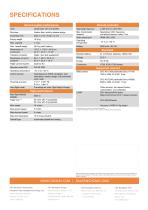
SPECIFICATIONS General system performance Type Remote controller Quadcopter with 4 propellers Operating frequency Carbon fiber, quickly release design Assembly time Specialized UAV frequency, auti-disturb feature, radius 7 km Empty weight Video output port Operating temperature Standard battery Transport container Water, dust and quakeproof Dimensions of unit in container Flight Control System Operating temperature Control system Dual-frequency GNSS navigation, dual redundancy sensor design, fully-automatic work mode 1 cm + 1 ppm Hz 2 cm + 1 ppm V Hovering accuracy Auto-flight mode Supported...
Open the catalog to page 4All CHC Navigation | CHCNAV catalogs and technical brochures
 RS10
RS104 Pages
 TX63
TX634 Pages
 H3
H34 Pages
 TD63 PRO
4 Pages
 CoProcess
4 Pages
 CoPre
CoPre4 Pages
 i73+ IMU RTK GNSS
4 Pages
 i83 GNSS Receiver
4 Pages
 i93
i934 Pages
 iBase_DS_EN
4 Pages
 i89
i894 Pages
 LT800
LT8004 Pages
 P330 PRO
4 Pages
 LT60H
LT60H4 Pages
 D270
D2704 Pages
 APACHE 3 Pro USV
4 Pages
 LT800H RTK
4 Pages
 AlphaAir 10
4 Pages
 AlphaUni 20
4 Pages
 C5 & C30
4 Pages
 CGI-610
4 Pages
 TG63
TG634 Pages
 NX510 SE
4 Pages
 HCE600
4 Pages
 LandStar 8
4 Pages
 CPS
CPS4 Pages
 CGO 2
CGO 24 Pages
 P5
P54 Pages
 DL8
DL84 Pages
 CTS-112R4
4 Pages
 P2 Elite
4 Pages
 P2
P24 Pages
 C220GR2
4 Pages
 AT312
AT3124 Pages
 NX510 PRO
4 Pages
 Alpha3D
4 Pages
 AlphaUni 900/1300
4 Pages
 AlphaAir 450
4 Pages
 APACHE6
4 Pages
 Apache4
4 Pages
 Apache 3
4 Pages
 AlphaAir 1400-2400
4 Pages
 D390_DS_EN
4 Pages
 D230_DS_EN
4 Pages
- Flowmeter
- Liquid flow monitor
- Management software solution
- Data logger
- Analysis software solution
- Windows software
- Cloud-based software
- Touch screen tablet
- USB camera module
- Wireless tablet
- Rugged tablet
- 3D software solution
- Bluetooth tablet
- Water flow monitor
- WiFi tablet
- Inspection imager
- GNSS tablet
- Wireless datalogger
- Industrial tablet
- Rugged camera