
- Catalogs
- Bentley Systems Europe B.V.
- Sri Lanka Survey Department Deploys Bentley Map for Digital Topographic Mapping


- Products
- Catalogs
- News & Trends
- Exhibitions
Sri Lanka Survey Department Deploys Bentley Map for Digital Topographic Mapping

Sri Lanka Survey Department Deploys Bentley Map for Digital Topographic Mapping
The Survey Department of Sri Lanka, a national organization responsible for high-quality land information, deployed Bentley Map and MicroStation for a digital terrain model (DTM) project in Jaffna, Northern Province. This initiative aimed to improve data quality and functionality for GIS applications, aiding in decision-making for regional development.
Project Overview
The project, initiated in February 2010, focused on creating 1:10000 scale DTMs and orthophotos for the Northern Province. Despite challenges such as restricted access to new aerial photography due to regional instability, the project utilized existing aerial data and advanced digital photogrammetry techniques to produce accurate 3D information.
Technological Implementation
Bentley Map and MicroStation were pivotal in building the large-scale DTM for Jaffna. These tools facilitated the extraction and clean-up of digital mapping data, enhancing the GIS model's functionality. The project also involved creating topological vector layers and integrating spatial data collection with digital photogrammetry.
Outcomes and Benefits
The DTM project, completed in January 2012, significantly improved data quality and increased the number of data layers available for development planning. It provided critical information for addressing urgent issues like infrastructure rebuilding and flood hazard management. The project was supported by the Japan International Cooperation Agency, highlighting international collaboration in Sri Lanka's development efforts.
Conclusion
The deployment of Bentley software was crucial for the project's success, enabling the Survey Department to enhance workflows and leverage existing data effectively. The resulting digital terrain model supports safer and more informed development in the Northern Province.
Catalog excerpts
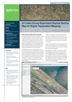
Sustaining Infrastructure Project Summary Survey Department of Sri Lanka Jaffna, Northern Province, Sri Lanka Project Objectives • Integrate spatial data collection • Produce 1:10000 scale digital topographic maps • Create a geospatial model of the City of Jaffna from stereo pairs of aerial photographs Products Used Bentley Map®, MicroStation® CASE STUDY Sri Lanka Survey Department Deploys Bentley Map for Digital Topographie Mapping upport Development in the Northern rrovmce Fast Facts • Bentley Map was used to build the large-scale digital terrain model for ability to produce topological vector • Bentley software enabled digita mapping data extraction and topol- • MicroStation's advanced rendering Improved the model's functionality • Bentley products enhanced project team workflows, improved data quality, and increased the number of data layers • DTMs will contribute to improved safety in developing areas, where urgent issues can be addressed based on quality data have been completed without Bentley software Improved Data Quality and Functionality The Survey Department of Sri Lanka is a national surveying and mapping organization charged with providing high- quality land information products and services. Led by the Surveyor General, the department has more than 5,000 technically qualified and dedicated personnel in surveying, mapping, and allied fields. As part of a very large digital terrain model (DTM) project, the Survey Department used Bentley Map and MicroStation to deliver improved data quality and functionality for the City of Jaffna GIS. The Northern Province of Sri Lanka faces urgent issues such as repatriating internally displaced persons, rebuilding infrastructure, renovating irrigation facilities, reconstructing fisheries, and planning new development. Jaffna itself cov- ers an area of 20.2 square kilometers and has a population of nearly 84,500. The maps provide up-to-date and accurate information to aid planners in making decisions about how to address critical issues during development in the Northern Province. Initiated in February 2010, the mapping project included production of 1:10000 scale DTMs and orthophotos, and GIS maps for the Northern Province. The project team was undeterred by the inability to take new aerial photographs or perform additional ground surveys due to terrorist activ- Advances in digital photogrammetry have bridged the gap between GIS data collection and conventional photogram- metry, making it possible to obtain accurate 3D information from existing aerial photography. Work began with the creation of stereo pairs of 1:20000 aerial photographs and signalized ground control points using Intergraph's ERDAS LPS and the ORIMA add-on for aerial triangulation. DTMs were generated automatically, and orthophotos were created from the aerial triangulated block, digital terrain model, and stereo pairs. MicroStation provided the ability to produce topological vector layers in conjunction with ERDAS PRO600. GIS model shown in Bentley Map.
Open the catalog to page 1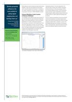
"Bentley geospatial editing digital topology clean-up. " - Pitiyage Shammie Prabhath Photogrammetric Technician Survey Department Find out about Bentley Contact Bentley Global Office Listings Sustaining Infrastructure Bentley Map was used for editing and exporting the data to shapefiles. These tools also enabled the Survey Depart- ment to build the database with elevations. The digital ter- rain models, orthophotos, and vector layers were added to the geospatial information in ERDAS IMAGINE VirtualGIS. Enhanced Workflows Enable Creation The challenges of this ambitious project were overcome,...
Open the catalog to page 2All Bentley Systems Europe B.V. catalogs and technical brochures
 Digital Airport Project Showcase
18 Pages
 Water_Hazelwood_Coal_Mine
2 Pages
 Water_Simtejo_case_study
2 Pages
 Wimbledon Stadium_Case Study
2 Pages
 WSP-Shard_Case_Study
3 Pages
 Bentley’s Water Project Showcase
92 Pages
 Mine Water Software Solution
4 Pages
 AutoPLANT Equipment V8i
2 Pages
 AutoPLANT Piping V8i
2 Pages
 ConstructSim
2 Pages
 promis•e
2 Pages
 Bentley Datasheets
2 Pages
 Making PDS Interoperable
17 Pages
 Bentley OpenPlant PowerPID
2 Pages
 STAAD.Pro
2 Pages



Archived catalogs
 Water modelling
24 Pages
 Bentley Water V8 XM
2 Pages
 Bentley Cadastre Specsheet
2 Pages
 STAAD Foundation
2 Pages
 RAM CADStudio
2 Pages
 Bentley MAP
2 Pages
 Bentley Structural Brochure
2 Pages
 Bentley Project Yearbook 2006
82 Pages
 Bentley SewerCAD
2 Pages
 Bentley WaterCAD
2 Pages
 Bentley WaterGEMS
2 Pages
 Bentley HAMMER
2 Pages
 Bentley StormCAD
2 Pages
 Bentley SewerGEMS
2 Pages
 Bentley AutoPlant P&ID
2 Pages
 Bentley Microstation
2 Pages
 Bentley Architecture
2 Pages
 Bentley ProjectWise brochure
2 Pages
 Bentley CivilStorm
2 Pages
 Bentley ProjectWise
4 Pages
 Bentley PowerDraft
2 Pages
 Bentley AutoPipe Specsheet
2 Pages


- Automation software solution
- Management software solution
- Analysis software solution
- Process software
- Real-time software
- Windows software
- Computer-aided design software
- Cloud-based software
- Control software
- Design software solution
- Industrial software
- 3D software solution
- Interface software
- Visualization software solution
- Quality software
- Simulation software solution
- Programming software solution
- Automated software
- Development software
- Network software