
- Catalogs
- Bentley Systems Europe B.V.
- Helsinki Creates 3D City Models to Promote Commercial Research and Development - Digital City Initiatives by Reality Modeling Technology


- Products
- Catalogs
- News & Trends
- Exhibitions
Helsinki Creates 3D City Models to Promote Commercial Research and Development - Digital City Initiatives by Reality Modeling Technology

Helsinki Creates 3D City Models to Promote Commercial Research and Development - Digital City Initiatives by Reality Modeling Technology
Helsinki, Finland's capital, is advancing its digital city initiatives by creating comprehensive 3D city models using Bentley's reality modeling technology. This initiative supports urban growth, commercial ventures, and collaboration with universities.
Project Overview
The Helsinki 3D+ project, a EUR 1 billion initiative, aims to capture city assets and create detailed 3D models of Helsinki's infrastructure. The project involves surveying over 500 square kilometers and managing extensive data to produce accurate city models.
Technology and Methodology
Helsinki utilized Bentley's technology for geo-coordination, modeling, and visualization. The project combined LiDAR scanning and photogrammetry to gather data, resulting in a detailed 3D reality model with 20 cm accuracy. The models include a CityGML semantic information model, enabling advanced city analyses and simulations.
Open Data Approach
The project emphasizes open data sharing, allowing citizens, companies, and universities to access the models for various applications, including commercial planning and development. ProjectWise software facilitated data management and collaboration.
Benefits and Applications
The 3D models provide realistic timetables, reduce errors, and digitize operations, leading to significant savings. They support infrastructure improvement, alternative energy sources, and environmental sustainability. Helsinki's models are used in pilot projects to achieve carbon neutrality and optimize solar power utilization.
Conclusion
Helsinki's innovative use of 3D city models positions it at the forefront of digital city development, demonstrating the potential of reality modeling technology in urban planning and sustainability efforts.
Catalog excerpts
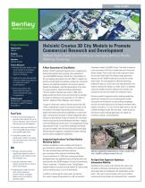
Advancing Infrastructure Project Summary Organization: Helsinki Solution: Reality Modeling Location: Helsinki, Finland Project Objective: • Generate 3D reality models of the city of Helsinki for visualization and city analyses to promote digital city initiatives. • Implement an open data approach with city residents and companies for commercial research and development. • Deliver pilot projects that demonstrate the power of reality modeling technology for applications. Products used: Bentley Map ®, ContextCapture, Descartes, LumenRT, Pointools, ProjectWise ® Helsinki Creates 3D City Models to Promote Commercial Research and Development Helsinki Heads Digital City Initiatives by Leveraging Bentley's Reality Modeling Technology Fast Facts • Helsinki used ContextCapture to generate a 3D model of the city to improve Helsinki's internal services and promote smart development. • The reality mesh was created from more than 50,000 oblique images covering 500 square miles. • ProjectWise served as the collaborative interface to manage and share data across internal and external teams. ROI • Bentley's advanced software capabilities enabled the team to generate two 3D models at lower than expected costs. • Using the software on other projects will help the city meet its carbon neutral goals. • Integrating the models with the city's internal processes provides realistic timetables, reduces errors, and digitizes operating chains. A New Generation of City Models Helsinki, Finland's capital and regional center, is experiencing booming development and a growing urban population of more than 600,000 residents. Helsinki has a long tradition of 3D city modeling dating back to the mid-1980s. To support city growth, promote digital city initiatives, enable new commercial ventures, and implement programs with university partners, Helsinki has developed a new 3D representation of the entire city using innovative, advanced modeling technologies. "The first models of Helsinki were made in 1985. Lots of people worked with them and we are continuing this heritage. Our project is delivering a new generation of city models to Helsinki," explained Project Manager Jarmo Suomisto. As part of a three-year initiative, Helsinki launched the EUR 1 billion undertaking to capture city assets and create rich 3D city models of the present-day infrastructure that could be shared with internal and external stakeholders, as well as the public, and showcase the power of reality modeling through a collection of pilot projects. Known as Helsinki 3D+, the project required surveying more than 500 square kilometers, mapping more than 600 ground control points, and managing and sharing large amounts of data. To meet these challenges and deliver accurate city models within the prescribed period and budget, Helsinki required integrated, comprehensive reality modeling and information management capabilities. Integrated Applications Facilitate Reality Modeling Options Helsinki used Bentley's reality modeling technology for geo-coordination, optioneering, modeling, and visualization. The team produced large-scale base maps and geo-coordinated utility networks with Bentley Map. Using a combination of LiDAR laser scanning and oblique photogrammetry, they gathered terrain and surface data, and captured more than 50,000 images of the city and surrounding islands, comprising 11 terabytes of data. ContextCapture enabled Helsinki to produce the final detailed 3D reality model with an overall accuracy of up to 20 centimeters. In addition to delivering the reality mesh, the Helsinki 3D+ project required the generation of a 3D city semantic information model in CityGML format. The model is based on a city scan made in 2015 but includes new point clouds and oblique images. Point clouds were used to generate terrain and surface models while the oblique images generated textures for the CityGML model and to process the reality mesh model. The interoperability of Bentley technology enabled the team to use the same raw data gathered for the model to produce this digital city model, which is a database model that enables versatile, advanced city analyses and simulations that can be enriched with analytical results. Bentley's powerful integrated reality modeling capabilities significantly lowered the cost of producing both models covering the entire Helsinki city and outlying archipelago, with the city model being one of the largest consistent reality models in existence. "It is not only the reality mesh or only the CityGML intelligent model. We need both," stated Suomisto. Having two models extends applications for digital city initiatives, research, and development. Helsinki used Bentley applications to create a reality mesh and a CityGML intelligent model of the city. An Open Data Approach Optimizes Information Mobility Significant to the success of the Helsinki 3D+ project was the ability to efficiently and effectively share the models and project data and collaborate with stakeholders and the public. "We want to get the people of the city of Helsinki involved with these models and understand them," explained
Open the catalog to page 1
“The first models of Helsinki were made in 1985. Lots of people worked with them and we are continuing this heritage. Our project is delivering a new generation of city models to Helsinki.” – Jarmo Suomisto Helsinki Project Manager Find out about Bentley at: www.bentley.com Contact Bentley 1-800-BENTLEY (1-800-236-8539) Outside the US +1 610-458-5000 Global Office Listings www.bentley.com/contact Suomisto. “For example, we have [implemented] a new citizen interaction platform for city planning.” The team enlivened the models and produced animated visualizations and presented them to the public...
Open the catalog to page 2All Bentley Systems Europe B.V. catalogs and technical brochures
 Digital Airport Project Showcase
18 Pages
 Water_Hazelwood_Coal_Mine
2 Pages
 Water_Simtejo_case_study
2 Pages
 Wimbledon Stadium_Case Study
2 Pages
 WSP-Shard_Case_Study
3 Pages
 Bentley’s Water Project Showcase
92 Pages
 Mine Water Software Solution
4 Pages
 AutoPLANT Equipment V8i
2 Pages
 AutoPLANT Piping V8i
2 Pages
 ConstructSim
2 Pages
 promis•e
2 Pages
 Bentley Datasheets
2 Pages
 Making PDS Interoperable
17 Pages
 Bentley OpenPlant PowerPID
2 Pages
 STAAD.Pro
2 Pages


Archived catalogs
 Water modelling
24 Pages
 Bentley Water V8 XM
2 Pages
 Bentley Cadastre Specsheet
2 Pages
 STAAD Foundation
2 Pages
 RAM CADStudio
2 Pages
 Bentley MAP
2 Pages
 Bentley Structural Brochure
2 Pages
 Bentley Project Yearbook 2006
82 Pages
 Bentley SewerCAD
2 Pages
 Bentley WaterCAD
2 Pages
 Bentley WaterGEMS
2 Pages
 Bentley HAMMER
2 Pages
 Bentley StormCAD
2 Pages
 Bentley SewerGEMS
2 Pages
 Bentley AutoPlant P&ID
2 Pages
 Bentley Microstation
2 Pages
 Bentley Architecture
2 Pages
 Bentley ProjectWise brochure
2 Pages
 Bentley CivilStorm
2 Pages
 Bentley ProjectWise
4 Pages
 Bentley PowerDraft
2 Pages
 Bentley AutoPipe Specsheet
2 Pages


- Automation software solution
- Management software solution
- Analysis software solution
- Process software
- Real-time software
- Windows software
- Computer-aided design software
- Cloud-based software
- Control software
- Design software solution
- 3D software solution
- Industrial software
- Interface software
- Visualization software solution
- Quality software
- Simulation software solution
- Automated software
- Programming software
- Development software
- Network software