- Catalogs
- Bentley Systems Europe B.V.
- Digital Twin Campus Initiative Drives Smart Facilities Management for Hong Kong Science Park
- Products
- Catalogs
- News & Trends
- Exhibitions
Digital Twin Campus Initiative Drives Smart Facilities Management for Hong Kong Science Park
1 /2Pages

Digital Twin Campus Initiative Drives Smart Facilities Management for Hong Kong Science Park
1 /2Pages
Catalog excerpts

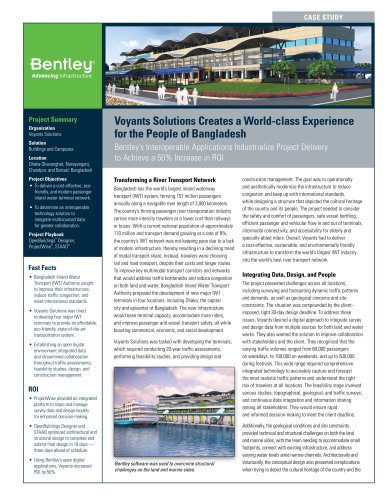
CASE STUDY Project Summary Organization Hong Kong Science & Technology Parks Corporation & Chain Technology Development Co. Limited Solution Reality Modeling Location Hong Kong Project Objectives • Develop hybrid modeling solutions to visualize, simulate, and analyze real-time data. • Extend the scope of reality and information modeling to facilitate digital twin campus initiatives. • Create a connected data environment with big data management and artificial intelligence. Products Used ContextCapture, Descartes, LumenRT, MicroStation®, OpenCities™ Map, Pointools Fast Facts • Bentley’s reality modeling and BIM applications provided the foundation for a hybrid modeling platform to transform HKSP into a digital campus. • HKSP serves as a “smart” prototype to realize Hong Kong’s digital city vision. ROI • The team completed reality modeling of the 22-hectare campus in two days using ContextCapture. • Bentley’s integrated technology solution increased efficiency, reduced remedial work, and enhanced decision-making through a connected data environment. Digital Twin Campus Initiative Drives Smart Facilities Management for Hong Kong Science Park Bentley Applications Provide Georeferenced Data to Facilitate Hybrid Reality Modeling A Digital Replica for Science Park As a statutory body dedicated to building a vibrant innovation and technology ecosystem, Hong Kong Science & Technology Parks Corporation (HKSTP) spearheads the Hong Kong Science Park (HKSP), providing an environment for organizations to foster innovative technology development throughout the region. The HKSP, a campus hosting 350 technology companies located along the Tolo Harbor waterfront, houses 21 state-of-the-art buildings covering 3.5 million square feet and still expanding. The technology clusters contribute to devising innovative solutions for a smart city. It is positioned to be a smart campus that is used by forward-looking smart city initiatives as a test bed and a living lab. “We aim to collect valuable data to enable future innovation and leverage artificial intelligence (AI), big data management, and Internet of Things (IoT) to create a smart campus,” Simon Wong, chief project development officer at HKSTP, said. Specializing in big data analytics, building information modeling (BIM) processes, and hybrid reality modeling, CHAIN Technology Development, one of the incubatees of HKSTP’s LEAP program, was retained to provide the digital twin solution, which the organization called the Hybrid Reality Platform (HRP), for the HKSP. The project presents massive amounts of 2D object data and 3D geospatial data in varying formats, which have collected from IoT devices. CHAIN utilizes HRP to visualize, simulate, analyze, and manage the IoT data amid continued infrastructure development and ongoing construction of the park. Such a complicated data management platform required technology that was capable of programming large-sized BIM objects and 3D reality meshes within a cloud-based platform and establishing digital workflows, components, and context to drive the smart city initiative. 3D modeling environment, georeferencing capabilities, and clash analysis features to accommodate the large files and ensure that the BIM models replicated the realworld environment. With images taken from unmanned aerial vehicles, the team generated a reality mesh of the entire existing 22-hectare campus area with ContextCapture in two days. OpenCities Map (formerly Bentley Map) established a location intelligence framework to georeference the 3D models and data objects. Bentley’s integrated modeling applications generated an accurate, georeferenced 3D map, providing the basis for a centralized digital campus platform. Bentley’s BIM applications provided the modeling and analysis for the buildings and supporting infrastructure. Additionally, ContextCapture optimized reality modeling for both existing and new development areas of the park, facilitating accurate conceptual design and enabling dynamic 4D construction monitoring and management. The interoperability of Bentley software enabled the integration of sophisticated 3D digital maps, models, reality meshes, and a wide range of geospatial data in varying formats to develop a connected data environment. Interoperability Establishes Collaborative Framework To establish a 3D collaborative data infrastructure, CHAIN leveraged the power of Bentley’s BIM and reality modeling technology. Using MicroStation provided the comprehensive Hong Kong Science & Technology Parks Corporation & Chain Technology Development, Ltd. was able to create a reality mesh of the entire 22
Open the catalog to page 1
"We have made use of Bentley's reality modeling technology to create a 3D model as a foundation and, more importantly, a centralized, geo-intelligent data hub to provide insights for better design and management of the smart campus." - Jackie Wong, Head of Business Development, Chain Technology Find out about Bentley at: www.bentley.com Contact Bentley 1-800-BENTLEY (1-800-236-8539) Outside the US +1 610-458-5000 Global Office Listings www.bentley.com/contact Realizing the Potential of Digital Twins from Reality Modeling Reality modeling is providing new potential for digital capture and consumption....
Open the catalog to page 2All Bentley Systems Europe B.V. catalogs and technical brochures
 Digital Airport Project Showcase
18 Pages
 Water_Hazelwood_Coal_Mine
2 Pages
 Water_Simtejo_case_study
2 Pages
 Wimbledon Stadium_Case Study
2 Pages
 WSP-Shard_Case_Study
3 Pages
 Bentley’s Water Project Showcase
92 Pages
 Mine Water Software Solution
4 Pages
 AutoPLANT Equipment V8i
2 Pages
 AutoPLANT Piping V8i
2 Pages
 ConstructSim
2 Pages
 promis•e
2 Pages
 Bentley Datasheets
2 Pages
 Making PDS Interoperable
17 Pages
 Bentley OpenPlant PowerPID
2 Pages
 STAAD.Pro
2 Pages


Archived catalogs
 Water modelling
24 Pages
 Bentley Water V8 XM
2 Pages
 Bentley Cadastre Specsheet
2 Pages
 STAAD Foundation
2 Pages
 RAM CADStudio
2 Pages
 Bentley MAP
2 Pages
 Bentley Structural Brochure
2 Pages
 Bentley Project Yearbook 2006
82 Pages
 Bentley SewerCAD
2 Pages
 Bentley WaterCAD
2 Pages
 Bentley WaterGEMS
2 Pages
 Bentley HAMMER
2 Pages
 Bentley StormCAD
2 Pages
 Bentley SewerGEMS
2 Pages
 Bentley AutoPlant P&ID
2 Pages
 Bentley Microstation
2 Pages
 Bentley Architecture
2 Pages
 Bentley ProjectWise brochure
2 Pages
 Bentley CivilStorm
2 Pages
 Bentley ProjectWise
4 Pages
 Bentley PowerDraft
2 Pages
 Bentley AutoPipe Specsheet
2 Pages


- Management software solution
- Automation software solution
- Analysis software solution
- Process software
- Windows software
- Real-time software
- Computer-aided design software
- Cloud-based software
- Control software
- Design software solution
- 3D software solution
- Industrial software
- Interface software
- Quality software
- Visualization software solution
- Simulation software solution
- Automated software
- Programming software
- Development software
- Network software