
- Catalogs
- Bentley Systems Europe B.V.
- ContextCapture Underpins the City of Coatesville’s Largest Brownfield Redevelopment


- Products
- Catalogs
- News & Trends
- Exhibitions
ContextCapture Underpins the City of Coatesville’s Largest Brownfield Redevelopment

ContextCapture Underpins the City of Coatesville’s Largest Brownfield Redevelopment
The case study discusses the use of ContextCapture by CEDARVILLE Engineering Group to support the redevelopment of Coatesville's largest brownfield site, "The Flats." This initiative aims to revitalize a former industrial area in Coatesville, Pennsylvania, by creating an accurate 3D terrain model without the need for costly on-site surveys.
Project Background
Coatesville, once a thriving steel-producing city, has faced economic challenges due to the decline of manufacturing jobs. The Coatesville Redevelopment Authority (RDA) is working to rehabilitate brownfield sites to promote economic development. CEDARVILLE provided conceptual design and planning services for "The Flats," a 30-acre site with complex conditions such as hazardous materials and floodplain vulnerability.
Solution: Reality Modeling
CEDARVILLE opted for photogrammetric reality modeling using UAVs to capture site data, eliminating the need for traditional surveys. Bentley's ContextCapture was chosen for its scalability, precision, and interoperability, allowing the creation of a detailed 3D model from over 750 aerial photos.
Benefits and Outcomes
- The 3D model serves as a valuable resource for economic planning and development.
- Reality modeling reduced costs and risks associated with on-site surveys.
- The model enabled accurate calculations of stockpile fill, saving significant costs.
- ContextCapture facilitated efficient data collection and presentation, enhancing decision-making and stakeholder buy-in.
Technological Impact
The use of ContextCapture allowed for the creation of a multi-resolution 3D reality model, enhancing processing power and responsiveness. The model provided essential data for engineering and planning, including volumetric calculations and floodway analysis.
Future Prospects
Following the success of this project, CEDARVILLE plans to expand the use of reality modeling technology for other infrastructure projects, demonstrating its potential to drive future developments.
Conclusion
ContextCapture proved instrumental in visualizing and planning the redevelopment of "The Flats," offering a strategic advantage for Coatesville's economic development. The project highlights the efficiency and precision of reality modeling in modern infrastructure planning.
Catalog excerpts
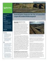
CASE STUDY Project Summary Organization CEDARVILLE Engineering Group, LLC Solution Government Location Coatesville, PA, United States Project Objectives • Deliver an accurate 3D terrain model to support the redevelopment of Coatesville’s largest brownfield site. • Challenge traditional survey methods to generate a 3D reality model that allows users to visualize and measure topography and ground conditions for planning and design. Products Used ContextCapture Fast Facts • The comprehensive 3D model of the brownfield area is a valuable resource that the city can use for related economic planning and development projects. • Reality modeling drove the success of this project to the extent that CEDARVILLE has embraced the use of ContextCapture for future infrastructure projects. ROI • Using ContextCapture, CEDARVILLE generated a high-resolution 3D reality model from more than 750 aerial photos, site photographs, and old survey data in mere hours. • The flexibility and interoperability of Bentley software enabled CEDARVILLE to overcome traditional survey restraints and produce an accurate 3D reality mesh of the constrained footprint, eliminating the need for costly and risky on-site visits. • The 3D terrain model provided the necessary details to help city planners and engineers accurately calculate 22,400 cubic yards of stockpile fill, saving significant costs on otherwise purchased clean fill. ContextCapture Underpins the City of Coatesville’s Largest Brownfield Redevelopment CEDARVILLE Engineering Group Produces Accurate 3D Terrain Model Eliminating the Need for Costly On-site Surveys of the Constrained Footprint Planning Redevelopment of a Former Industrial Site Coatesville, the poorest community in Chester County, Pennsylvania’s wealthiest, has suffered from the exportation of manufacturing and industrial jobs that have left a once thriving steel-producing city struggling to prosper amid a degrading infrastructure. To facilitate economic development, the Coatesville Redevelopment Authority (RDA) is working to rehabilitate commercial, residential, and industrial facilities that are now brownfield sites. As part of its interest in promoting the community redevelopment and sustainable growth, CEDARVILLE Engineering Group (CEDARVILLE) provided at no cost to the city or RDA conceptual design and planning services for a large brownfield redevelopment project known as “The Flats.” To deliver 3D conceptual design plans, CEDARVILLE needed to survey existing site conditions of the former steel-mill location. Spanning 30 acres, “The Flats” encompasses abandoned foundations from demolished industrial structures, hazardous materials, and soil contamination, and is subject to railroad intrusions and floodplain vulnerability. These conditions made it expensive and potentially dangerous to perform a traditional on-site survey and required the project team to consider alternative solutions to address the survey restraints. With special procedures and permits needed to enter the site, “it could be a USD 40,000 effort to get a traditional survey,” commented April Barkasi, founder and president of CEDARVILLE. Given the restricted site access and detailed analysis necessary amid a modest budget, CEDARVILLE needed accurate, scalable software to safely and cost-efficiently capture a 3D model of the existing terrain conditions for effective redevelopment planning of “The Flats.” Reality Modeling Provides Optimal Solution Challenging cost-prohibitive and risky conventional survey methods, CEDARVILLE explored numerous options to safely survey the existing terrain and accurately model the site. The team compiled various disparate data forms already available, determined additional data needs, and ultimately decided that photogrammetric reality modeling provided an optimal, CEDARVILLE captured more than 750 aerial photos via a drone in a matter of 20 minutes, and using ContextCapture, incorporated base imagery to build a precise reality model. cost-effective solution. This new technology allowed CEDARVILLE to survey the site using unmanned aerial vehicles (UAVs) to capture simple photographs, eliminating the need for an on-site surveys, and create an accurate model as a texturized mesh. Numerous reality modeling applications are available, but CEDARVILLE required an interoperable technology that could handle the capacity of the 30-acre brownfield site, the highresolution images, and the existing data and metadata, which could then generate an accurate 3D mesh needed to work with design cross sections and analysis profiles. Based on these requirements, CEDARVILLE determined that Bentley’s ContextCapture met the scalability, engineering precision, interoperability, and modeling criteria for the project. “We wanted to generate topographic data as efficiently as we could,” explained Barkasi. Using ContextCapture for reality modeling provided the flexibility and precision necessary for the team to timely and cost-efficiently deliver to the RDA its conceptual planning assessment and designs for the redev
Open the catalog to page 1
surface model to articulate its recommendations and findings for design options, grading, and infrastructure planning. The texturized mesh provided a complete visual rendition of the project, easily recognized and usable by the team, the client, and the stakeholders. innovative tools in technology, we have developed a process that efficiently creates 3D scalable models with precision and accuracy. Reality modeling is where infrastructure of the future begins.” – April Barkasi, Founder and President, CEDARVILLE Find out about Bentley at: www.bentley.com Contact Bentley 1-800-BENTLEY (1-800-236-8539)...
Open the catalog to page 2All Bentley Systems Europe B.V. catalogs and technical brochures
 Digital Airport Project Showcase
18 Pages
 Water_Hazelwood_Coal_Mine
2 Pages
 Water_Simtejo_case_study
2 Pages
 Wimbledon Stadium_Case Study
2 Pages
 WSP-Shard_Case_Study
3 Pages
 Bentley’s Water Project Showcase
92 Pages
 Mine Water Software Solution
4 Pages
 AutoPLANT Equipment V8i
2 Pages
 AutoPLANT Piping V8i
2 Pages
 ConstructSim
2 Pages
 promis•e
2 Pages
 Bentley Datasheets
2 Pages
 Making PDS Interoperable
17 Pages
 Bentley OpenPlant PowerPID
2 Pages
 STAAD.Pro
2 Pages


Archived catalogs
 Water modelling
24 Pages
 Bentley Water V8 XM
2 Pages
 Bentley Cadastre Specsheet
2 Pages
 STAAD Foundation
2 Pages
 RAM CADStudio
2 Pages
 Bentley MAP
2 Pages
 Bentley Structural Brochure
2 Pages
 Bentley Project Yearbook 2006
82 Pages
 Bentley SewerCAD
2 Pages
 Bentley WaterCAD
2 Pages
 Bentley WaterGEMS
2 Pages
 Bentley HAMMER
2 Pages
 Bentley StormCAD
2 Pages
 Bentley SewerGEMS
2 Pages
 Bentley AutoPlant P&ID
2 Pages
 Bentley Microstation
2 Pages
 Bentley Architecture
2 Pages
 Bentley ProjectWise brochure
2 Pages
 Bentley CivilStorm
2 Pages
 Bentley ProjectWise
4 Pages
 Bentley PowerDraft
2 Pages
 Bentley AutoPipe Specsheet
2 Pages


- Automation software solution
- Management software solution
- Analysis software solution
- Process software
- Real-time software
- Windows software
- Computer-aided design software
- Cloud-based software
- Control software
- Design software solution
- Industrial software
- 3D software solution
- Interface software
- Visualization software solution
- Quality software
- Simulation software solution
- Programming software solution
- Automated software
- Development software
- Network software