Catalog excerpts

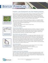
Bentley PowerCivil is comprehensive design software, offering civil engineers and designers a flexible2D/3D tool for land planning and development and site modeling. No CAD platform is required; PowerCivil runs standalone with native DGN and DWG file formats, using a full complement of CAD- based toolsets. Unique relationship modeling enables rapid, dynamic exploration of site development scenarios. Combined with a complete set of plan preparation tools, plan sheet generation, and automaticvolume/material quantity calculations, this enables more effective project execution.PowerCivil maximizes the power of Bentleys market-leading civil solutions in one integrated multidisci-pline product for survey, graphical coordinate geometry (COGO), digital terrain modeling, site grading, water and sewer, storm drainage, and street design. PowerCivil can be used for a wide range of projects: ?Commercial building, plant, and manufacturing sites?Airports and rail terminals?Subdivisions, urban complexes, parks, campuses, and golf courses?Dams, mines, and landfills?Drainage, utility. and floodplain projects > A natural civil engineerҒs workflowaddresses the challenges of landdevelopment projects of all types. PowerCivil streamlines design, project deliverable production and electronic conveyance to construction.Intelligent associativity between design disciplines reduces errors and ensures consistent, accurate plan production improving constructability. The software offers tools for easy import, incorporation, and export of design information and timely coordinate geometry (COGO). In addition, PowerCivil worksseamlessly with Bentley > ֮ PowerSurvey > and Bentley > ٮ PowerMap > solutions. > Work interactively in multipleviews to suit your purpose. PowerCivil has been developed to match the way civil engineers and designers need to work. You canrapidly explore an array of design options because the software offers instant visual feedback. Unique intelligent associativity eases handling of virtually all types of civil features in an object context: from ponds, ditches, and channels to pads, streets, and cul-de-sacs. You control the associativity betweenobjects in the model, including the precedence of feature components and relationships. As you modifydesign objects, associated features automatically adjust, obeying your custom design constraints and intent. The 2D/3D capabilities allow you to work the way you need to, interactively designing in plan, profile, section, and 3D. PowerCivil enables you to resolve unsuitable conditions on the fly, make design changes interactively, and speed the design process. > View existing and proposedcontours during site development. Regardless of the data format you choose to work in or need to deliver, PowerCivil is the civil design software most capable of meeting your project requirements. It supports: ?Industry-leading survey data collectors for direct input and output of survey data?Native file support for both DGN and DWG data?Import or export XML data for surfaces and coordinate geometry?Production of PDF plan sets > PowerCivil not only increases individual productivity, but also promotes collaboration between multipleusers. The software includes wizards to guide you in the creation of intelligent land features such as pads, ponds, channels, subdivisions, streets, and roads. Rapid updating and intelligent features enable easy incorporation of client-driven changes. Project team members can work in multiple disciplines, witheach user referencing and viewing the work of others. > Visit us on the Web for more information about Bentley solutions and services. www .bentley .com >
Open the catalog to page 1
Support for direct import of raw data and ASCII data from virtually any source, including popular data collectors Plan and profile sheet composition and extensive plan/profile and cross-section labeling tools Profile generation for single and multiple surfaces with tabular data annotation Creation, editing, and review of DTM models for surface data quality assurance and control Design and Computation Manager for applying drafting standards and automating quantity take-off Coordinate transformations plus adjustments, includ- ing network least squares, transit, and compass rule Quantities...
Open the catalog to page 2All Bentley Systems Europe B.V. catalogs and technical brochures
-
Digital Airport Project Showcase
18 Pages
-
Water_Hazelwood_Coal_Mine
2 Pages
-
Water_Simtejo_case_study
2 Pages
-
Wimbledon Stadium_Case Study
2 Pages
-
WSP-Shard_Case_Study
3 Pages
-
Bentley’s Water Project Showcase
92 Pages
-
Mine Water Software Solution
4 Pages
-
AutoPLANT Equipment V8i
2 Pages
-
AutoPLANT Piping V8i
2 Pages
-
ConstructSim
2 Pages
-
promis•e
2 Pages
-
Bentley Datasheets
2 Pages
-
Making PDS Interoperable
17 Pages
-
Bentley OpenPlant PowerPID
2 Pages
-
STAAD.Pro
2 Pages
Archived catalogs
-
Water modelling
24 Pages
-
Bentley Water V8 XM
2 Pages
-
Bentley Cadastre Specsheet
2 Pages
-
STAAD Foundation
2 Pages
-
RAM CADStudio
2 Pages
-
Bentley MAP
2 Pages
-
Bentley Structural Brochure
2 Pages
-
Bentley Project Yearbook 2006
82 Pages
-
Bentley SewerCAD
2 Pages
-
Bentley WaterCAD
2 Pages
-
Bentley WaterGEMS
2 Pages
-
Bentley HAMMER
2 Pages
-
Bentley StormCAD
2 Pages
-
Bentley SewerGEMS
2 Pages
-
Bentley AutoPlant P&ID
2 Pages
-
Bentley Microstation
2 Pages
-
Bentley Architecture
2 Pages
-
Bentley ProjectWise brochure
2 Pages
-
Bentley CivilStorm
2 Pages
-
Bentley ProjectWise
4 Pages
-
Bentley PowerDraft
2 Pages
-
Bentley AutoPipe Specsheet
2 Pages


