map3D_2013
1 /2Pages

map3D_2013
1 /2Pages
Catalog excerpts
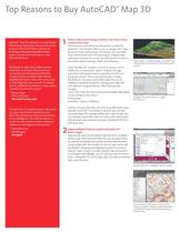
Top Reasons to Buy AutoCAD Map 3D ® AutoCAD® Map 3D software is a model-based infrastructure application that provides broad access to CAD and GIS data, helping GIS, planning, and engineering professionals access, evaluate, and share data to make informed decisions. 1 “ mployees in many of our offices use the E maps daily. In the past, they would have contacted us for the data and waited for a map or tried to complete tasks without detailed information. Now, with county data at their fingertips, they can use it to answer queries, schedule maintenance, or get project updates in much more quickly.” AutoCAD Map 3D includes a rich set of survey tools to enable you to more easily import, compute, manage, and utilize field measurements acquired from GPS and terrestrial sources. The survey functionality includes the ability to consume custom field codes that can be mapped to database attributes, making asset collection more efficient using any device. Other functionality includes: Leica® GSI, CPlan RO, ASCII point, and LandXML data import Survey database and schema Point groups Automatic creation of features —Shawn Olson GIS Coordinator Plymouth County, Iowa “ t’s easier for us to apply business rules based I on power transmission standards to our data. The software can help spot and address errors intelligently. The software allows us to edit the data models to better match our preferences and regional requirements.” —Zoran Brankovic GIS Manager Swissgrid Better understand existing conditions and create a more complete base map. Directly access and edit more information in a familiar AutoCAD® environment. With access to design, GIS, imagery, point cloud, and business information, you can make more informed decisions and more easily integrate data collected in the field via survey and GPS devices in order to accurately update drawings, maps, and databases. Easily import, compute, manage, and utilize field measurements acquired from GPS and terrestrial sources. Manage CAD and GIS data in a single environment. Overlay GIS and CAD data, and work more efficiently using standard AutoCAD® commands to directly edit GIS data. AutoCAD Map 3D’s interoperability with major design and GIS software means that users can read, write, and convert data between most standard formats, including SHP, DGN, and raster data. 2 Apply intelligent industry models and analysis for better insight. Improve the value of information with the ability to betteranalyze data. With AutoCAD Map 3D, you can apply industry-specific standards and business process requirements, using configurable data models for electric, gas, water, and wastewater. Mapping and integrated spatial and network analysis make it easier to create stylized maps and preliminary designs that highlight specific features, such as service areas, zoning districts, land usage, pipe and cable installation dates, and diameter. Convert data to an intelligent industry model. [Image goes here.] Use connectivity information built into the industry models to identify connected facilities or analyze the impact of your actions on your infrastructure.
Open the catalog to page 1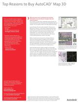
Top Reasons to Buy AutoCAD Map 3D ® “ ow, our Autodesk solution integrates N data directly from ArcSDE and gives us an inclusive view of the pipes—location, size, and surroundings—in less than 15 minutes. We complete this task 16 times faster, freeing staff for other tasks.” –Scott Stover Manager Corridor Approvals and Records York Region, Ontario, Canada "Autodesk’s solution allowed us to improve the accuracy and availability of our planning, design, and as-built asset information; share more accurate geospatial and customer information with the field; and more easily generate key reports for...
Open the catalog to page 2All AUTODESK catalogs and technical brochures
 Autodesk ® Flame®
2576 Pages
 Autodesk® In Games
7 Pages
 Autodesk® DirectConnect
80 Pages
 AUTODESK ® 3DS MAX
1358 Pages
 CEIT-KE
2 Pages
 Novax DMA
2 Pages
 autocad_civil3d
6 Pages
 building_design_suite_2013
4 Pages
 autocad_design_suite_2013
2 Pages
 autocad_mep_brochure
4 Pages
 acade_jic_overview_broch_us
4 Pages
 alias_2013_
10 Pages
 Autodesk Utility Design
2 Pages
 Autodesk Toxik
4 Pages
 Autodesk Subcontractor
4 Pages
 Autodesk Smoke
2 Pages
 Autodesk Mudbox
4 Pages
 Autodesk MotionBuilder
4 Pages
 Autodesk Moldflow Adviser
4 Pages
 Autodesk Maya
4 Pages
 Autodesk Lustre
6 Pages
 Autodesk LandXplorer
4 Pages
 Autodesk Inferno
1 Page
 Autodesk Flare
1 Page
 Autodesk Flint
1 Page
 Autodesk Cleaner XL
2 Pages
 Autodesk Cleaner
2 Pages
 Autodesk Buzzsaw
4 Pages
 Autodesk Backdraft Conform
6 Pages
 AutoCAD Revit MEP Suite
4 Pages
 AutoCAD P&ID
4 Pages
 AutoCAD Inventor Suites
32 Pages
 AutoCAD Electrical
4 Pages
 Autodesk Quantity Takeoff
4 Pages
 Autodesk Revit Structure
8 Pages
 AutoCAD Civil
6 Pages


Archived catalogs
 AutoCAD Raster Design
2 Pages
 AutoCAD MEP
6 Pages
 Autodesk Navisworks Review
4 Pages
 AutoCAD Civil 3D
2 Pages
 factory_design_suite_2013
4 Pages
 Autodesk 3ds Max Design
4 Pages
 AutoCAD Map 3D
4 Pages
 AutoCAD Mechanical
4 Pages
 AutoCAD Structural Detailing
6 Pages
 Autodesk Alias Design
4 Pages
 Autodesk Alias Surface
4 Pages
 Autodesk Revit Structure
8 Pages
 AutoCAD LT
2 Pages
 Autodesk MapGuide Enterprise
4 Pages
 Autodesk Topobase
2 Pages
 Autodesk Ecotect Analysis
4 Pages
 AutoCAD Architecture
4 Pages
 acade_jic
4 Pages
 autocad_lt_2013
2 Pages
 3DS
3DS8 Pages
 BIM and Visualization
11 Pages


- SARRALLE management software
- SARRALLE automation software
- SARRALLE analysis software
- SARRALLE process software
- SARRALLE Windows software
- SARRALLE real-time software
- SARRALLE CAD software
- SARRALLE cloud software
- SARRALLE control software
- SARRALLE design software
- SARRALLE industrial software
- SARRALLE interface software
- Measurement software
- SARRALLE quality software
- SARRALLE visualization software
- SARRALLE simulation software
- SARRALLE automated software
- SARRALLE programming software
- SARRALLE development software