
- Catalogs
- Aeryon Labs Inc.
- Aeryon Map Edition


Aeryon Map Edition

Aeryon Map Edition
Aeryon small Unmanned Aerial Systems (sUAS) are designed for ease of use and reliability, featuring point-and-click touchscreen navigation and camera control, eliminating the need for joysticks. They are transportable and deployable by a single operator without additional launch or recovery equipment. Aeryon sUAS are capable of reliable flight performance in challenging weather conditions where other systems may fail. They come with integrated and independently stabilized imaging payloads, and embedded geotags and metadata for live target location sharing and image processing. Automated or dynamic flight plans can generate detailed image mosaics and maps.
The Aeryon Map Edition is a comprehensive aerial surveying and GIS solution that includes the Aeryon SkyRanger sUAS and Pix4Dmapper software for field and office image processing. It supports 3D output visualization and editing, and is designed for applications requiring survey-grade accuracy orthomosaics, Digital Surface Models (DSMs), and point clouds. The system integrates seamlessly with GIS, CAD, and traditional photogrammetry software.
- 2D and 3D output results compatible with standard GIS, CAD, and Photogrammetry software.
- 2D outputs include geo-referenced orthomosaics in GeoTIFF format and Google tiles export in KML and HTML formats.
- 3D outputs include geo-referenced DSMs in GeoTIFF format, TIN models, and point clouds in LAS, LAZ, XYZ, and PLY formats.
- Object export available in DXF, SHP, and KML formats.
- Integrated multi-camera support for various project needs, including RGB and IR cameras.
- Aerial and oblique imagery can be stitched together, with results viewable, assessable, editable, and interpretable directly in the software.
For more information about Aeryon Map Edition, Pix4Dmapper software, or other GIS solutions, contact your Aeryon Sales Representative.
Catalog excerpts

YOUR COMPLETE AERIAL MAPPING AND SURVEYING SOLUTION Aeryon Map Edition is a bundled offering that provides an end-to-end aerial surveying and GIS solution. Aeryon small Unmanned Aerial Systems (sUAS) enable the immediate and reliable collection of high quality aerial imagery and integrate seamlessly with a variety of image processing options that give everyday users and GIS specialists the ability to gather aerial imagery faster, more accurately and more cost-effectively than satellites, manned aircraft or ground-based measurements. As a Vertical Take-Off and Landing (VTOL) aerial vehicle, Aeryon sUAS can operate lower and slower than manned aircraft, and fly in confined environments where fixed-wing UAVs cannot operate safely. The result of this capability is incredibly detailed imagery, up to 1cm/px resolution, required for precise modeling and measurement. Lightweight and easy to use, Aeryon sUAS provide: Point-and-click touchscreen navigation and camera control – no joysticks required Single operator transport and deployment, no launch or recovery equipment Reliable flight performance even in the most demanding weather conditions, when other systems cannot fly Integrated and independently stabilized imaging payloads Embedded geotags and metadata enable sharing live target location and image processing Automated or dynamic flight plans to generate detailed image mosaics and maps The Aeryon Map Edition is designed for any application that requires survey-grade accuracy orthomosaics, Digital Surface Models (DSMs) and point clouds from aerial or oblique imagery – and seamless integration with GIS, CAD and traditional photogrammetry software. Aeryon Map Edition includes: Aeryon SkyRanger sUAS Integrated imaging payload for image capture Pix4Dmapper software to enable field and office image processing, including integrated tools for 3D output visualization and editin
Open the catalog to page 1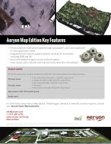
Aeryon Map Edition Key Features Choice of Aeryon sUAS and integrated imaging payload (2- and 3-axis stabilized) to meet application needs Integrated multi-camera support (several cameras for one project, including RGB and IR) Aerial and oblique imagery can be stitched together View, assess, edit, interpret and improve results directly in the software Output results 2D and 3D output results are easily readable by standard GIS, CAD and Photogrammetry software packages 2D output results Geo-referenced orthomosaics in GeoTIFF output format Google tiles export in KML and HTML output format Geo-referenced...
Open the catalog to page 2All Aeryon Labs Inc. catalogs and technical brochures
 SR-EO/IR Mk II
2 Pages
 HDZoom30 Inspection brochure
2 Pages
 HDZoom30 brochure tactical
2 Pages
 Aeryon SkyRanger
2 Pages
 VideoZoom10x Payload
2 Pages
 Aerial Vehicle Systems
2 Pages


