
カタログの抜粋
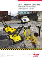
Leica Detection Solutions The best way to detect underground utilities
カタログの1ページ目を開く
Leica Detection Solutions Surveyors, utility companies and contractors, now more than ever, need accurate, highly reliable, and up-to-date information – available for immediate use. Using the latest technology, detecting underground features becomes a simple and efficient task, increasing your safety and the protection of buried utilities. Our detection solutions provide a truly streamlined process from the field to the office, and back again, able to cover the entire utility detection, avoidance and mapping workflow with integrated solutions. Cable Avoidance Undertaking any excavation will...
カタログの2ページ目を開く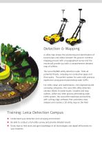
Detection & Mapping A utility map shows the positioning and identification of buried pipes and cables beneath the ground. Combine mapping process with a topographical survey and the results will provide you with a comprehensive detailed map of utilities. The Leica DS2000 utility detection radar finds all potential threats, including non-conductive pipes and fibre optics. The perfect system for users with previous experience using ground penetrating radar (GPR). For utility repair and maintenance, civil engineering and surveying companies, the Leica DSX utility detection solution allows to...
カタログの3ページ目を開く
Leica Geosystems – when it has to be right Revolutionising the world of measurement and survey for nearly 200 years, Leica Geosystems is the industry leader in measurement and information technologies. We create complete solutions for professionals across the planet. Known for innovative product and solution development, professionals in a diverse mix of industries, such as surveying and engineering, building and heavy construction, safety and security, and power and plant trust Leica Geosystems for all their geospatial needs. With precise and accurate instruments, sophisticated software,...
カタログの4ページ目を開くLeica Geosystems/ライカのすべてのカタログと技術パンフレット
-
 Leica Pegasus TRK100
4 ページ
-
 Leica GR30 & GR50
4 ページ
-
 Leica LOC8 DS EN
2 ページ
-
 Leica GM30 FLY en
2 ページ
-
 Leica GM30 DS en
2 ページ
-
 Leica Disto & Leica Lino
32 ページ
-
 Leica iCON PA10 DS
4 ページ
-
 Leica MCH100 Flyer
2 ページ
-
 Pegasus Manager BRO
4 ページ
-
 Pegasus Swift DS
2 ページ
-
 Pegasus Swift BRO
6 ページ
-
 Pegasus Backpack BRO
6 ページ
-
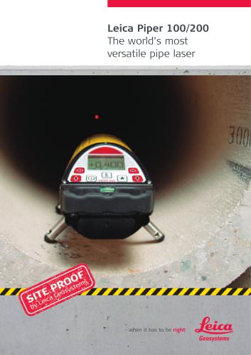
 Leica Piper Series
2 ページ
-
 Leica iCON build
4 ページ
-
 Leica GS07 DS EN
2 ページ
-
 Leica GS18 DS EN
2 ページ
-
 Leica CS20 DS EN
2 ページ
-
 Leica CS30 DS EN
2 ページ
-
 Leica CS35 DS EN
2 ページ
-
 Leica TS16 DS
2 ページ
-
 Leica TS13 DS EN
2 ページ
-
 Leica FlexLine TS07
1 ページ
-
 Leica ULTRA DS
2 ページ
-
 Leica ULTRA BRO
4 ページ
-
 Detection Campus BRO
4 ページ
-
 Leica iCON gps 60
4 ページ
-
 Leica M-Com Brochure
4 ページ
-
 Leica ConX Flyer
2 ページ
-
 Leica GM10
2 ページ
-
 Leica AR25
2 ページ
-
 Leica AR10
2 ページ
-
 Leica GeoMoS Now
2 ページ
-
 Leica AR20 Flyer
2 ページ
-
 Leica VADASE
2 ページ
-
 Leica Nova TS60
3 ページ
-
 Leica Nova TM50
4 ページ
-
 Leica TM6100A
6 ページ
-
 Leica TDRA6000
8 ページ
-
 Leica 3D Disto
22 ページ
-
 Leica Geo Office
3 ページ
-
 Leica Viva
5 ページ
-
 Leica SmartWorx Viva
3 ページ
-
 Leica Digicat xf-Series
12 ページ
-
 Leica NA2 / NAK2
8 ページ


カタログアーカイブ
-
 Construction Catalogue
84 ページ
-
 Leica ULTRA
4 ページ
-
 Leica Exchange Flyer
2 ページ
-
 Leica iCON CC66
2 ページ
-
 Leica iCONtrol
4 ページ
-
 Leica iCON robot 60
4 ページ
-
 Leica iCON robot 50
2 ページ
-
 Leica Zeno GIS
3 ページ


