Group: Leica Geosystems

Catalog excerpts

Leica Zeno GIS series
Open the catalog to page 1
Your Vision: Easy-to-use Mobile GIS Welcome to Leica Zeno GIS With Leica Zeno GIS hardware and software solutions it has never been so easy. Manage and maintain assets, inspect infrastructure, respond to emergencies and conduct as-built and incident mapping with ease. 4 steps to Easy Mobile CIS Lofca Zeno Office works seamlessly with your enterprise GI5 to manage and improve feature quality by providing complete GNSS information. Your benefit - utilize Zeno CIS together with existing total Station and CNSS measurement processes in one integrated One-click Automated workflow leica Zeno Off...
Open the catalog to page 2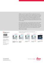
Whether you want to map the location of a power pole, the run of a pipeline, the area of a building or a farm; whether you are downtown or out in the country; whether you want to collect new features, or update and maintain the data from your Enterprise or Geographic Information System: For collecting, verifying and updating geographic data or an as-built of civil infrastructure models, Leica Geosystems offers the right solution – with seamless data exchange between field and office, for GIS or CAD workflow. When the data really counts, Leica Geosystems offers the right combination of...
Open the catalog to page 3All Leica Geosystems catalogs and technical brochures
-
 Leica LOC8 DS EN
2 Pages
-
 Leica Rugby CLA-ctive & CLH
2 Pages
-
 Leica GM30 FLY en
2 Pages
-
 Leica GM30 DS en
2 Pages
-
 Leica GR30 / GR50 Data Sheet
2 Pages
-
 Leica GR30 / GR50 Brochure
4 Pages
-
 Leica Cyclone 3DR Data Sheet
2 Pages
-
 Leica Pegasus TRK 500/700 DS
4 Pages
-
 Leica RTC360 LT Data Sheet
2 Pages
-
 Leica Flexline TS10 DS EN
2 Pages
-
 Leica Flexline Series DS EN
2 Pages
-
 ScanCrete Solution Flyer
2 Pages
-
 Leica Disto & Leica Lino
32 Pages
-
 Leica iCON PA10 DS
4 Pages
-
 Leica MCH100 Flyer
2 Pages
-
 Leica iCON grade Brochure
8 Pages
-
 Pegasus Manager BRO
4 Pages
-
 Pegasus Swift DS
2 Pages
-
 Pegasus Swift BRO
6 Pages
-
 Pegasus Two Ultimate BRO
3 Pages
-
 Pegasus Two Ultimate DS
2 Pages
-
 Pegasus Backpack BRO
6 Pages
-
 Leica DS2000 starter kit FLY
2 Pages
-
 Leica Viva GS10 Data Sheet
2 Pages
-
 Leica Piper Series
2 Pages
-
 Leica BLK2GO Spec Sheet
2 Pages
-
 Leica Viva GS14 Data Sheet
2 Pages
-
 Leica iCONsite foremen
2 Pages
-
 Leica iCON gps 80 Contractor
6 Pages
-
 Leica iCON gps 80 OEM
6 Pages
-
 Leica iCON build
4 Pages
-
 Leica iCON site Brochure
4 Pages
-
 Leica GS07 DS EN
2 Pages
-
 Leica GS18 DS EN
2 Pages
-
 Leica CS20 DS EN
2 Pages
-
 Leica CS30 DS EN
2 Pages
-
 Leica CS35 DS EN
2 Pages
-
 Leica Infinity Data Sheet
2 Pages
-
 Leica Viva GS16 Data Sheet
2 Pages
-
 Leica GS18 I data sheet
2 Pages
-
 Leica Captivate DS EN
2 Pages
-
 Leica TS16 DS
2 Pages
-
 Leica TS13 DS EN
2 Pages
-
 Leica Nova TS60 DS EN
2 Pages
-
 Leica Nova MS60 DS EN
2 Pages
-
 Leica FlexLine TS07
1 Pages
-
 Leica Zeno Connect Flyer
2 Pages
-
 Leica Zeno Mobile Data Sheet
2 Pages
-
 Leica ULTRA DS
2 Pages
-
 Leica ULTRA BRO
4 Pages
-
 Detection Campus BRO
4 Pages
-
 Leica Rugby 600 Series
4 Pages
-
 Leica Cyclone Cloud Flyer
2 Pages
-
 Leica TruView Cloud Flyer
2 Pages
-
 Leica CloudWorx for AutoCAD
2 Pages
-
 Leica iCON gps 60
4 Pages
-
 Leica iCON gps 70 Series
4 Pages
-
 Leica GS18 T GNSS RTK Rover
4 Pages
-
 Leica M-Com Brochure
4 Pages
-
 Leica ConX Flyer
2 Pages
-
 Leica iCON CC80 Flyer
2 Pages
-
 Leica iCON roller Flyer
2 Pages
-
 Leica PowerBlade Flyer
2 Pages
-
 Leica PowerDigger Lite Flyer
2 Pages
-
 Leica Viva GS25 Data Sheet
2 Pages
-
 Leica LS Digital Levels
3 Pages
-
 Leica GeoMoS Brochure
3 Pages
-
 Leica Active Assist Flyer
2 Pages
-
 Leica GM10
2 Pages
-
 Leica AR25
2 Pages
-
 Leica AR10
2 Pages
-
 Leica GeoMoS Adjustment
2 Pages
-
 Leica GeoMoS Now
2 Pages
-
 Leica AR20 Flyer
2 Pages
-
 Leica VADASE
2 Pages
-
 Leica iCON grade iGG4
4 Pages
-
 Leica Nova TS60
3 Pages
-
 Leica iCON telematics
2 Pages
-
 AR25 Choke Ring Antenna
2 Pages
-
 Leica Nova TM50
4 Pages
-
 Leica TM6100A
6 Pages
-
 Leica Digicat i-Series
8 Pages
-
 Leica Absolute Tracker AT402
16 Pages
-
 Leica T-Scan TS50A brochure
4 Pages
-
 Leica TDRA6000
8 Pages
-
 Leica 3D Disto
22 Pages
-
 Leica Geo Office
3 Pages
-
 Leica Viva
5 Pages
-
 Leica SmartWorx Viva
3 Pages
-
 PROTECT by Leica Geosystems
8 Pages
-
 Leica Digicat xf-Series
12 Pages
-
 Leica NA2 / NAK2
8 Pages


Archived catalogs
-
 Construction Catalogue
84 Pages
-
 Leica Detection Solutions
4 Pages
-
 Leica Detection Campus
2 Pages
-
 Leica MultiWorx Data Sheet
2 Pages
-
 Leica DX Manager Flyer
2 Pages
-
 Leica FlexLine TS02plus
2 Pages
-
 Leica Viva GS15 Brochure
4 Pages
-
 Leica Viva GS15 Data Sheet
2 Pages
-
 Leica Viva GS16 Brochure
4 Pages
-
 Leica ULTRA
4 Pages
-
 Leica Exchange Flyer
2 Pages
-
 Leica Zeno 20 Brochure
5 Pages
-
 Leica iCON CC66
2 Pages
-
 Leica iCONstruct Software
2 Pages
-
 Leica iCON builder 60
4 Pages
-
 Leica iCONtrol
4 Pages
-
 Leica Nova MS60 Brochure
3 Pages
-
 Leica Viva TS16 Brochure
3 Pages
-
 Leica iCON robot 60
4 Pages
-
 Leica iCON robot 50
2 Pages
-
 Leica Infinity Brochure
4 Pages


