 Website:
Hi-Target Surveying Instrument Co.,Ltd
Group: GNSS SURVEYING
Catalog excerpts

Measurement Method: Absolute Encoding Angle Measurement Minimum Readout: 175710" (0.3mgon/1.5mgon/3mgon) optional Accuracy1: 2” 3 Single Prism: 3000m (9,842ft.) under good condition 3 Three Prisms: 6000m (19,685ft.) under good condition Reflective Sheet: 800m (2,624 ft.) Accuracy: 2 mm +2ppm Measuring Time (Fine/Quick/Tracking): 1.5s/1s/0.5s 2 Reflectorless Range: 600m (1968.5 ft) Distance Measurement single Prism: >7500m (24606ft.) Distance Measurement (HTS-420 with Reflector) Magnification: 30X Field of View: 1°30' (2.7m at 100m) Minimum Focusing Distance: 1.2m Reticle: Illuminated System: Dual-axis liquid tilt sensor Compensator Working Range: ±3' Bluetooth 4 Communication Interface: Standard RS232, SD card , USB pen drive, mini-B Internal Data Memory: Approx. 20,000 Points Data Format: ASCII Operation Operation system: Real-time Operating System Display: Gray and white display with adjustable contrast; 280 X 160 pixels; 6 lines X 25 characters Keyboard: 2 sides Alphanumeric backlit crystal keyboard W Hi -Target Surveying the World, Mapping the Future Laser Plummet Type: Laser point, 4 brightness levels adjustment/Optical plummet (optional) Centering Accuracy: 1 mm at 1.5m instrument height Power Supply Battery Type: Rechargeable Li-ion battery Voltage/Capacity: ZBA-400: 7.4V (DC) / 3000mAh 5 Operating Time With ZBA-400: Optimal 16 hours (Continuous angle measurement every 30 seconds) /10 hours (typical) Measuring Times: Approx. 12000 times Weight Weight (Incl. Battery&Tribrach): Approx. 5.5kg (12.11b.) Environmental Operating Temperature: -20°C ~ + 50°C( -4°F to +122°F) Storage Temperature: -40°C ~ + 70°C(-40°F to + 158°F) Dust&Water Proof (IEC60529 Standard)/Humidity: IP54, 95%, non-condensing 1 Standard deviation based on ISO 17123-3. 2 Calculated by Kodak Gray Card white side (90% reflective), exact distance depends on measuring object, observation and environment conditions. 3 Good condition: no haze, visibility about 40km, moderate sunlight, 4 Maximum extension up to 32GB. 5 New battery at 25°C, 24 hours continuously angel measurement mode. Hi-Target Surveying Instrument Co. Ltd ADD: Building 13, Tian'An Technology Zone HQ Center, No. 555, North of Panyu RD, Panyu District, 511400 Guangzhou, China. www.hi-target.com.cn +86-20-28688296 info@hi-target.com.cn C€ IP65 ©2020 Hi-Target Surveying Instrument Co., Ltd. All rights reserved.
Open the catalog to page 1
Dual-axis Compensation The HTS-420R is configured with advanced dual-axis compensator for auto error elimination and auto accuracy compensation. Absolute Encoding The absolute encoding disk ensures high accuracy, efficiency and stable performance. No need to initialize but to measure the angle immediately as the HTS-420R is turned on. The previous data and setting are automatically saved. No data or setting is missed even though the HTS-420R is power-off unexpectedly. High-performance MCU SMT32 Based on ARM Cortex™-M processor, the SMT32 MCU enabling the HTS-420R extra high processing speed...
Open the catalog to page 2All Hi-Target Surveying Instrument Co. catalogs and technical brochures
-
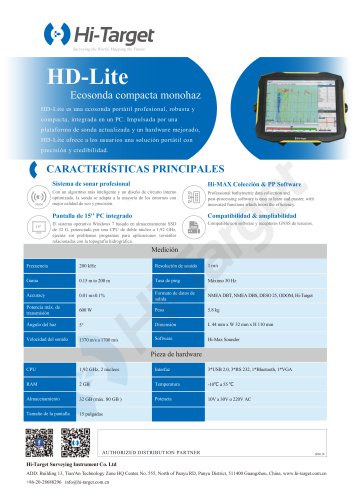
HD-Lite
1 Pages
-
Hi-Target/USV/ iBoat BS12
2 Pages
-
Hi-Target catalog-20230907s
20 Pages
-
Hi-Target/GNSS Receiver/V500
2 Pages
-
Hi-Target/GNSS Receiver/vRTK
4 Pages
-
Hi-Target/GNSS Receiver/V200
2 Pages
-
Hi-Target/USV/ iBoat BS3
2 Pages
-
Hi-Target/Auto Level/ HT-32
2 Pages


