
Catalog excerpts
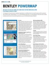
Bentley > PowerMap > Ι provides powerful and precise geospatial data creation, maintenance and analysis. Users can easily integrate data from a wide variety of geospatial data sources into engineering and mapping workflows. Multiple data types with varying coordinate systems are also transformed on-the- flyђ as they are integrated with Bentley PowerMap. Bentley PowerMap supports extensive spatial analysis, thematic mapping and presentation. These capabilities include tools for creating buffers and performing topology overlays. Bentley PowerMap takes full advantage of XML feature modeling. Through the Geospatial Administrator, XFM lets subject matter experts create highly interactive graphic applications without programming and provides for customization by developers in VBA, MDL, and other languages. XFM applications help users maintain standards by encapsulating them with the feature definition and placement tools, including property-based annotation and symbology. > Bentley PowerMaps interoperability features provide for easy export to other GIS formats Topology can be created ґon-the-fly or ґon-demand in Bentley PowerMap. Topological relationships are stored in the DGN file according to the same model used by Oracle Spatial. > Bentley PowerMap has unparalleled capabilities for those needing to create and maintain geospatial information as part of the management of infrastructure assets across their lifecycle. Bentley Map allows you to enforce business and topological rules defined by the Geospatial Administrator. The Geospatial Administrator also defines geographic objects, their behavior, and the GUI. Bentley PowerMap brings the accuracy of CAD and the ease-of-use of GIS together in one environment. > Bentley PowerMap can edit data directly in any standard Oracle Spatial environment employing a featurelocking mechanism for multi-user environments. Organizations can also take advantage of Oracle versioning to manage conflicts in an ґextract, edit and post to Oracle Spatial workflow enabled by the Bentley > Ү Geospatial Server > . > 3D city map published to Google Earth ٙ An intuitive Map Manager simplifies the display and query of large amounts of complex spatial information. The Map Manager takes advantage V8 XM Editions new display capabilities, including display ordering and transparency. Bentley PowerMap includes a full suite of spatial analysis and presentation capabilities. These include tools for creating buffers around objects, performing topology overlays, creating thematic maps and more. The results of these analytical processes can be plotted, printed, or published to PDF. > Bentley PowerMap facilitates geospatial data integration within the enterprise and extends the value of all types of spatial information. Bentley PowerMap can be implemented with a 2-tier database connection, a 2-tier connection to Oracle Spatial or a 3-tier connection to Oracle Spatial or ESRI ArcGIS. Bentley PowerMap supports high fidelity output and maps and prints can be published to intelligent PDFs (with 3D images, bookmarks and Web links). Map finishing can be taken to the next level using DGNs created in Bentley PowerMap with Bentley > Ү Symbology may be driven by properties, such as the thematic display of water pipes symbolized by diamater CADscript > and MicroStation. Bentley CADscript supports WYSIWYG map finishing and the production of print-ready four color separations. For more information about Bentley Map, visit www.bentley.com/bentleymap >
Open the catalog to page 1
Օ ՕՕ Օ Օ ՕՕ ՕՕ Օ Օ Օ ՕՕ Օ Efficient data compilation and editingDesign, build and publish accurate maps Enforce business and topological rules Brings CAD accuracy, ease-of-use and efficiency to GIS Օ ՕՕՕ Օ ՕՕՕ ՕՕ Օ Place features like any other XFM featuresTopology graph is maintained while editing Use shared editing commands to move common primitives > Smart, quick drawing and editing of GIS features Raster management AccuSnap, AccuDraw Display priority, transparency 3D display and editing Spatial Analysis Thematic Display > Grid and graticule generation Marginalia Interactively place...
Open the catalog to page 2All Bentley Systems Europe B.V. catalogs and technical brochures
-
 Digital Airport Project Showcase
18 Pages
-
 Water_Hazelwood_Coal_Mine
2 Pages
-
 Water_Simtejo_case_study
2 Pages
-
 Wimbledon Stadium_Case Study
2 Pages
-
 WSP-Shard_Case_Study
3 Pages
-
 Bentley’s Water Project Showcase
92 Pages
-
 Mine Water Software Solution
4 Pages
-
 AutoPLANT Equipment V8i
2 Pages
-
 AutoPLANT Piping V8i
2 Pages
-
 ConstructSim
2 Pages
-
 promis•e
2 Pages
-
 Bentley Datasheets
2 Pages
-
 Making PDS Interoperable
17 Pages
-
 Bentley OpenPlant PowerPID
2 Pages
-
 STAAD.Pro
2 Pages


Archived catalogs
-
 Water modelling
24 Pages
-
 Bentley Water V8 XM
2 Pages
-
 Bentley Cadastre Specsheet
2 Pages
-
 STAAD Foundation
2 Pages
-
 RAM CADStudio
2 Pages
-
 Bentley MAP
2 Pages
-
 Bentley Structural Brochure
2 Pages
-
 Bentley Project Yearbook 2006
82 Pages
-
 Bentley SewerCAD
2 Pages
-
 Bentley WaterCAD
2 Pages
-
 Bentley WaterGEMS
2 Pages
-
 Bentley HAMMER
2 Pages
-
 Bentley StormCAD
2 Pages
-
 Bentley SewerGEMS
2 Pages
-
 Bentley AutoPlant P&ID
2 Pages
-
 Bentley Microstation
2 Pages
-
 Bentley Architecture
2 Pages
-
 Bentley ProjectWise brochure
2 Pages
-
 Bentley CivilStorm
2 Pages
-
 Bentley ProjectWise
4 Pages
-
 Bentley PowerDraft
2 Pages
-
 Bentley AutoPipe Specsheet
2 Pages


