AutoCAD Civil 3D
1 /2Pages

AutoCAD Civil 3D
1 /2Pages
Catalog excerpts
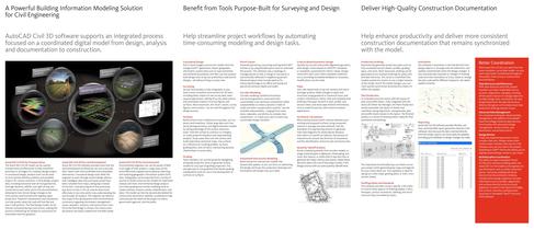
Conceptual Design Parcel Layout Criteria-Based Geometric Design Production Drafting Annotation Pull in aerial imagery and terrain models from the Google Earth application; import geographic information system data such as road centerlines and wetlands boundaries; and then use the purpose-built design tools to lay out preliminary road and lot designsٗall without hiring a survey crew. Generate parcels by converting existing AutoCAD > entities or by using flexible layout tools to automate the process. The software uses a topology to manage parcels so that a change to one parcel is automatically...
Open the catalog to page 2All AUTODESK catalogs and technical brochures
 Autodesk ® Flame®
2576 Pages
 Autodesk® In Games
7 Pages
 Autodesk® DirectConnect
80 Pages
 AUTODESK ® 3DS MAX
1358 Pages
 CEIT-KE
2 Pages
 Novax DMA
2 Pages
 autocad_civil3d
6 Pages
 building_design_suite_2013
4 Pages
 autocad_design_suite_2013
2 Pages
 autocad_mep_brochure
4 Pages
 acade_jic_overview_broch_us
4 Pages
 alias_2013_
10 Pages
 Autodesk Utility Design
2 Pages
 Autodesk Toxik
4 Pages
 Autodesk Subcontractor
4 Pages
 Autodesk Smoke
2 Pages
 Autodesk Mudbox
4 Pages
 Autodesk MotionBuilder
4 Pages
 Autodesk Moldflow Adviser
4 Pages
 Autodesk Maya
4 Pages
 Autodesk Lustre
6 Pages
 Autodesk LandXplorer
4 Pages
 Autodesk Inferno
1 Page
 Autodesk Flare
1 Page
 Autodesk Flint
1 Page
 Autodesk Cleaner XL
2 Pages
 Autodesk Cleaner
2 Pages
 Autodesk Buzzsaw
4 Pages
 Autodesk Backdraft Conform
6 Pages
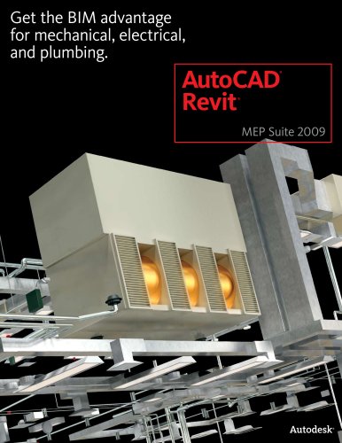 AutoCAD Revit MEP Suite
4 Pages
 AutoCAD P&ID
4 Pages
 AutoCAD Inventor Suites
32 Pages
 AutoCAD Electrical
4 Pages
 Autodesk Quantity Takeoff
4 Pages
 Autodesk Revit Structure
8 Pages
 AutoCAD Civil
6 Pages


Archived catalogs
 AutoCAD Raster Design
2 Pages
 AutoCAD MEP
6 Pages
 Autodesk Navisworks Review
4 Pages
 factory_design_suite_2013
4 Pages
 Autodesk 3ds Max Design
4 Pages
 AutoCAD Map 3D
4 Pages
 AutoCAD Mechanical
4 Pages
 AutoCAD Structural Detailing
6 Pages
 Autodesk Alias Design
4 Pages
 Autodesk Alias Surface
4 Pages
 Autodesk Revit Structure
8 Pages
 AutoCAD LT
2 Pages
 Autodesk MapGuide Enterprise
4 Pages
 Autodesk Topobase
2 Pages
 Autodesk Ecotect Analysis
4 Pages
 AutoCAD Architecture
4 Pages
 acade_jic
4 Pages
 autocad_lt_2013
2 Pages
 3DS
3DS8 Pages
 map3D_2013
2 Pages
 BIM and Visualization
11 Pages


- AUTODESK automation software
- AUTODESK management software
- AUTODESK analysis software
- AUTODESK process software
- Windows software
- Real-time software
- AUTODESK CAD software
- AUTODESK cloud software
- AUTODESK control software
- AUTODESK design software
- AUTODESK 3D software
- Industrial software
- Interface software
- Measurement software
- AUTODESK quality software
- AUTODESK visualization software
- AUTODESK simulation software
- AUTODESK automated software
- AUTODESK programming software
- AUTODESK development software